Tuesday, February 16, 2021

Timucuan Ecological and Historic Preserve


The Timucuan Ecological and Historic Preserve comprises 46,000 acres of wetlands, waterways, and other habitats in northeastern Duval County. It is named for the Timucua Indians who had 35 chiefdoms throughout northern Florida and south Georgia at the time of Spanish colonization.


Wetlands at Round Marsh | National Park Posters


Established February 16, 1988 - a patchwork of public land on both sides of the St. Johns River - Timucuan encompasses sites of historic, cultural, and ecological interest scattered between Amelia Island and Mayport. Most of these sites are directly tied to the indigenous people of this region, the Timucua, and their interactions with the Europeans who attempted to settle here.


Hiking Near Round Marsh | National Park Posters


The history and culture of the Preserve stretches over 6,000 years. Here, you can listen to the life stories of the native people who survived in Florida's environment prior to European contact. You can learn of the clash of cultures that occurred as nations converged in the New World, from European attempts at colonization to the struggles of enslaved African peoples.


Archeological excavation by a University of North Florida team has revealed more information about indigenous peoples in the area. On Black Hammock Island, they have discovered remnants of the second-oldest pottery in the United States, dating to 2500 BCE. (There have been slightly older finds in the Savannah River area.)


They also have excavated more recent artifacts contemporary with the Mocama chiefdom. In the last 25 years, these Native American people have been recognized as distinct from the Timucua, although they spoke a Timucuan dialect. Their chiefdom extended from the St. Johns River to St. Simons Island, Georgia.


Archeologists believe they have found evidence of a Spanish mission on the island as well. San Juan del Puerto, one of the oldest Spanish missions in Florida, was established here during the 16th century. Franciscan brothers were missionaries to the Timucua and Guale Indians along the coast, whose territory included the Sea Islands in Georgia and up to the Savannah River.


The Fort Caroline National Memorial is located in the Timucuan Preserve. Fort Caroline memorializes the short-lived French presence in sixteenth century Florida. Here you will find stories of exploration, survival, religious disputes, territorial battles, and first contact between American Indians and Europeans.


Fort Caroline | National Park Posters


Fort Caroline National Memorial also hosts the Timucuan Preserve Visitor Center. When visiting the park you can discover history, hike on nature trails, watch for dolphins in the St. Johns River, become a Junior Ranger and more.


Kingsley Plantation | National Park Posters


The Kingsley Plantation, the oldest standing plantation in the state. During the eighteenth and nineteenth centuries, many people came to Florida. Some, like Zephaniah Kingsley, sought to make their fortunes by obtaining land and establishing plantations. Others were forced to come to Florida to work on those plantations, their labor providing wealth to the people who owned them. Some of the enslaved would later become free landowners, struggling to keep their footing in a dangerous time of shifting alliances and politics. All of these people played a part in the history of Kingsley Plantation.


Source: https://national-park-posters.com/blogs/national-park-posters/timucuan-ecological-and-historic-preserve

attachement

Saturday, February 13, 2021

Best Things to do at Indiana Dunes National Park


Indiana Dunes National Park hugs 15 miles of the southern shore of Lake Michigan and has much to offer. Whether you enjoy scouting for rare species of birds or flying kites on the sandy beach, the national park's 15,000 acres will continually enchant you. Hikers will enjoy 50 miles of trails over rugged dunes, mysterious wetlands, sunny prairies, meandering rivers and peaceful forests.


Dunes, Indiana Dunes National Park


Winter Activities


Hiking, cross-country skiing and snowshoeing are popular in the wintertime. If you need snowshoes or cross-country skis, free rentals are available at the Paul H. Douglas Center for Environmental Education for use on the Paul H. Douglas Trail, weather permitting. The best areas to bring your own cross-country skiing or snowshoe equipment include the Glenwood Dunes Trail System and the Tolleston Dunes Trail System.


Paul H. Douglas Center for Environmental Education


Beaches and Swimming


Fifteen miles of sandy beach along the southern shore of Lake Michigan offer a wide variety of recreational activities. Whether it's enjoying a summer sunset stroll or marveling at the arctic beauty of Lake Michigan's shelf ice, you can enjoy the beach in all seasons.


There are several beach parking lots along the Indiana Dunes National Park. All beaches and parking lots are open daily from 6:00 am to 11:00 pm and have potable water and restrooms. Additionally, West Beach has showers and lifeguards from the Friday of Memorial Day weekend through the Monday of Labor Day weekend.


Biking


Discover much more than just sand dunes as you bike on an interconnected trail system that spans 37 miles across the entire length of the national park. A wide variety of trails traverse the various habitats and cultural history of Indiana Dunes National Park. The varying lengths make it easy to choose the trail that's right for you. From a short easy ride to a challenging all-day trek, most of the trails are open all year and the experience will change with each season.


Bird Watching


Located at the southern tip of Lake Michigan, the national park is an important feeding and resting area for migrating birds. Lake Michigan influences the migration patterns of bird species. During the fall migration, southbound birds follow the north-south shoreline and are funneled into the Indiana Dunes. The large expanse of open water and miles of shoreline also attract large numbers of wintering birds.


Bird Watching, Indiana Dunes National Park


Indiana Dunes National Park provides an excellent opportunity for birders to see a variety of bird species. Birders can observe hawks during migration from the top of a sand dune, watch waterfowl with a spotting scope from the shoreline, or look for wetland birds in remnant sections of the Great Marsh. Whether you have beginner or advanced identification skills, Indiana Dunes National Park is a great place for birders.


The national park plays an important role in the annual Indiana Dunes Birding Festival, which takes place the third weekend in May. This incredible four-day event showcases dozens of birding spots around the region with expert led outings.


Indiana Dunes Birding Festival


Indiana Dunes Birding Festival | National Park Posters

Start making plans for a return to #dunesbirding with the Indiana Dunes Birding Festival, May 13-16, 2021. The 2021 event will be a hybrid/virtual event, with both in-person and virtual birding experiences, stretched over 4 days. Mark your calendars now and plan on joining us for some great spring migration in the Indiana Dunes.


Birding in the Indiana Dunes is the best the state has to offer. With its rich biodiversity, varying habitats and miles of Lake Michigan shoreline, the Indiana Dunes is a hotspot for migrant birds. The annual Indiana Dunes Birding Festival is held to celebrate the dunes area's various birding habitats and bird watching opportunities to create a positive impact on the economic, conservation, and environmental education for visitors and residents to the Indiana Dunes region.


Fishing & Boating


Fishing


Fishing is allowed under federal, state and local laws. You need an Indiana Fishing License and a stamp if fishing for trout and salmon. Watch for drop-offs in creeks and along beaches.


Sailing & Power-boating


Sailing, Indiana Dunes National Park


Sailing and power-boating are popular on Lake Michigan. There are no marinas, boat rentals or boat launches within the national park. There are services available through commercial and city facilities in Porter, Lake and LaPorte counties. Check these county tourism links for information.


Kayaking


Kayaking, Indiana Dunes National Park


Kayaking is increasingly popular on Lake Michigan since the inception of the Lake Michigan Water Trail and in area waterways like the Little Calumet River and Burns Waterway. Launching hand-carried, non-motorized boats from any Indiana Dunes National Park beach is permitted with the exception West Beach's lifeguarded swimming area (Friday of Memorial Day weekend through the Monday of Labor Day weekend). Lake Michigan's water conditions can quickly change from calm to dangerous, so check the weather forecast and always use a certified personal flotation device.


Canoeing


Canoeing is also popular on the region's rivers and waterways, but is generally not recommended for Lake Michigan due to frequent windy conditions and large waves. Canoeing is popular on the Little Calumet River.


Hiking


Discover much more than just sand dunes as you hike through 14 distinct trail systems covering more than 50 miles of trails. A wide variety of hiking trails traverse the various habitats and cultural history of Indiana Dunes National Park. The varying lengths and difficulty levels make it easy to choose the trail that's right for you. From a short easy stroll to a challenging all-day trek, most of the trails are open all year and the hiking experience will change with each season.


Click here to see the Indiana Dunes National Park poster.


Rob Decker is a photographer and graphic artist who had the rare privilege of studying under Ansel Adams in Yosemite National Park when he was just 19 years old. Now, Rob is on a journey to explore and photograph all 61 of America's National Parks. He's creating WPA-style posters to help people celebrate their own national park adventures -- as well as encourage others to get out and explore!


Source: https://national-park-posters.com/blogs/national-park-posters/best-things-to-do-at-indiana-dunes-national-park

attachement

Friday, February 12, 2021

Bandelier National Monument


Bandelier National Monument celebrates its 105th anniversary February 11th!


Bandelier was designated by President Woodrow Wilson as a National Monument on February 11, 1916 -- named for Adolph Bandelier -- a Swiss-American anthropologist who researched the cultures of the area and supported preservation of the sites.


Located near Los Alamos, New Mexico, the monument protects Ancestral Pueblo archeological sites, a diverse and scenic landscape, and the country's largest National Park Service Civilian Conservation Corps National Landmark District.


The Monument protects over 33,000 acres of rugged but beautiful canyon and mesa country as well as evidence of a human presence going back over 11,000 years.  Petroglyphs, dwellings carved into the soft rock cliffs, and standing masonry walls pay tribute to the early days of a culture that still survives in the surrounding communities.


Bandelier National Monument


The Ancestral Pueblo people lived here from approximately 1150 CE to 1550 CE. They built homes carved from the volcanic tuff and planted crops in mesatop fields. Corn, beans, and squash were central to their diet, supplemented by native plants and meat from deer, rabbit, and squirrel. Domesticated turkeys were used for both their feathers and meat while dogs assisted in hunting and provided companionship.


Bandelier National Monument


Over 70% of the Monument is wilderness, with over one mile elevation change, from about 5,000 feet along the Rio Grande to over 10,000 feet at the peak of Cerro Grande on the rim of the Valles Caldera, providing for a wide range of life zones and wildlife habitats. There are three miles of road, and more than 70 miles of hiking trails.


The park infrastructure was developed in the 1930s by crews of the Civilian Conservation Corps and is a National Historic Landmark for its well-preserved architecture. The National Park Service cooperates with surrounding Pueblos, other federal agencies, and state agencies to manage the park.


Learn how you can get this limited edition, WPA-style print.


Rob Decker is a photographer and graphic artist who had the rare privilege of studying under Ansel Adams in Yosemite National Park when he was just 19 years old. Now, Rob is on a journey to explore and photograph all 62 of America's National Parks. He's creating WPA-style posters to help people celebrate their own national park adventures -- as well as encourage others to get out and explore!


Source: https://national-park-posters.com/blogs/national-park-posters/bandelier-national-monument

attachement

Monday, February 1, 2021

Jewel Cave National Monument


Jewel Cave National Monument contains Jewel Cave, currently the third longest cave in the world. With more than 208 miles of mapped and surveyed passageways, this underground wilderness appeals to human curiosity. Its splendor is revealed through fragile formations and glimpses of brilliant color. Its maze of passages lure explorers, and its scientific wealth remains a mystery. This resource is truly a jewel in the National Park Service and it became a national monument in 1908.


Frank and Albert Michaud, two local prospectors, discovered the cave in 1900, when they felt cold air blowing out of a small hole in a canyon. It is unknown whether any previous inhabitants of the area were aware of the natural cave opening, which was not large enough for a person to enter.


After enlarging the cave entrance with dynamite, the Michaud brothers found a cavern lined with calcite crystals, which led them to name it "Jewel Cave".


Nailhead Spar | National Park Posters


Nail Spar


Frostwork


Frostwork


Flowstone


Flowstone


Drapery


Drapery


The brothers tried to capitalize on the discovery, widening the opening, building walkways inside, and opening it to tourists. Although their venture was unsuccessful, news of the discovery eventually reached Washington. President Theodore Roosevelt proclaimed Jewel Cave a National Monument on February 7, 1908. The area around the natural entrance to the cave was further developed by the Civilian Conservation Corps in the 1930s. The National Park Service assumed management of the monument in 1933 and began offering tours in 1939.


Jewel Cave Exploration


As recently as 1959, less than 2 miles of passageway had been discovered. That year, however, Herb and Jan Conn, local rock climbers, began exploring, and within two years had mapped 15 miles. Much of the new discoveries lay outside the boundaries of the monument, under land managed by the United States Forest Service. The two agencies performed a land swap in 1965, establishing the present boundaries of the park, and enabling the development of a new part of the cave. The Park Service sunk a 300 feet elevator shaft to a previously remote cave area, and built concrete walks and metal stairs and platforms along a one-half-mile loop. The "Scenic Tour" was opened in 1972. Most modern-day visitors tour that part of the cave. In August 2000, an 83,000 acres forest fire burned 90% of the monument and the surrounding area. The visitor center and historic buildings were spared.


Logomites | National Park Posters


Cave Explorers with Logomites


Jewel Cave is open year round. The Park Service offers three tours: the scenic tour, a half-mile loop through a paved and lighted central portion of the cave accessible by elevator; the historic tour, a candlelight tour through the earliest-discovered part of the cave; and a wild caving tour, through an undeveloped part of the cave near the scenic loop. There are 3 surface trails varying in length and difficulty.


Click here to see the Jewel Cave National Monument poster.


Rob Decker is a photographer and graphic artist who had the rare privilege of studying under Ansel Adams in Yosemite National Park when he was just 19 years old. Now, Rob is on a journey to explore and photograph all 62 of America's National Parks. He's creating WPA-style posters to help people celebrate their own national park adventures -- as well as encourage others to get out and explore!


Source: https://national-park-posters.com/blogs/national-park-posters/jewel-cave-national-monument

attachement

Thursday, January 28, 2021

Best Things To Do In Rocky Mountain National Park


Rocky Mountain National Park's 415 square miles encompass and protect some of the world's most spectacular mountain environments. Trail Ridge Road – which crests at over 12,000 feet offers awe-inspiring overlooks to see these subalpine and alpine worlds. With more than 350 miles of hiking trails, and wildflowers, wildlife, and starry nights -- in a world of superlatives, Rocky is on top!


My name is Rob Decker and I'm a photographer and national park enthusiast. In fact, I've been to more than 50 of our amazing national parks. Rocky Mountain National Park is literally in my backyard, and I have explored almost every area of the park — so I'm ready to help! Whether this is your first time to Rocky Mountain, or if you are returning after many years and would like to be re-introduced to the park — this list of the best things to do is just for you!


Hiking


Moraine Park, Rocky Mountain National Park


Rocky Mountain National Park has 355 miles of hiking trails. They range from flat lakeside strolls to steep mountain peak climbs. If you are new to the park, consult with rangers at the visitor centers. They can provide advice about trails which are appropriate to different fitness and experience levels. As you plan your hike, keep in mind that park elevations range from 7,500 to over 12,000 feet. Even very fit individuals coming from lower elevations may experience altitude problems. Symptoms include headaches, shortness of breath, insomnia and rapid heartbeat. To minimize symptoms drink plenty of fluids, avoid alcohol, don't skip meals and get plenty of rest. 


Fishing


Fishing Lily Lake, Rocky Mountain National Park


Sport fishing is permitted in Rocky Mountain National Park. Fishing activities are balanced with efforts to restore and perpetuate natural aquatic environments and life. Fishing was popular with early settlers and visitors in the Rocky Mountains. In an attempt to improve the sport, many streams and lakes were stocked with non-native species of trout. The National Park Service stocked non-native Yellowstone cutthroat trout as late as 1969. The only trout native to the park are the greenback cutthroat and the Colorado River cutthroat. These efforts to enhance recreational opportunities in National Park areas were reconsidered in the 1970s. Since 1975, native greenback cutthroat and Colorado River cutthroat trout are being restored to park waters and exotic or non-native fish are being removed.


Wildlife Viewing


Rocky Mountain National Park visitors have a passion for viewing wild animals, especially the big ones. With an elk herd numbering between 600 to 800 in the winter, about 350 bighorn sheep, numerous mule deer and a small population of moose calling the park home, it's no surprise that wildlife watching is rated the number-one activity by a vast majority of Rocky's three million annual visitors.


Elk Bugling, Rocky Mountain National Park


Wildlife Viewing Tips


The park's great large-animal population makes it one of the country's top wildlife watching destinations. Here are a few park favorites:

  • Elk can be seen anytime, a popular viewing period being the fall rut, or mating season. Look for elk in meadows and where meadow and forest meet.

  • Bighorn sheep are commonly seen at Sheep Lakes from May through mid-August.

  • Moose frequent willow thickets along the Colorado River in the Kawuneeche Valley on the park's west side.

  • Otters were reintroduced into the Colorado River area and are doing fairly well. These animals are difficult to spot.

  • Mule deer are common and can be seen anywhere. They are most often found at lower elevations in open areas.

  • Bats feed over lakes and ponds at dawn and dusk.

  • Marmots and pikas favor rocky areas. Marmots are best seen on the alpine tundra along Trail Ridge Road. Pikas - small, light-colored mammals - are common in rock piles. Listen for their sharp, distinctive bark and watch for movement.

  • Clark's nutcrackers, Steller's jays, golden eagles and prairie falcons can be seen along Trail Ridge Road.

  • White-tailed ptarmigans, some of the most sought-after birds in Rocky Mountain National Park, are common but difficult to spot. For best results, hike on the tundra and look carefully. Ptarmigans usually remain still, relying on their natural camouflage for protection.

  • American dippers, or water ouzels, can be found along most streams. Listen for their loud call, similar to the rapid clicking of two stones together, as they fly up and down their territories.


Big Horn Sheep, Rocky Mountain National Park


Despite their good intentions, some wildlife watchers are loving park animals to death. Feeding junk food to wildlife reduces its ability to survive the long mountain winter. When they panhandle near roadsides, animals fall easy prey to automobiles. As they become habituated to humans and lose their natural fear, the animals become aggressive and may be destroyed. Harassing or feeding wildlife is illegal in all national parks.


Horseback Riding


Horseback Riding, Rocky Mountain National Park


Horses have been part of Rocky Mountain Park's tradition since its designation in 1915. Recreational pack animal use is balanced with other recreational uses such as hiking. Packing is managed to maintain the natural resources and unique ecosystems in the park. Horses, mules, ponies, llamas, and burros are allowed on park trails. No goats are allowed on park trails. For overnight camping, stock is permitted at established backcountry campsites designated for stock use. There are two stables located within the park: Glacier Creek Stables and Moraine Park Stables. There are many stables outside the park. Find contact information for the various stables in the area. There are two Estes Park stables open in the winter: Sombrero Stables and Aspen Lodge Stables. Approximately 260 miles of trails are open to commercial and private horse use, which makes up about 80% of the total trail network in the park.


Wilderness Camping


Rocky Mountain National Park offers some unique camping experiences and here are some things to consider when choosing your wilderness campsite. The first step in planning your trip: decide where you want to camp and for how long. I suggest purchasing a Rocky Mountain National Park topographic map to choose a destination and route. Then, use the Wilderness Campsite Map and Wilderness Designated Site Details to select wilderness campsites. Remember to consider the abilities of the least experienced member of your party and the distance and elevation gain from the trailhead to your destination.


Elevation


Rocky Mountain National Park is a high elevation park. If you live at sea level, it will take you several days to become acclimated. Most trails begin above 8,000 feet and climb abruptly higher. If you are not acclimated, you can get acute mountain sickness. Rangers recommend spending at least one night at 7,000–8,000 feet prior to setting out. This will allow your body to begin to adjust to the elevation.


Weather and Clothing


When you visit or call the park, discuss your plans with a ranger. Find out if snow has melted from the trails and destinations where you hope to hike. Check the weather forecast before starting your trip. Mountain weather changes very quickly. Within just a few hours, bright sunny skies may give way to raging storms. High winds often occur in the high country. Wind chill accelerates the lowering of body temperature which can result in hypothermia. Proper clothing is your first line of defense against cold. Plan to dress in layers so you can regulate your temperature by bundling up or peeling down. Be sure to pack rain and storm gear. Remember, you assume complete responsibility for your own safety and that of your group while hiking in Rocky Mountain National Park.


Ranger-Led Evening Programs


All evening programs are free and open to the public and are held at several locations throughout the park during evening hours. Both the Beaver Meadows Visitor Center and Kawuneeche Visitor Center are in non-fee areas of the park.


East Side Locations:


Beaver Meadows Visitor Center Auditorium (Hwy 36) is located approximately three miles west of the town of Estes Park. Evening programs are held mid- May through mid-June and intermittently throughout the year.


Aspenglen Campground Amphitheater is located at the Fall River Entrance (Hwy 34) approximately 4 miles from downtown Estes Park. Evening programs will resume mid-June, 2019.


Glacier Basin Campground Amphitheater is located along Bear Lake Road approximately 8 miles from downtown Estes Park.Evening programs will resume mid-June, 2019.


Moraine Park Campground Amphitheater is located along Bear Lake Road approximately 5 miles from downtown Estes Park. Evening programs will resume mid-June, 2019.


West Side Locations:


Kawuneeche Visitor Center Auditorium is located approximately one mile north of the town of Grand Lake (Hwy 34). Evening programs are held on Saturday nights throughout the summer. Please stop at a the visitor center for more information on specific topics.


Timber Creek Campground Amphitheater is located in the Kawuneeche Valley (Hwy 34) approximately eight miles from the Grand Lake Entrance. Evening programs are held throughout the summer and into September. Please stop at a the Kawuneeche visitor center for more information on specific topics.


Kids Activities


Bear Lake, Rocky Mountain National Park


Kids are born naturalists. They access the natural world by asking questions, which sometimes come in bunches. Introducing children to the outdoors can begin at any time, but why not begin early? And why not start them out in Rocky Mountain National Park, one of the country's premier outdoor wonderlands. Infants can be carried in a front pack, which can be tucked inside the jacket if it's chilly. Hike anywhere. Your kids will be enthralled by the stunning scenery and the fresh mountain air, so enthralled that he or she will fall asleep in short order. When they reach the toddler stage, children begin to more actively interact with nature. It is a time of observation, of making initial connections and stockpiling notes. It is a wonderful time to introduce them to one of the many discovery trips found around the park. A few suggestions.


  • Explore the edges of Bear Lake while enjoying the guidebook-guided trail tour that explains the area's natural and human history. Water holds an amazing variety of plant and animal life that will pique a child's curiosity.

  • Discover Rocky Mountain's amazing array of wildlife. At particular times during the summer (ask a park ranger), the bighorn sheep come down to Sheep Lakes. Kids especially enjoy watching them cross the road after the lambs are born.

  • Find a ponderosa pine forest and watch for Abert's squirrels. Their dark color and busy activities catch a toddler's eye for contrast and movement. Kids that are a bit older develop a more complex understanding of the world around them. While some children might enjoy expending energy hiking along a trail, most seem happiest thoroughly exploring a smaller area. On any hike with three to five year olds, it's a good idea to include a magnifying glass in the backpack. Textures of trees, plants, bugs and rocks are exciting close-up. In the early summer, enjoy the amazing floral colors found along the trail to Cub Lake.

  • Have the youngsters keep an eye out for hummingbirds that may be visiting the flowers. Watch for beaver along the way in the Cub Creek drainage. Beaver dams are easy to spot in this area and stream banks are ideal places to look for animal tracks.

  • The park has a "Rocky's Junior Ranger Program" for children in kindergarten through eighth grade. Emphasis is placed on park preservation, flora and fauna facts, and environmental education. When kids complete the Junior Ranger booklet, they earn a badge. Check at a visitor center for information.


Fairy Primrose, Rocky Mountain National Park


These are but a few of the things you can do at Rocky Mountain National Park. Check with the park rangers when you arrive to see what activities are available, what wildlife might be easiest to see, or where the wildflowers are blooming. I've created three posters for Rocky Mountain National Park -- one that features a view of Moraine Park, one for Cub Lake, and one for the iconic Longs Peak.


Click here to see the Rocky Mountain National Park, Cub Lake poster.


Click here to see the Rocky Mountain National Park, Moraine Park poster.


Click here to see the Rocky Mountain National Park, Longs Peak poster.


Rob Decker is a photographer and graphic artist who had the rare privilege of studying under Ansel Adams in Yosemite National Park when he was just 19 years old. Now, Rob is on a journey to explore and photograph all 61 of America's National Parks. He's creating WPA-style posters to help people celebrate their own national park adventures -- as well as encourage others to get out and explore!


Source: https://national-park-posters.com/blogs/national-park-posters/best-things-to-do-in-rocky-mountain-national-park

attachement

Tuesday, January 12, 2021

Martin Luther King, Jr. Memorial


Located in downtown Washington, DC, the memorial honors Martin Luther King, Jr.'s legacy and the struggle for freedom, equality, and justice. A prominent leader in the modern civil rights movement, Dr. King was a tireless advocate for racial equality, working class, and the oppressed around the world.


There is no fee to visit. The memorial is open 24 hours a day and is in an outdoor setting


From Smithsonian Metro, it's a 15-20 minute walk following Independence Avenue to the west.


Bookstore, restrooms, and drinking fountains are located across West Basin Drive near the main entrance.


Things to do include ranger programs at times posted in the memorial.


While you're here, you may want to visit the adjacent Franklin Delano Roosevelt Memorial or head to the Lincoln Memorial and find the spot on the steps where Martin Luther King, Jr. gave his iconic "I Have a Dream" speech.


Martin Luther King, Jr. Map


Rob Decker is a photographer and graphic artist with a single passion for our National Parks! Rob is on a journey to explore and photograph each of our national parks and to create WPA-style posters to celebrate the amazing landscapes, vibrant culture and rich history that embody America's Best Idea!


Click here to learn more about Rob & the National Park Poster Project!


Source: https://national-park-posters.com/blogs/national-park-posters/martin-luther-king-jr-memorial

attachement

Monday, January 4, 2021

Muir Woods National Monument


Muir Woods National Monument is located on Mount Tamalpais near the Pacific coast, in southwestern Marin County, California. It is part of the Golden Gate National Recreation Area, and is 12 miles north of San Francisco. It protects 554 acres of which 240 acres are old growth coast redwood (Sequoia sempervirens) forests, one of a few such stands remaining in the San Francisco Bay Area.


Muir Woods National Monument | National Park Posters


At Muir Woods, visitors are invited to step back in time to the days of one of the earliest park advocates. Walk among the soaring old growth coast redwoods, cooling their roots in the fresh water of Redwood Creek and lifting their crowns to reach the sun and fog. Federally protected as a National Monument since 1908, this primeval forest is both refuge and laboratory, revealing our relationship with the living landscape. Immerse yourself in the sights that inspired John Muir to be such a strong voice for the preservation and conservation of America's most special places.


Muir Woods has a rich and varied history, from its use by the Coast Miwok people, to its early days of tourism and the Mount Tamalpais Mill Valley Scenic Railway, to an era of conservation, to modern preservation. In each era, the forest has been affected by the actions of humans, for better or for worse.


Redwood Sorrel, Muir Wood Woods National Monument | National Park Posters


The incredible diversity of flora and fauna at Muir Woods can be daunting some times, elusive at other times. The redwoods themselves dominate the scene, but the Steller's jay often steals the show. Ladybugs clustering by the thousands on ancient horsetail ferns boggle the imagination, while the slimy banana slug is able to disgust and fascinate all at once. Plants adapt to low light levels on the forest floor, while whole plant and animal communities bustle in the canopy above our heads.


Muir Woods National Monument | National Park Posters


Muir Woods National Monument is an old-growth coastal redwood forest. Due to its proximity to the Pacific Ocean, the forest is regularly shrouded in a coastal marine layer fog, contributing to a wet environment that encourages vigorous plant growth. The fog is also vital for the growth of the redwoods as they use moisture from the fog during drought seasons, in particular the dry summer.


The monument is cool and moist year round with average daytime temperatures between 40 and 70 degrees Fahrenheit. Rainfall is heavy during the winter and summers are almost completely dry with the exception of fog drip caused by the fog passing through the trees. Annual precipitation in the park ranges from 39.4 inches in the lower valley to 47.2 inches higher up in the mountain slopes.


Click here to see the Muir Woods National Monument poster


Source: https://national-park-posters.com/blogs/national-park-posters/muir-woods-national-monument

attachement

Pinnacles National Park


Pinnacles National Park, located east of the Salinas Valley in Central California, protects the western half of an extinct volcano that has moved 200 miles from its original location on the San Andreas Fault, embedded in a portion of the California Pacific Coast Ranges. Some 23 million years ago multiple volcanoes erupted, flowed, and slid to form what would become Pinnacles National Park. What remains is a unique landscape.


Pinnacles National Monument was established in 1908 by U.S. President Theodore Roosevelt and was created from the former Pinnacles National Monument by legislation passed by Congress in late 2012 and signed into law by President Barack Obama on January 10, 2013.


Pinnacles has a lot of interesting terrain -- boulder-covered caves, towering rock spires, massive monoliths and sheer-walled canyons. And Pinnacles National Park has some interesting creatures, too, including California Condors, bats and tarantulas! The park's unusual talus caves house at least thirteen species of bat and park lands are prime habitat for prairie falcons, golden eagles and are a release site for California condors that have been hatched in captivity.


Travelers journey through chaparral, oak woodlands, and canyon bottoms. Hikers enter rare talus caves and emerge to towering rock spires teeming with life. Pinnacles National Park offers a variety of climbing routes that range from easy top ropes to the multi-pitch climbs along Machete Ridge. The majority of routes here involve steep, bolt protected face climbing.


Click here to learn more about Pinnacles National Park.


Source: https://national-park-posters.com/blogs/national-park-posters/pinnacles-national-park

attachement

Friday, December 25, 2020

Best Things to do in Shenandoah National Park


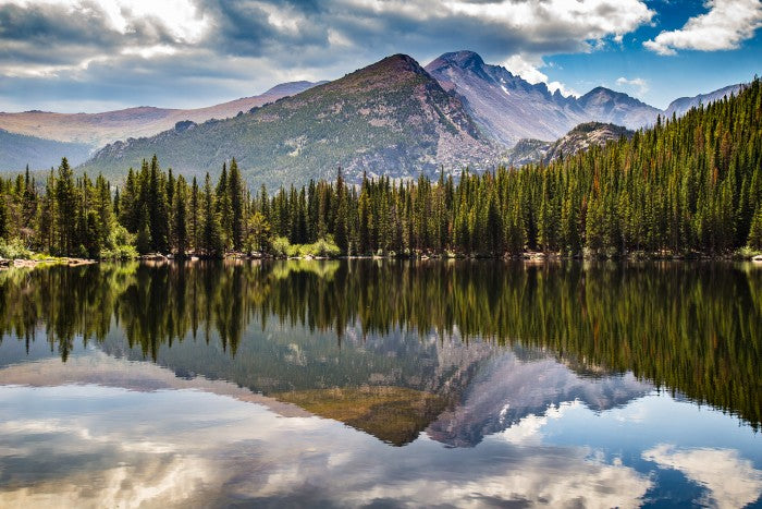
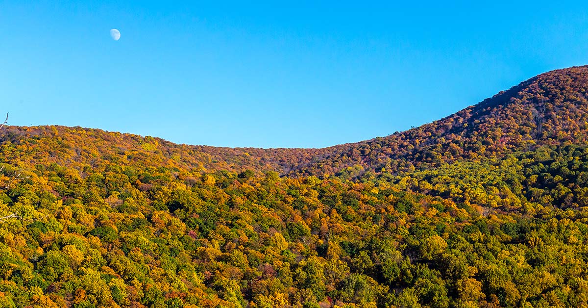
Just 75 miles from the bustle of Washington, D.C., Shenandoah National Park is your escape to rest, relaxation and recreation. Meander along Skyline Drive -- a 105-mile road that runs the entire length of the park in the Blue Ridge Mountains of Virginia, generally along the ridge of the mountains. Hike to cascading waterfalls, spectacular vistas and quiet wooded hollows. Or picnic with the family and enjoy the 200,000 acres of protected lands are haven to deer, songbirds, and an incredible night sky.


The park is long and narrow, with the broad Shenandoah River and Valley to the west side, and the rolling hills of the Virginia Piedmont to the east. Although the scenic Skyline Drive is the most prominent feature of the park, almost 40% of the land area has been designated as wilderness and is protected as part of the National Wilderness Preservation System. My name is Rob Decker and I'm a photographer and graphic artist with a single great passion for America's National Parks! I've been to 50 of our 61 National Parks — and I have explored many areas of the park — so I'm here to offer some suggestions! If this is your first time to the park, or you're returning after many years, check out some of the best things to do in Shenandoah National Park!


Experience Skyline Drive


As you travel along Skyline Drive you will notice mileposts on the west side of the road (right side if you are traveling south, left if you are heading north). These posts help you find your way through the park and help you locate areas of interest. The miles begin at 0 at Front Royal and continue to 105 at the southern end of the park. The largest developed area, Big Meadows, is near the center of the park, at mile 51. All park maps and information use these mileposts as a reference.


Shenandoah National Park


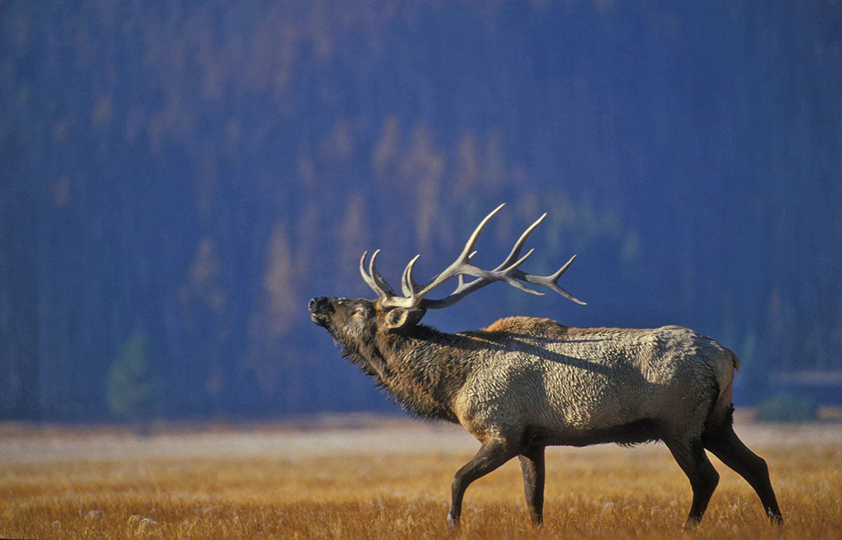
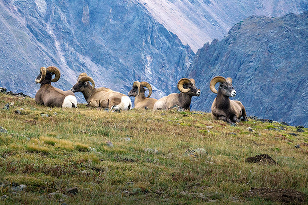
The speed limit is 35 mph, so you can roll down your windows, feel the breeze and experience every curve and turn of this beautiful drive. There are nearly 70 overlooks that offer stunning views of the Shenandoah Valley to the west or the rolling Piedmont to the east. Black bear, wild turkey, and a host of other woodland animals call Shenandoah home and regularly cross Skyline Drive in their daily travels. Watch carefully for these animals who may dart across your path without warning.


Who Doesn't Love a waterfall?


Shenandoah National Park


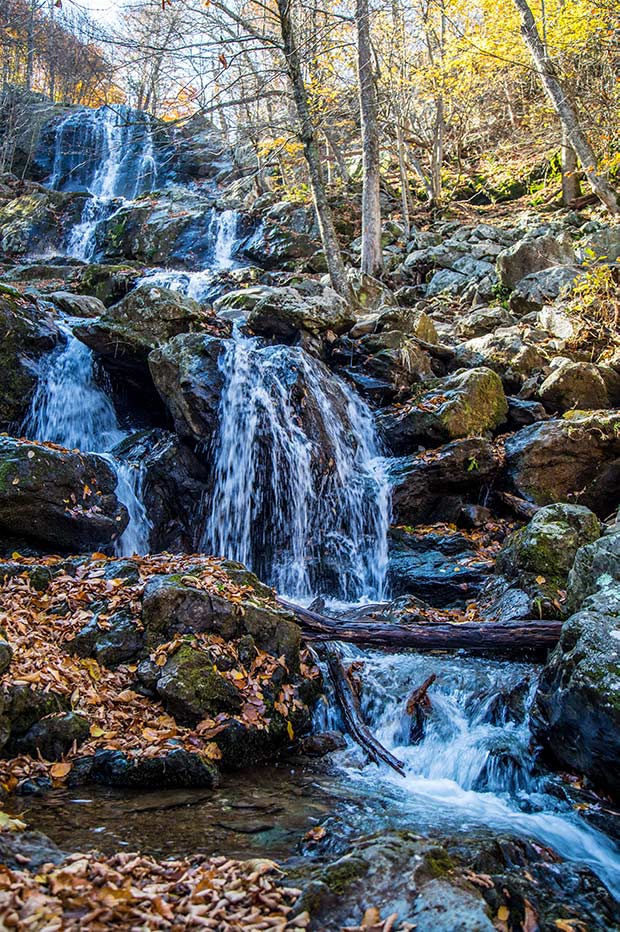
Besides small cascades along streams, there are large and lovely waterfalls in each section of Shenandoah National Park. All are accessible from a parking place along Skyline Drive. But they all involve a hike downhill—and, of course, the harder hike back up! Check out the waterfalls -- each with its own beauty and personality. Here are some of the more popular falls…

  • Overall Run Falls at mile 21.1

  • Whiteoak Canyon Falls at mile 42.6

  • Cedar Run Falls at mile 45.6

  • Rose River Falls at mile 49.4

  • Dark Hollow Falls at mile 50.7

  • Lewis Falls at mile 51.4

  • South River Falls at mile 62.8

  • Jones Run Falls at mile 84.1


Get Out and Hike!


Shenandoah National Park


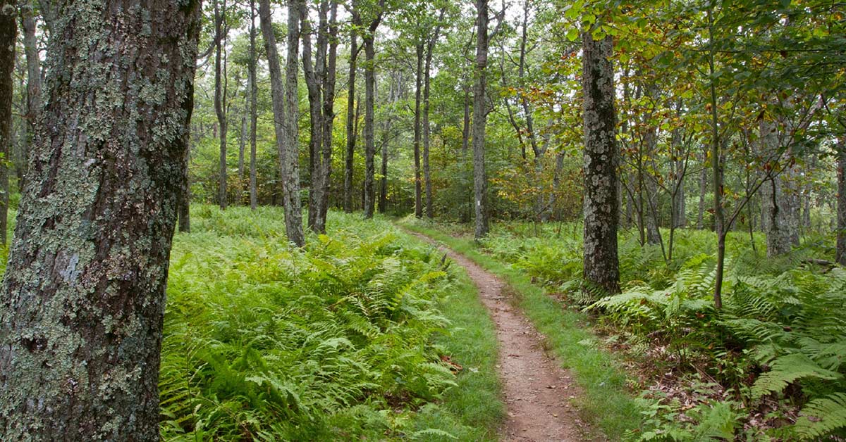
There's so much more to see than just waterfalls, and hiking is the best way to get out an explore the park. There are over 500 miles of hiking trails in Shenandoah ranging from easy to very strenuous. You can even hike part of the Appalachian Trail! When you are out on the trails, look for the concrete trail markers with directional information at trailheads and intersections. Here are some suggestions for hiking the North, Central and Southern Districts of the park.


North District Hikes in Shenandoah


From the tallest waterfall in the park, to the quiet historical Fox Hollow Trail, the North District of Shenandoah has something for everyone. Hikes in the North District of Shenandoah National Park include the quiet, historical Fox Hollow Trail, the scenic Overall Run Falls, and Compton Peak, with impressive columnar jointing geological features. While in the North District be sure to talk to a ranger at Dickey Ridge Visitor Center.


Central District Hikes in Shenandoah


Whether you are looking for a short hike through the forest or a destination hike leading to peaks or waterfalls, the Central District of Shenandoah National Park offers many options for recreation and relaxation. Hiking options in the Central District include scenic waterfalls like Dark Hollow Falls and Whiteoak Canyon, sweeping summits like Stony Man Mountain and Marys Rock. The Central District also includes Big Meadows and Skyland, areas rich with history that currently are home to lodging, dining, and shopping options.


South District Hikes In Shenandoah


The South District is the most remote area of Shenandoah National Park. Whether you are looking to take a shorter hike to rugged talus slopes or a longer trip into the Wilderness, your adventure starts here. The South District offers plenty of hiking opportunities from the easier Blackrock Summit -- featuring a rocky talus slope and majestic views -- to the very strenuous Riprap Trail featuring cascades, and views of Shenandoah's Wilderness. While there is no visitor center in the South District, the Loft Mountain Wayside and Campground can offer some services.


Bicycling Through the Park


Another great way to see the park is on two wheels! Bicycling is permitted along Skyline Drive and on paved areas in the park. Bicycles (road and mountain bikes) are not permitted on trails, unpaved roads or in grassy areas. Because Skyline Drive is a two-lane road with steep hills and numerous blind curves, cyclists are urged to use extreme caution.


Shenandoah National Park


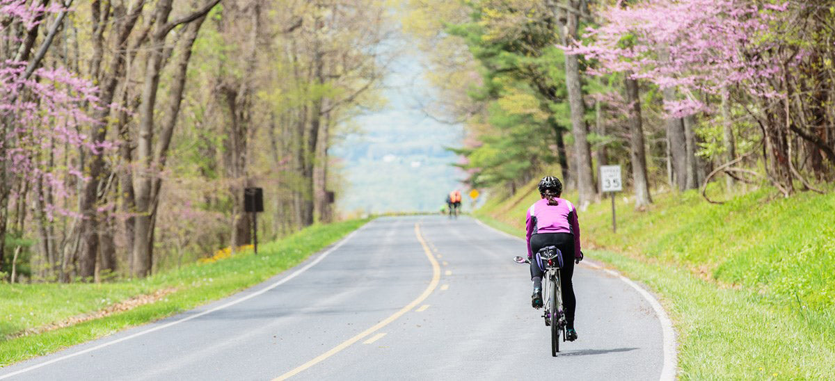
Photo Courtesy NPS/Neal Lewis


Cyclists should be prepared to operate their bicycles during periods of low visibility, or while traveling through a tunnel, or between sunset and sunrise. During periods of fog, reflectors will not provide the necessary safety for bicyclists. Lights on both the front and rear of the bicycle are required. Mountain areas can experience dramatically different weather than what is being experienced in the lowlands, so be prepared!


Camping & Sleeping Under the Stars


There's no better place to do it than Shenandoah! Beautiful campgrounds, each with unique features and access to nearly 200,000 acres of backcountry to explore are perfect for your next camping adventure!


Shenandoah National Park


Mathews Arm Campground


Mathews Arm, at mile 22.1 of Skyline Drive, is the nearest campground for those entering the park from the north. It is next to a nature trail and the trail to Overall Run Falls, the tallest waterfall in the park. Elkwallow Wayside, with camping supplies and food service, is two miles away.


Big Meadows Campground


Located at mile 51.2 of Skyline Drive, Big Meadows Campground is near many of the major facilities and popular hiking trails in the park. Three waterfalls are within walking distance; the Meadow, with its abundant plant growth and wildlife, is close by.


Lewis Mountain Campground


Lewis Mountain Campground is located off mile 57.5 of Skyline Drive and is the smallest campground in the park.


Loft Mountain Campground


Located at mile 79.5 of Skyline Drive, Loft Mountain Campground is the largest campground in the park. The campground sits atop Big Flat Mountain with outstanding views to east and west. Two waterfalls and the trails into the Big Run Wilderness area are nearby.


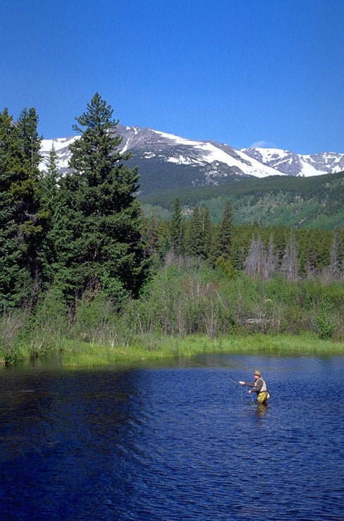
Fishing in Mountain Streams


Shenandoah National Park


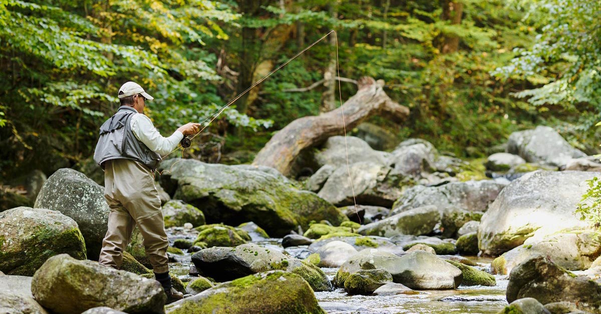
Photo courtesy NPS/Neal Lewis


Shenandoah National Park contains over 70 mountain streams that support diverse aquatic resources including brook trout populations. Fishing opportunities are abundant but are also regulated in order to preserve and protect fish resources. For current rules, license requirements, guidelines on ethical fishing techniques, and planning a fishing trip, make sure to review the park's fishing regulations.


Rock Climbing


Rock climbing is a popular activity in Shenandoah National Park. Opportunities for all levels of climbers abound. Providing these opportunities are part of Shenandoah's mission as is protecting the resources. Responsible rock climbing practices will ensure that these opportunities will be enjoyed by future generations.


Ranger Programs


Ranger-guided programs give visitors the opportunity to explore the wonders of the park with a Ranger. Programs are offered in spring, summer, and fall. Discover the many stories of Shenandoah's past, take a walk through the splendor of a unique mountain meadow, or learn about the many animals and plants that thrive in Shenandoah National Park.

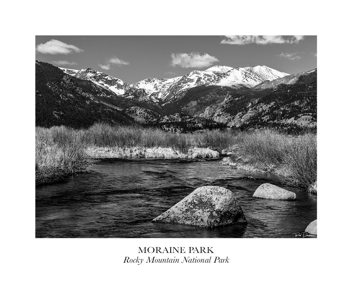
I've created a poster for Shenandoah National Park that features Dark Hollow Falls.


Click here to see the Shenandoah National Park poster.


Rob Decker is a photographer and graphic artist with a single passion for our National Parks! Rob is on a journey to explore and photograph each of our national parks and to create WPA-style posters to celebrate the amazing landscapes, vibrant culture and rich history that embody America's Best Idea!


Click here to learn more about Rob & the National Park Poster Project!


Source: https://national-park-posters.com/blogs/national-park-posters/best-things-shenandoah-national-park

attachement