Death Valley National Park
Death Valley National Park is a land of extremes, with steady drought and record summer heat. Yet, each extreme has a striking contrast. Towering peaks are frosted with winter snow. Rare rainstorms bring vast fields of wildflowers. Lush oases harbor tiny fish and offer refuge for wildlife and humans. With nearly three million acres, Death Valley National Park is the driest, hottest, and lowest point in North America. Despite its morbid name, a great diversity of life survives in Death Valley.
My name is Rob Decker and I'm a photographer and graphic artist with a single great passion for America's National Parks! I've been to 52 of our 61 National Parks — and I have explored many areas of Death Valley National Park — so I'm here to offer some suggestions! If this is your first time to the park, or your returning after many years, check out some of the best things to do in the park! From Badwater Basin to Furnace Creek to Stovepipe Wells, Death Valley National Park offers much to see and do!
Visit Badwater Basin
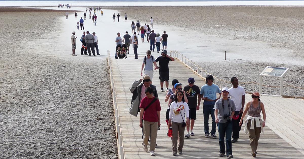
Badwater Basin is the lowest elevation in North America at - 282 feet below sea level. A visit to this otherworldly salt flat will provide you with a unique experience and a landscape that appears to stretch on forever. A short 1/4 mile (400 m) hike will you bring you to the polygon salt formations that Death Valley is famous for, or in the summer months, the view can be enjoyed from the parking area.
Tour Artists Drive
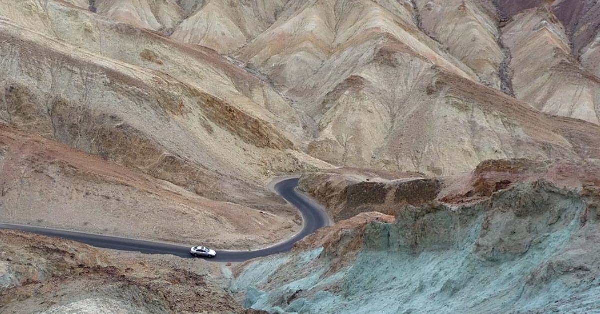
Enjoy a scenic drive through a geologic rainbow! Artists Drive is a one-way, nine mile drive that passes through eroded, colorful desert hills. A stop at Artists Palette along the way, either from the car window or a short walk, will provide the most colorful views. Enjoy geology and scenic vistas along this trip!
Play at the Devils Golf Course
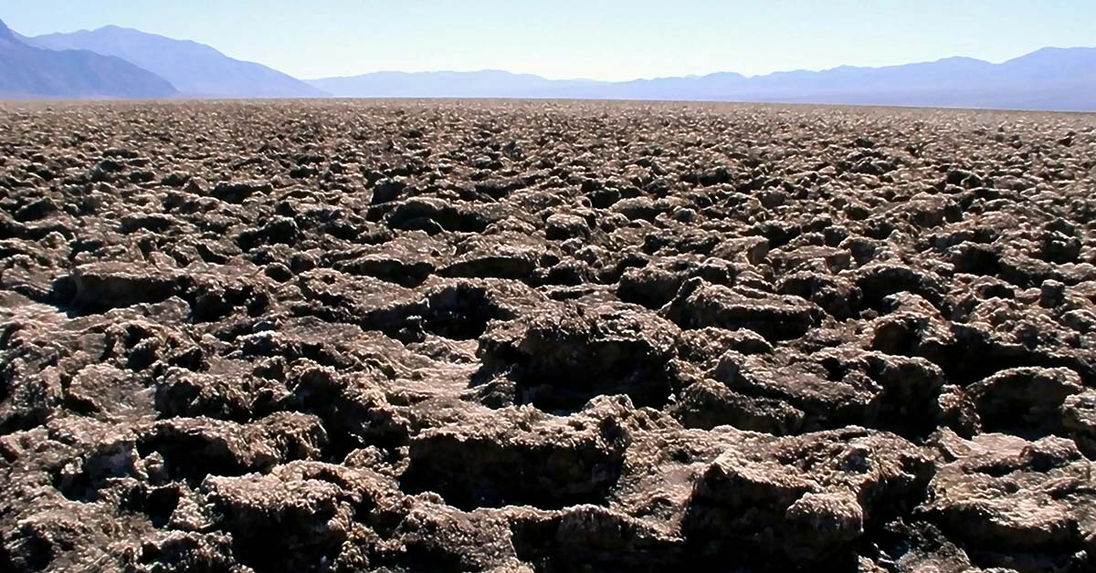
An immense area of rock salt eroded by wind and rain into jagged spires. So incredibly serrated that "only the devil could play golf on such rough links". Listen carefully and you'll hear sounds like tiny pops and pings. Bend your ear to the ground and the sound grows louder. The sound is literally billions of tiny salt crystals bursting apart as they expand and contract in the heat.
Hike Golden Canyon
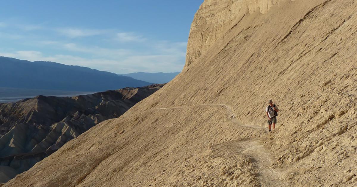
A labyrinth landscape of golden colored hills and winding narrow canyons create hiking options ranging from easy strolls to strenuous adventures. The most popular routes can be combined with one another for longer adventures, up about 4.5 miles. Regardless which adventure is right for you, take the map and route description with you.
Catch the Sunrise at Zabriskie Point
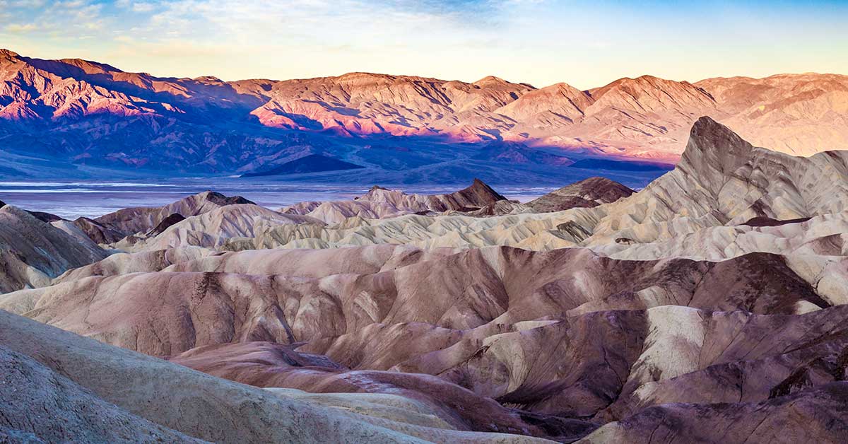
The most famous viewpoint in the park. Overlooking the golden colored badlands of the Furnace Creek formation, visitors can simply enjoy the view or elect to start the hike from the point around Badlands Loop. Connector trails lead to Golden Canyon, Gower Gulch, and Red Cathedral. The point is most popular at sunrise and sunset.
Visit Mesquite Flat Sand Dune
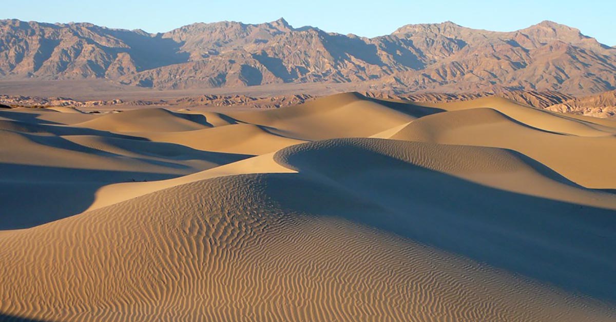
Mesquite Flat Sand Dunes are the largest dune field in the park. This dune field includes three types of dunes: crescent, linear, and star shaped. Polygon-cracked clay of an ancient lakebed forms the floor. Mesquite trees have created large hummocks that provide stable habitats for wildlife.
See Death Valley from Above at Dantes View
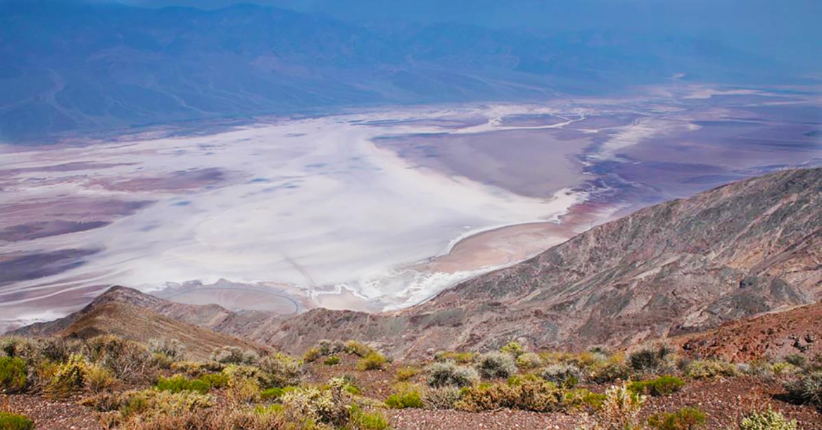
At 5,475 ft, this is the most breathtaking viewpoint in the park. Facing west, the view of the Panamint Mountains towering over the lowest point (-282 ft.) in North America (Badwater Basin) offers one of the best sunrises in the park. On the far western horizon are the Sierra Nevadas, home to the highest point (14,505 ft.) in the contiguous United States.
Step Back in Time at the Keane Wonder Mine
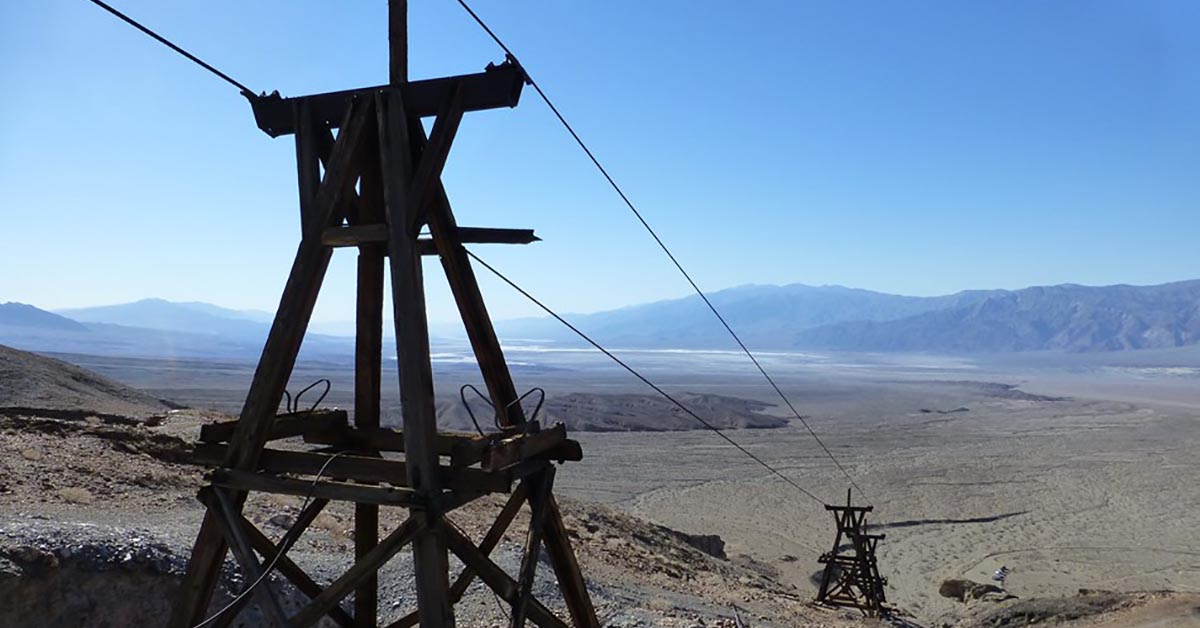
Experience one of the most unique historical mining sites in Death Valley! The Keane Wonder Mine reopened in 2017 after its closure in 2008. Operating in the early 1900s, the Keane Wonder Mine was one of the most successful gold mines in Death Valley. It now remains as one of the best examples of a historical gold mining operation in the park.

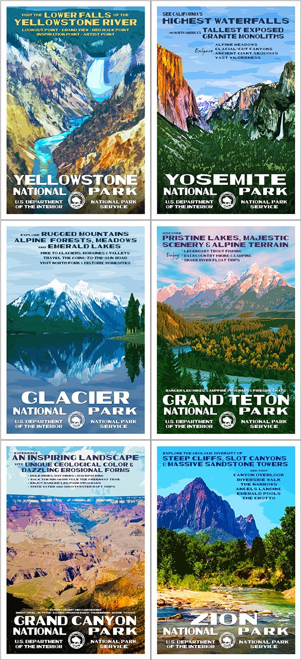
The Death Valley National Park poster features a view of the sunrise from Zabriskie Point.
Click here to see the Death Valley National Park poster.
Click here to read more about Death Valley National Park.
Source: https://national-park-posters.com/blogs/national-park-posters/best-things-to-do-in-death-valley-national-park