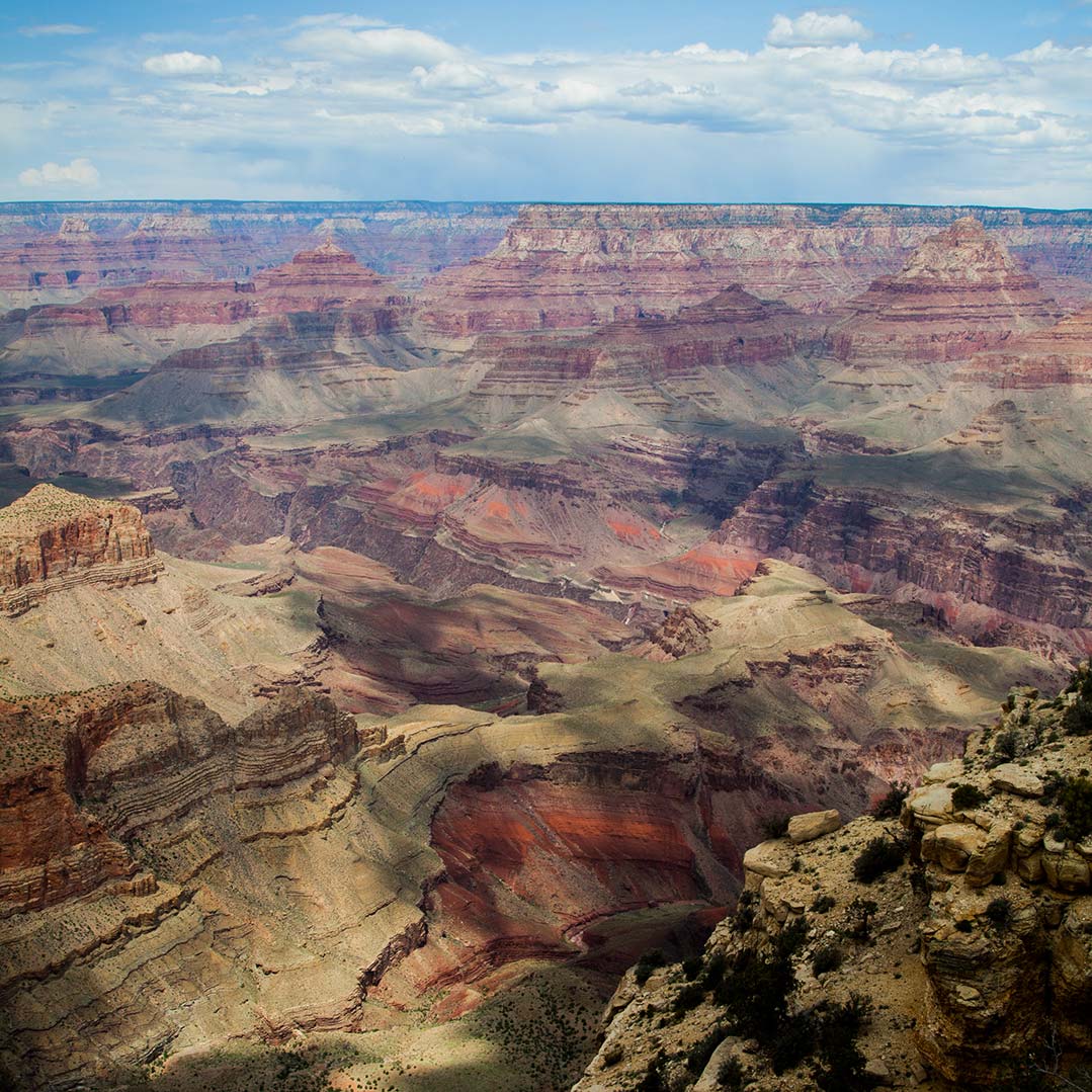
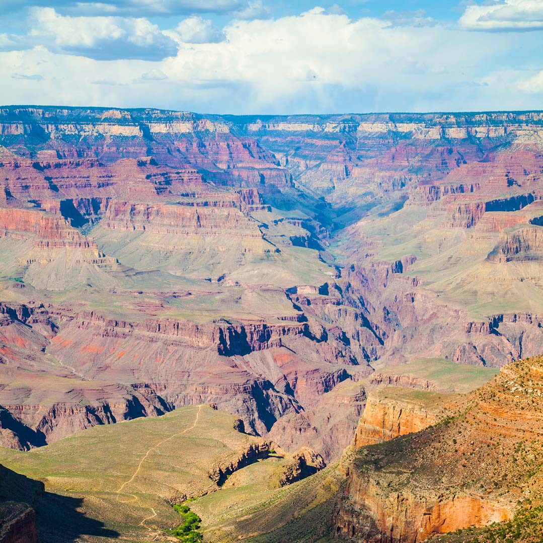
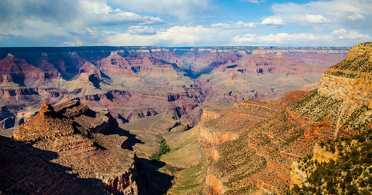
There's nothing like your first visit to Grand Canyon National Park — and the first time you look over the rim — it's simply awe-inspiring! The extraordinary combinations of geologic color and erosional forms decorate this canyon, which is 277 river miles long, up to 18 miles wide, and a mile deep. Without question, the Grand Canyon overwhelms our senses through its immense size.
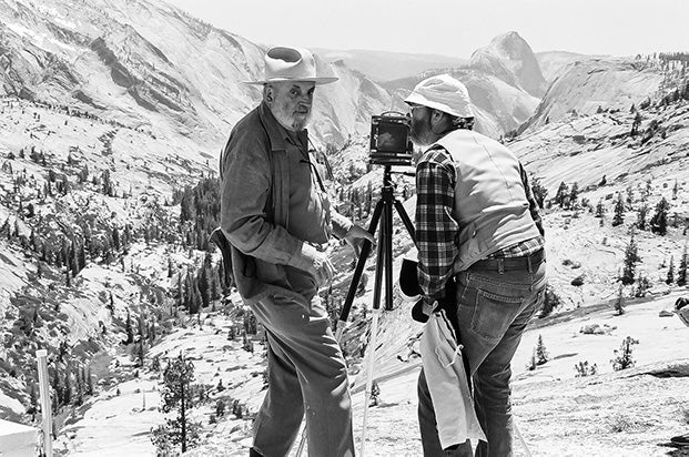
My name is Rob Decker and I'm a photographer and graphic artist with a single great passion for America's national parks! I've been to 48 of our 61 national parks — and Grand Canyon National Park is one place you have to see! Whether you're more comfortable exploring the canyon from the rim, or want to take a more adventurous route on foot, by bike, or on the back of a mule, I've been to Grand Canyon National Park many times — so I'm ready to help! If this is your first time to the park, or your returning after many years, here are some of the best things to do in Grand Canyon National Park!
Walking or Hiking
The Rim Trail
Going on a hike is a wonderful way to experience the Grand Canyon National Park's rich natural beauty and immense size. The Rim Trail is perfect for quiet views of the inner canyon and for visitors who desire an easy hike. The Rim Trail stretches from the South Kaibab Trailhead west to Hermits Rest, a distance of about thirteen miles -- and most of the trail is paved. Between Pipe Creek Vista and Bright Angel Lodge only a few short sections of the trail have grades that exceed accessibility standards. West of Bright Angel Lodge, the Rim Trail narrows and climbs the Bright Angel Fault to viewpoints along Hermit Road. Between Powell Point and Monument Creek Vista the trail is a three foot wide dirt trail. The section of the Rim Trail between Monument Creek Vista and Hermits Rest is also known as the Hermit Road Greenway Trail and provides three miles of paved greenway trail provide additional views for cyclists and hikers.
Walk the Trail of Time
Start at the Yavapai Museum of Geology and finish up at the Verkamps Visitor Center — a 1.2 mile stroll along the canyon rim. The path contains information about the canyon's geologic history, and samples from each layer of the canyon.
Day Hikes: Exploring the Canyon on Foot
Day hikes are by far the most popular type of trip into the Grand Canyon. A down-and-back excursion lets you commit to traveling only as far as you think you can handle, and it allows for carrying less of a load to weigh you down. One of the most popular day hikes in Grand Canyon National Park is the 9-mile round-trip on the Bright Angel Trail to Indian Garden and back. If you go, you must bring enough food and water — and sunscreen — to last the day. Because this hike starts by descending into the canyon — the easy part comes first. You'll start at an elevation of 6,860 feet and drop to 3,800 feet — a hike that will take you 5-6 hours when taking plenty of breaks.
Overnight Backpacking
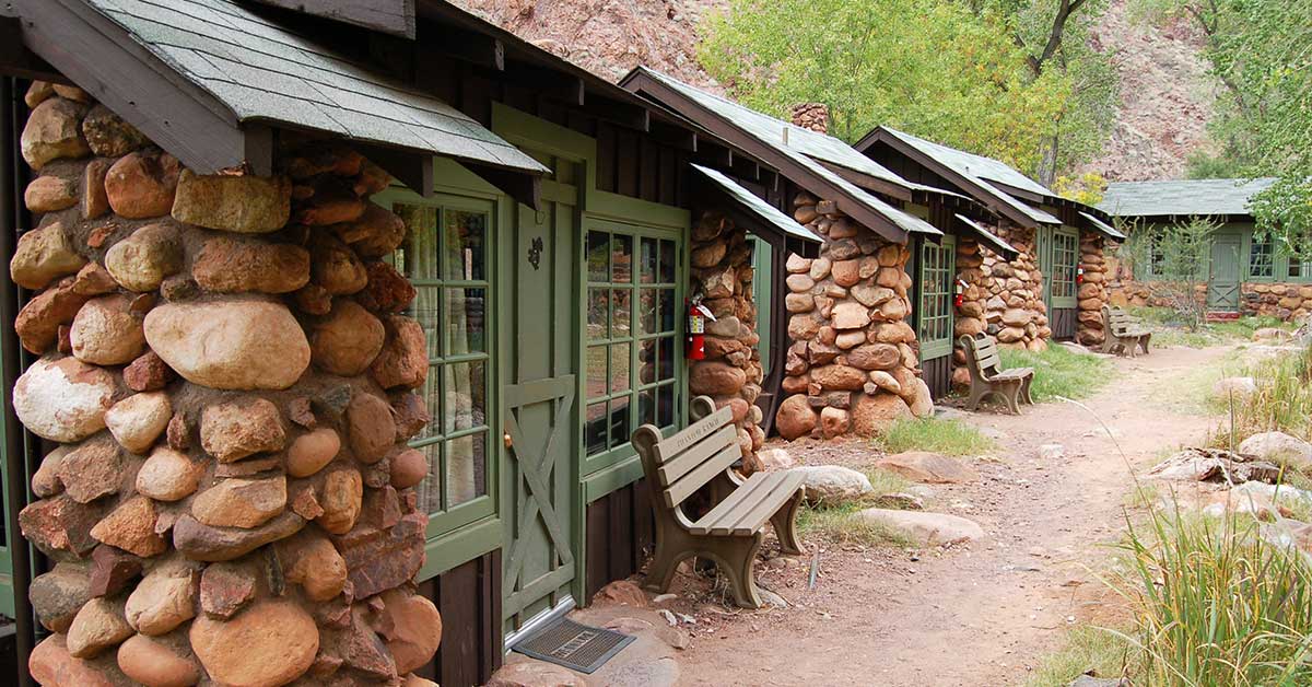
Spending the night is the best way to experience Grand Canyon National Park. You can take more time to enjoy the scenery — and travel farther to see more of it. Traveling to the bottom of the canyon in one day, camping at the bottom, and coming up the next day is the best way to see the Colorado River. Most people can't make it to the river and back in one day. The walk to Phantom Ranch is approximately 7.5 miles down the South Kaibab Trail (4-5 hours) or 10 miles on the Bright Angel Trail (4-6 hours). A good rule of thumb is for every hour it takes to hike down, it will take two to hike up.
Bicycling
Bicycling is a great way to experience the South Rim at Grand Canyon National Park. And bicycles are allowed on all paved and unpaved roads on the South Rim. Cyclists can enjoy approximately 13 miles of roads and Greenway Trails that allow for more intimate explorations along the rim. If you get tired, load your bike on one of the park's bicycle-friendly shuttle buses - there is a bus stop every one-half to one-mile along the 13 mile-stretch. Scenic Hermit Road follows the canyon rim for seven miles and is one of the best places in the park for cycling. Most of the year, private vehicle restrictions eliminate most traffic. The Hermit Road Greenway Trail, between Monument Creek Vista and Hermits Rest, provides a 2.8-mile bicycle path away from the road and, in places, along the rim of the Grand Canyon. Don't have a bike with you? Rent one from Bright Angel Bicycles, next to the Grand Canyon Visitor Center. Bright Angel Bicycles provides rentals and guided bicycle tours between mid-March and October 31. There is also a small coffee bar and café with a grab & go menu targeted toward hikers, bikers and pedestrians. The café is open year-round.
Tour the Scenic Hermit Road (also known as West Rim Drive)
Hermit Road is a scenic route along the west end of Grand Canyon Village on the South Rim which follows the rim for seven miles out to Hermits Rest. Access this popular route by using the free park shuttle, or travel on foot, by bicycle, or commercial bus tour. Along the canyon rim are nine designated viewpoints where the free Hermits Rest Route shuttle bus stops. Free shuttle bus service runs from March 1 through Nov. 30. During this time, the road is closed to private vehicles. Besides the main road, there is a designated greenway for travel by foot or bicycle. Commercial bus tours, jeep tours, and van tours, are also available.
Tour Desert View Drive (Hwy 64 - also known as East Rim Drive)
This 25 mile road leaves Grand Canyon Village, then travels east to Desert View. You can drive your private vehicle, or take a commercial bus tour, a jeep tour, or van tour. View the Colorado River at Moran, Lipan and Desert View Points. You may exit or enter the park on the eastern end at Desert View. (via Arizona Highways 64 and 89)
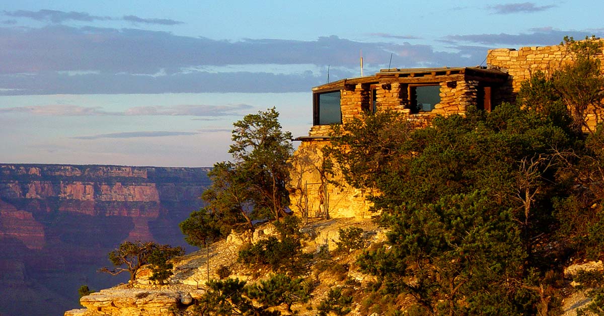
Explore Desert View Point
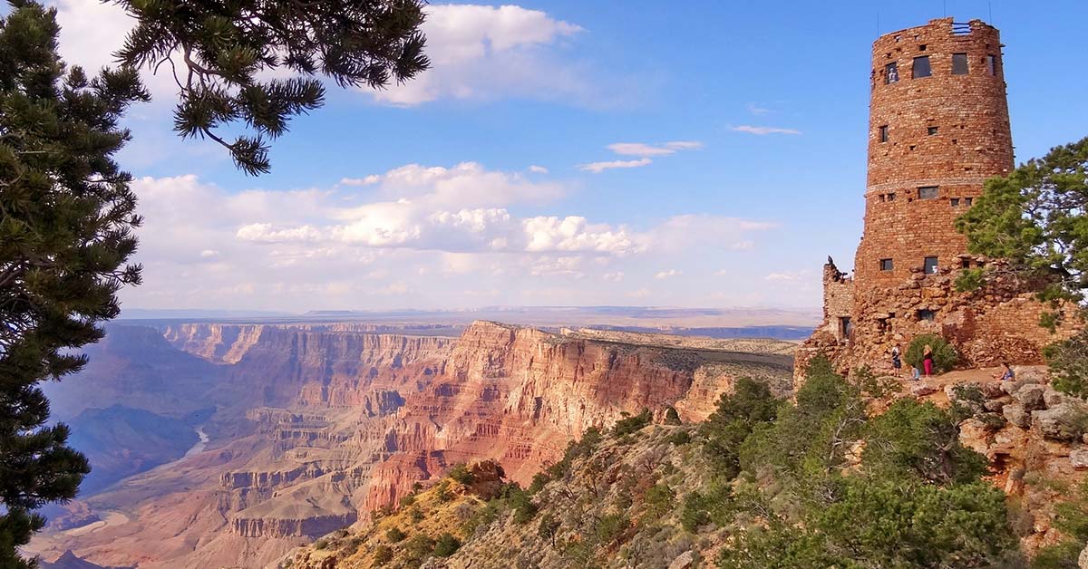
Climb to the top of a 70 ft. tall stone Watchtower for a panoramic view extending more than 100 miles on a clear day. Designed in 1932 by Mary Colter, the historic Watchtower is a replica of prehistoric towers found on the Colorado Plateau. There is also a general store, deli, seasonal campground, and gas station.
Experience Desert View's Cultural Demonstration Program
At Desert View, you can interact with tribal artisans from Grand Canyon's traditionally associated tribes - where they share their history and crafts. Jewelers, silversmiths, weavers, potters, sculptors, and a variety of other artisans are present throughout the year. The demonstrations are free and take place in the historic Watchtower on the rim of the Grand Canyon.
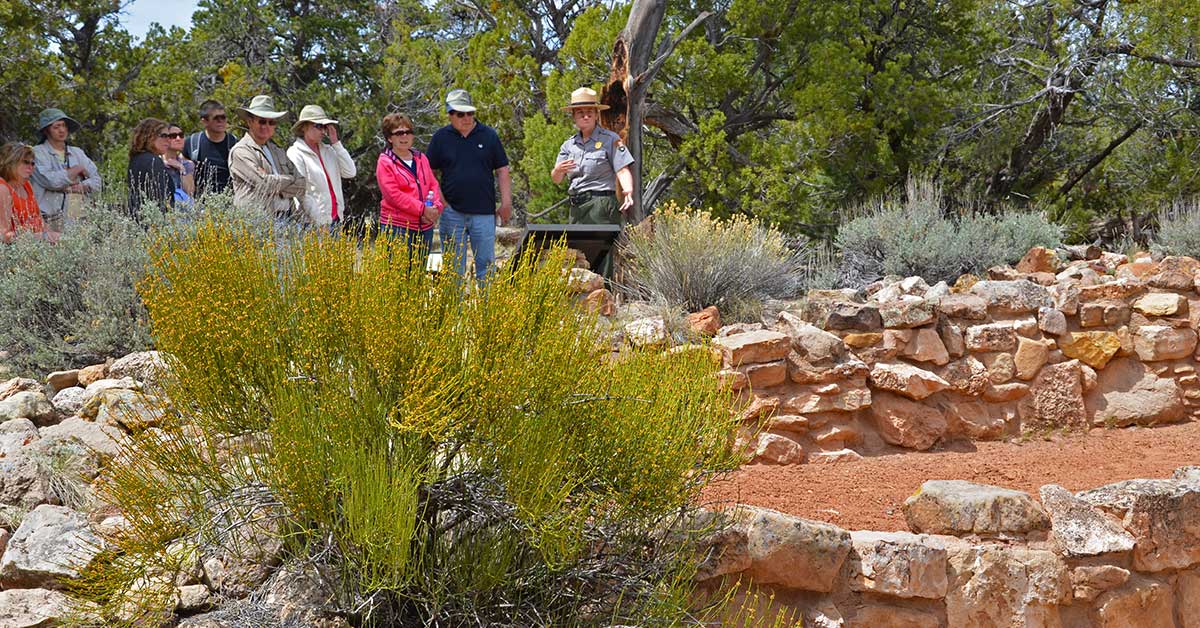
Tusayan Ruin
is the remains of a small Ancestral Puebloan village located 3 miles west of Desert View. The Tusayan Ruins — also known as the Tusayan Pueblo — is an 800-year-old Pueblo Indian site within Grand Canyon National Park. Many consider it to be one of the major archeological sites in Arizona. The site comprises a small, u-shaped pueblo featuring a living area, storage rooms, and a kiva.
Tusayan Museum
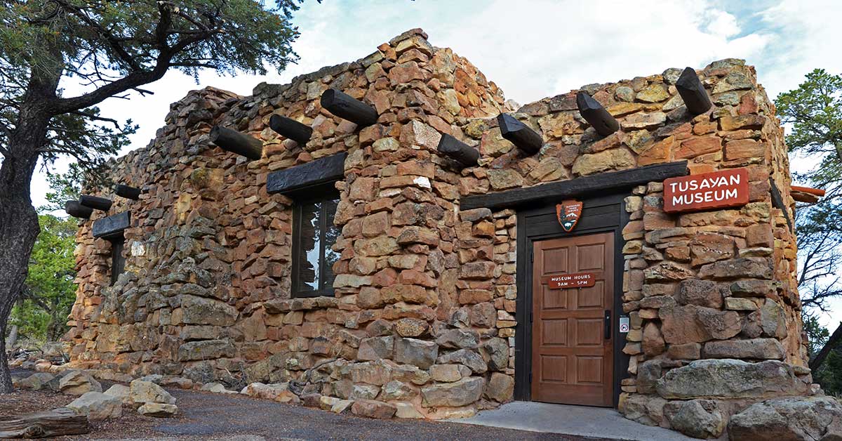
This interactive facility contains a variety of exhibits designed to enhance visitors' understanding of the unique human history of the Grand Canyon National Park area. The museum provides interesting displays — including artifacts dating back to 4,000 years. Admission is free. Hours: 9 am to 5 pm. There are also daily ranger-led tours of the ruins.
Explore the Grand Canyon on the back of a Mule
South Rim Mule Trips
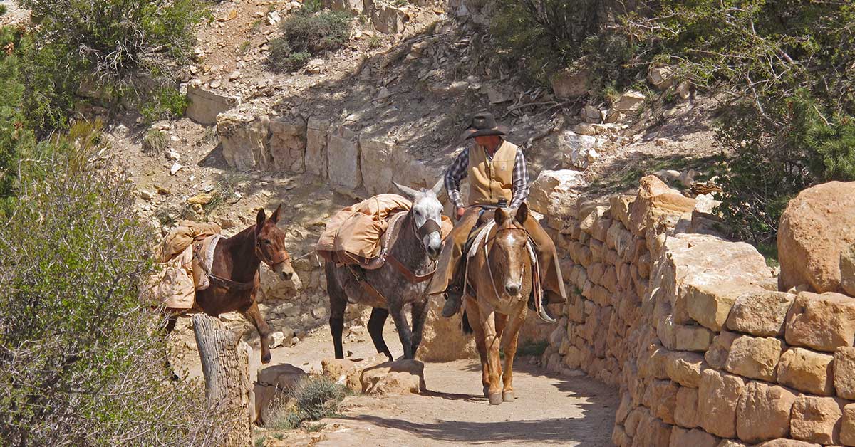
For the more adventurous visitor looking to create the memory of a lifetime, take a mule ride along the rim or perhaps down into the Grand Canyon itself. Horses may be iconic to the American West, but the equine of choice at Grand Canyon has long been its hybrid relative, the mule. These animals have the sure-footedness of a burro along with the larger size and strength of a horse. They have been carrying canyon visitors since the late 1800s. In fact, more than 600,000 people have taken Grand Canyon mule rides since they were first offered in 1887. There is no Grand Canyon National Park adventure more rewarding or more unique than a mule ride. The overnight rides take you deep into the canyon, where you can stay overnight at Phantom Ranch. If you think the view from the rim takes your breath away, wait until you experience the Grand Canyon from within.
Canyon Vistas Mule Ride
If you only have a short time to visit the South Rim, but are still looking for some adventure, take the Canyon Vistas Rim Ride. The ride doesn't take you into the canyon itself, but the views along the way are stunning. Grand Canyon mule riders can take in the breathtaking vistas of Grand Canyon National Park while traveling along the rim of the canyon.
Whitewater and Smooth-water Raft Trips on the Colorado River
Sit back, relax, listen and learn as you learn the story behind the scenery of one of America's great rivers. Here, canyon walls rise a thousand feet into the sky. Mysterious messages have been carved into stone by the Ancient Ones. And, look skyward for eagles, herons, and maybe even a California condor as you drift on the crystal clear water, carried by the gentle current of the Colorado River.
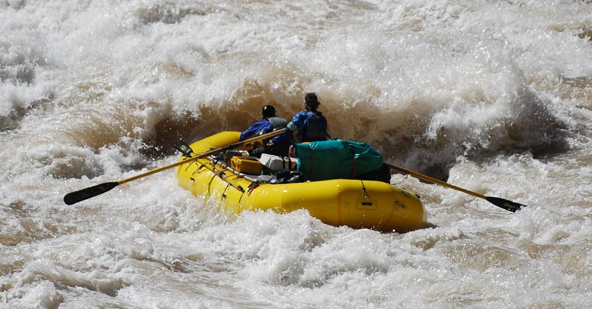
Ask any of the 22,000 Colorado River runners who brave the Grand Canyon white water river rafting trips each year to describe the experience — and you're likely to hear that it is “the trip of a lifetime.” Whitewater trips through Grand Canyon last from 3 days to 21 days and require reservations made well in advance. Or, you can experience the thrill of a 15.5-mile smooth water float trip down the Colorado River, through Glen Canyon and Horseshoe Bend. Any lodge within the park may arrange half-day and all-day smooth water trips from Glen Canyon Dam. Excursions include transportation from the lodges.
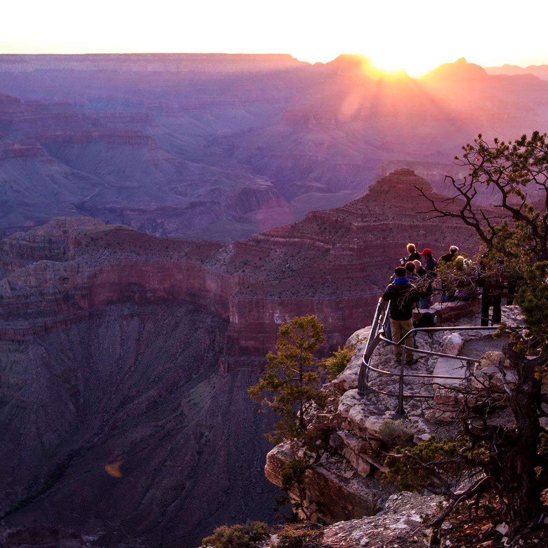
Photographing the Grand Canyon
The Grand Canyon is one of the most iconic landscapes in the United States and is a favorite destination of many photographers. Although there are endless amazing photographic opportunities at Grand Canyon National Park, once you spend a little time at the rim, and you soon realize why most viewpoints are the best places to view and photograph the canyon. The overlooks are at places where the rocks jut out into the canyon, providing the best views. Here are some of my favorite places to make lasting images...
- Yaki Point - Best to shoot here at dawn.
- Mather Point - The classic Grand Canyon view, and for good reason.
- Mohave Point - A spectacular view of the river looking west.
- Hopi Point - Another classic South Rim overlook with expansive views both east and west.
- Desert View Point - The Watchtower with the river below and the Palisades of the Desert in the background. Makes a great sunset shot.
Attend Free Ranger Programs
Grand Canyon National Park offers one of the most extensive ranger programs in the National Park Service system. Learn more about Grand Canyon nature, science, history and culture with a park ranger as your guide.
Ranger programs offer guided hikes, where you will learn about the wild inhabitants who survive in this place of extreme changes in elevation, exposure, and climate. Join a ranger to discover stories of humankind's enduring relationship with the canyon, or to hear captivating stories about diverse human connections. Learn how the Grand Canyon was formed while exploring Yavapai Geology Museum. Or, enjoy special events and evening programs during the summer in a beautiful auditorium or outdoor amphitheater — like star walks, night hikes, cemetery tours, and more. There are too many programs to list — and they are always changing, so check the South Rim Village or the South Rim Desert View Ranger Program schedule once you arrive.
Stop by a Visitor Center, Historic Home or Museum
And don't forget the Visitor Centers, historic homes and museums that house exhibits and provide all the park information you'll need for your stay at Grand Canyon National Park, including the film: Grand Canyon: A Journey of Wonder, that's shown in the theater at the Grand Canyon Visitor Center.

Click here to see the Grand Canyon National Park poster.
Rob Decker is a photographer and graphic artist with a single passion for our national parks! Rob is on a journey to explore and photograph each of our national parks and to create WPA-style posters to celebrate the amazing landscapes, vibrant culture and rich history that embody America's Best Idea!
Click here to learn more about Rob and the National Park Poster Project
Source:
https://national-park-posters.com/blogs/national-park-posters/best-things-grand-canyon-national-park-south-rim