Monday, May 31, 2021

Best Things to Do in Everglades National Park


While the Everglades may conjure images of hot and humid weather with mosquitos and alligators, there is so much more to this unique climate that is brimming with beauty and mystique. As the third-largest national park in the U.S (about 2,400 square miles!), unless you have access to a boat, most visitors only scratch the surface and visit a fraction of the area.


Everglades, Aligator | National Park Posters


Even if you only have one day to explore, you can easily drive through a good portion of it, go on short walks, look for manatees and alligators, and even take a kayak trip or a ride in an airboat. But hopefully you will have more time than that to fully appreciate all this national park has to offer.


The Everglades is a huge wetland, fed by water from Lake Okeechobee. But for many hundreds of years, we humans have been encroaching on its wonders. About a hundred years ago, we built canals, diverting the water from the lake into cities and residential areas, which has dramatically changed the delicate ecosystem here. As a result, wildlife populations dwindled, and now a few species are on the verge of extinction.


When you do visit the Everglades and explore its many activities, an awareness of the conservation and restoration efforts of this great place is a good thing to have in the back of your mind.


The Ernest F. Coe Visitor Center


As with most national parks, the visitor center should be one of the first stops, as it can glean valuable insight into what is offered and you can find out about current events happening within the park.


With educational exhibitions and plenty of maps, it's the perfect place to get an overview of the extensive offerings in the Everglades. Be sure to stay for a showing of River of Life, a 15-minute film that provides an excellent park overview. The Coe Visitor Center also provides information on park ranger-led activities (mostly talks and some walks) as well as details about boat tours and canoe rentals.


Everglades Visitor Center Exhibit


Books, postcards, and even insect repellant can be purchased so that you are well prepared for the best park experience possible. Many of the popular hiking trails are only a short drive away.


Where the Hiking is Superb


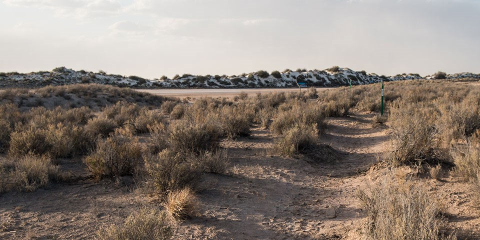
Everglade's Trails allow for hearty exploration of diverse habitats. Bring plenty of water and stay aware of changing weather conditions. Florida's weather can be temperamental, especially during the wet season. Mosquitos and other biting flies can be present year-round, so bug repellent is always a good idea when you're experiencing one of the most breathtaking climates in America. Sunscreen and hats are a must for the warmer months.


The Anhinga Trail is an easy 0.8-mile trail, partly paved and partly boardwalk that leads through a small section of wetlands. It's a great way to safely spot alligators and Anhingas, which is the bird the trail is named after.


The Gumbo Limbo Trail is paved and meanders through a shaded, jungle-like hammock of gumbo trees, royal palms, ferns, and lush plants. It is an easy 0.4-mile trek and starts at the Royal Palm Visitor Center, about four miles from the main park entrance. Pahayokee Overlook is a raised observation platform on a short boardwalk loop offering amazing sweeping vistas of the “river of grass.” Located 13 miles from the main park entrance.


The Mahogany Hammock Trail is another boardwalk trail that meanders through dense jungle-like hammock hardwoods. The lush vegetation is highlighted by gumbo-limbo trees, air plants, and the largest living mahogany tree in the U.S. Located about 20 miles from the main park entrance.


The Flamingo Trails offer a wide variety of differing climates and delve a little more into areas where species may be threatened, so check the latest developments with the visitor's center on trail availability.


Get On a Bike


Let the wetland wind whip past you on a bicycle trail, which is allowed on the main park roads, on the Shark Valley tram road, the Old Ingraham Highway, the Long Pine Key Nature Trail, the Snake Bight, and Rowdy Bend trails at Flamingo.


The Birdwatching is Divine


Here you will find some of the best birdwatching opportunities in the world. Over 300 species reside in the park or pass through on a migratory path. Some of the best spots for birding are near the Homestead entrance (Royal Palm area), and Flamingo Districts of the park.


Everglades, Heron | National Park Posters


The Anhinga Trail, Eco Pond, Mrazek Pond, Mahogany Hammock, Snake Bight Trail, and Paurotis Pond should be on your birdwatching list. A variety of exquisite and grand wading birds can be spotted in the Shark Valley areas.


Kayak Around Ten Thousand Islands


Ten Thousand Islands is an archipelago that covers more than 35,000 acres of Florida's southern tip. The eponymous national wildlife refuge lies in the northern portion, while the southern part is in Everglades National Park. The islands—which number in the hundreds, not thousands—are a perfect place to decompress in nature.


Everglades Kayaking | Robert B. Decker


A maze of mangroves in some of the most gorgeous scenery Florida has to offer awaits in this exotic location. It's also one of the least-explored places in the park, due to its remote location. Boat tours operate here through a portion of it when they're available. So if you're able to get a spot on a tour, look for bottlenose dolphins and manatees frolicking, and of course the ever-present crocodiles and alligators.


Tamiami Trail Scenic Drive


When the Tamiami Trail was constructed in 1928 traversing the Everglades, it was considered a feat of engineering, becoming the only route from Tampa to Miami at that time. Riding along the Tamiami Trail, visitors will enjoy the surprisingly varied landscape of the park, from pinelands to saw-grass marshes; you might catch a glimpse of an alligator sunning himself in one of the roadside canals and water birds are plentiful. In addition to the natural landscape, remnants of the 1950s and 60s tourist traps remain, man-made kitsch is abundant and there are plenty of opportunities to ride an airboat or go gator-sighting. Keep an eye out for the Skunk Ape, the Everglades' version of Big Foot.


Click here to see the Everglades National Park poster.


Rob Decker is a photographer and graphic artist who had the rare privilege of studying under Ansel Adams in Yosemite National Park when he was just 19 years old. Now, Rob is on a journey to explore and photograph all 61 of America's National Parks. He's creating WPA-style posters to help people celebrate their own national park adventures — as well as encourage others to get out and explore!


Join the growing community of 75k+ National Park enthusiasts to receive insider deals and updates.


See why 75k+ National Park fans have already joined...


Source: https://national-park-posters.com/blogs/national-park-posters/best-things-to-do-in-everglades-national-park

attachement

Monday, May 17, 2021

Big Cypress National Preserve – From Vast Wetlands to the Gulf


Closely linked to the Everglades to the south, a visit to southern Florida's Big Cypress National Preserve is a destination all its own, though many visitors don't realize it is separate from the Everglades National Park. Big Cypress itself covers an impressive 2,400 square miles and encompasses a huge swath of southern Florida east of Miami.


Big Cypress National Preserve | Robert B. Decker


When Congress created the preserve back in 1974 as America's first National Preserve, it was to protect the fresh water flow to the Everglades and the Ten Thousand Islands before emptying into Florida Bay. Its 729,000 acres are a natural habitat to many species, including the endangered Florida Panther. Here you will find five ecosystems: Hardwood hammocks, open prairies, Cypress domes, Pinelands, and Mangrove Estuaries.


The Welcome Center


Necessary for most any National Park or Preserve, coming to the information center is always a good idea as a first stop. The Welcome Center is located on the western end of the Tamiami Trail, and was built with renewable resources and energy efficiency in mind. Enjoy both indoor and outdoor exhibits and educational displays that will prepare you for the adventures ahead. During the cooler months, manatees frequent the warm canal waters at the back of the facility along the boardwalk.


Observe Wildlife Up Close and Personal


The Preserve is a fascinating swampland ecosystem brimming with exotic local wildlife such as alligators, southern leopard frogs, wild turkeys, snapping turtles, and the elusive Florida Panther. While the Florida Panther has been in endangered status for years, their population is slowly ticking back up, but sightings are rare.


Big Cypress National Preserve | Robert B. Decker


The bird watching is plentiful here, so be sure bring binoculars. With so much ground area in the Preserve, the number of bird species found in the Preserve is staggering.


Big Cypress National Preserve | Robert B. Decker


Explore the Wetlands in a Kayak or Canoe


This is one of the best ways to experience Big Cypress. Explore the myriad of waterways, which include creeks, rivers, and the bay. You can spend hours paddling different routes, so choose wisely depending on how much time you have. Routes range from three to seven hours. Intermediate rowing skills are required as these waters can be tricky in certain places – don't overestimate your abilities or the natural conditions.


You never know when an incoming tide, a headwind, or the hot Florida sun can make your day in the water difficult. November through March is the ideal paddling time, as the insects and weather conditions are most tolerable and when the water levels drop.


Camping at Big Cypress


What better way to experience a gorgeous national preserve than to sleep out in it under the stars?


There are eight campgrounds to choose from, and any of them may close seasonally, so be sure to check ahead. Reservations for certain campgrounds can be made online. Others are operated only on a first-come, first-served basis, such as Pink Jeep, Mitchell Landing, Gater Head, and Bear Island. Backcountry camping is also available, with the applicable backcountry permits. Speaking of a night under the stars…


Big Cypress is an International Dark Sky Place


The preserve has been recognized by the International Dark Sky Association (IDA) as a Dark Sky Place. With the encroachment of urbanization in the eastern U.S., most places make it nearly impossible to clearly view the night sky due to artificial light pollution from our cities and towns. Big Cypress has one of the last protected night skies where people can still enjoy the magnificence of the Milky Way and clearly witness thousands of stars with the naked eye.


Hiking in Big Cypress


Numerous hiking trails are available, and information on them can be found at the visitor's center. Whether you opt for a solo hike or a ranger-led hike, you will traverse through different areas of a rain-fed ecosystem which can change dramatically through the seasons. During the wet season, be prepared to hike through water, anywhere from a couple of inches all the way up to waist-deep in some areas. It's all part of the fun.


During either the wet or dry season, hiking offers many rewards – watching an otter eating a fish, feeling the wind rustle through your hair, discovering tropical blooms, or happening upon a bear track.


Off Road Vehicle Adventures


Do as past generations have done and explore the remote terrain that is impossible to reach by foot. In years past, explorers used airboats or swamp buggies (and some still do). But today, an off-road vehicle will do the trick nicely. Designated trails for off-road vehicles are used for hunting, frogging, wildlife observations, camping, and getting to private property. If you adhere to all regulations for off-roading within the Preserve, it is a fantastic way to see areas few people get to experience. 


Scenic Drives


There are two main scenic drives in Big Cypress National Preserve. Passenger vehicles are welcome on both roads; the only requirement is that you take your time and enjoy the scenery. The wildlife is everywhere.


On Loop Road, meander through 27 miles of pristine dwarf cypress forest, along with pine forests, hardwood hammocks, and an unlimited number of photographic opportunities throughout.


Turner River/Wagonwheel/Birdon Roads Loop Drive is a 17-mile excursion through wet prairies and wading bird feeding environments.


Both are off-the-beaten-path journeys that should not be missed.


Big Cypress National Preserve | National Park Posters


Click here to see the Big Cypress National Preserve poster.


Source: https://national-park-posters.com/blogs/national-park-posters/big-cypress-national-preserve-from-vast-wetlands-to-the-gulf

attachement

Best Things to do at Crater Lake National Park


Crater Lake inspires awe. Fed by rain and snow, it's the deepest lake in the United States and one of the most pristine on earth. Artists, photographers, and sightseers gaze in wonder at its blue water and stunning setting atop the Cascade Mountain Range.


Wizard Island | Crater Lake National Park


Crater Lake is also one of the snowiest inhabited places in the US. Each winter, deep snow forces the closure of the park's Rim Drive and North Entrance to cars -- and Rim Drive becomes a trail for skiing and snowshoeing; the North Entrance road becomes a snowmobile trail. These roads close for the season with the first big October snowstorm, or on November 1, whichever comes first. Plowing closed roads typically begins in mid-April. But it takes a long time to open them up and there are no set dates. The North Entrance and West Rim Drive can open as early as mid-May or as late as the end of June. The East Rim Drive fully opens sometime between mid-June and late July.


My name is Rob Decker and I'm a photographer and graphic artist with a single great passion for America's National Parks! Crater Lake is an amazing place and well worth the visit. If you're a winter sports enthusiast, then go early. Otherwise, I'd recommend that you go during the warmer summer months when all of the activities will be available to you during your stay -- sometimes roads, trails and campgrounds are closed due to snow. So if this is your first time to the park, or your returning after many years, here are some things you should know about Crater Lake National Park!


Winter Activities


The park receives an average of 43 feet of snow each year, making the winter months challenging. However, if you're prepared, the parks winter trails and unplowed roads provide skiers and snowshoers with access to open slopes, dense forests, and breathtaking views, making Crater Lake ideal for both day-trippers and backcountry visitors.


Ranger Led Snowshoe Walks


Snowshoe Hike | Crater Lake National Park


Ranger-guided snowshoe walks become increasingly popular each year. The walks generally last two hours, and cover 1 to 2 miles of moderate-to-strenuous terrain. The ranger determines the route but most walks begin at Rim Village and continue through the sub-alpine forests and meadows along the lake rim. The park provides snowshoes at no cost or you are welcome to use your own. Previous snowshoeing experience is not necessary but coming prepared with warm clothing and water-resistant footwear is required. All participants must be at least 8 years of age. Space on each tour is limited, and advance reservations are required. As winter approaches, call the park's visitor center at 541-594-3100 for information on how to sign up. The visitor center is open daily from 10:00 am to 4:00 pm except on December 25. Organized groups may be able to arrange for a separate tour, if staff is available.


Sledding


Many opportunities for sledding can be found throughout the park but there are no designated sled hills or snow play areas. Select a location with a gentle slope that is free of trees and other obstacles. The slope should end with a flat landing for safe and easy stopping. One popular spot is the open meadow south of Crater Lake Lodge. For your safety, sledding, tubing, and tobogganing are prohibited in the caldera and on all roadways within the park where vehicle traffic may occur and in all parking lots.


Downhill Skiing and Snowboarding


Snowboarding and downhill skiing are allowed in the park but are absolutely prohibited in the caldera. The park does not have any chairlifts. All downhill skiers and snowboarders must hike up to a destination before riding down a slope. Be familiar with the up and down routes, and potential dangers. Know how to self-rescue. Assisted rescues in avalanche areas, and from places hard to reach may take more than 24 hours. Avalanche terrain exists in the park but there is no formal avalanche forecasting. If you choose to be in avalanche areas carry probes, snow shovels, and avalanche transceivers. Taking an avalanche course is recommended.


Bicycling


Bicycling Crater Lake | Crater Lake National Park


Each year, increasing numbers of cyclists come to Crater Lake National Park to ride around the lake on the physically demanding, 33 mile Rim Drive. Steep hills at high elevation may encourage even the most fit riders to pause at many of the road's thirty overlooks and pull-outs. The payoff however is spectacular scenery, viewed at a pace that few visitors choose to take enough time for.


Rules and Safety


Riders face many hazards including high speeds on steep downhill sections, rocks, animals, potholes and other road hazards as well as heavy traffic volume. Only cyclists experienced at riding with auto traffic should consider road biking at Crater Lake. Park roads seldom have shoulders and no bike lanes exist. Bicycles are not permitted on park trails. Water is available only at Rim Village, Park Headquarters, and Mazama Village.


Mountain Biking


Crater Lake has one dirt road where mountain biking is allowed. The Grayback Drive provides eight miles of unpaved and vehicle free roadway. Those seeking the thrill of single track trails will have to look outside the park. Crater Lake does not offer any single track mountain biking trails.


Winter Fat Tire Biking


The activity of fat tire biking is growing in popularity in many winter recreation areas. But current park regulation prohibit the use and operation of fat tire bikes on winter trails within the park.


Crater Lake Boat Tours


Crater Lake Boat Tours | Crater Lake National Park


The best way to see Crater Lake is by boat! For visitors seeking to explore Wizard Island, we offer either a boat cruise or a quick shuttle ride straight to the island. There is a 2.2-mile round-trip trail (down to the boat dock and back) that drops approximately 700 ft. Due to the strenuous nature of this trail, we do not recommend these tours to anyone with medical or physical issues. The hike down to the dock takes approximately 30-45 minutes.


Camping


Mazama Campground | Crater Lake National Park


Lost Creek Campground is a small, tents-only campground located on the road to Pinnacles Overlook, three miles from the rim of Crater Lake. It usually opens in early July and closes in mid-October. In July and August, the campground typically fills by mid-afternoon.  Each site has a picnic table and bear-resistant food locker. Mazama Campground is located 7 miles south of Rim Village near Highway 62 in a forested setting. The campground is open only during the summer. Each site has a picnic table, fire ring, and bear-resistant food locker..


Backcountry Camping


Crater Lake National Park has over 90 miles of hiking trails that are accessible in the summer months, providing visitors a great way to discover the park. Come prepared to hike at elevations in changing weather patterns. Park elevations range from around 4,500 feet to almost 9,000 feet above sea level, and depending on the time of year, weather conditions can go from sunny and clear to heavy snow in just a few hours. If you're new to backcountry camping and travel, seek the proper training and advice of an experienced friend or park ranger. Always tell a friend your plans and remember safety is your responsibility.


Backcountry Camping Permits


A backcountry camping permit is required year-round for all overnight trips in the backcountry. The free permit is only valid for the dates, locations, and party size specified. Permits are not required for day hiking; however, day hikers must observe all backcountry regulations. All backcountry camping permits are issued free of charge and must be obtained in person, during business hours. You must have a valid park entrance pass for the entire length of your trip. For more information about backcountry camping permits, contact the backcountry office by phone at (541) 594-3060.


Ranger-Led Activities & Exhibits


The Sinnott Memorial Overlook, perched on a rock ledge behind the Rim Visitor Center, features an indoor exhibit room and an open parapet with spectacular lake views. The overlook has a relief model and exhibits on the park's geology and lake research. The overlook is open daily (weather permitting) from late June through October. Hours are 9:30 am to 6:30 pm in July and August, 9:30 am to 5:00 pm in June and September, and 10:00 am to 4:00 pm in October. Unfortunately, the overlook is not accessible to people with limited mobility; it is located down a steep, historic walkway with stairs. Ranger talks are presented daily from late June to late September.


Click here to see the Crater Lake National Park poster.


Rob Decker is a photographer and graphic artist who had the rare privilege of studying under Ansel Adams in Yosemite National Park when he was just 19 years old. Now, Rob is on a journey to explore and photograph all 61 of America's National Parks. He's creating WPA-style posters to help people celebrate their own national park adventures — as well as encourage others to get out and explore!


Join the growing community of 75k+ National Park enthusiasts to receive insider deals and updates.


See why 75k+ National Park fans have already joined...


Source: https://national-park-posters.com/blogs/national-park-posters/best-things-to-do-at-crater-lake-national-park

attachement

Friday, May 14, 2021

Colorado Public Lands Day


Colorado is synonymous with majestic mountains, lush prairie lands, deep forests, and the vibrant city of Denver. It is also an outdoor adventurer's dreamland, with endless activities to whet one's appetite for the outdoors. So it is only fitting that Colorado was the first state in the nation to establish a holiday honoring its public lands. For residents of this state, it is an opportunity to celebrate something that is central to the economy and quality of life here.


A Bit of History


In May 2016, the state holiday was established when the Colorado General Assembly passed a bill declaring the 3rd Saturday in May as Colorado Public Lands Day. The bipartisan bill brings attention to “the significant contributions that national, state and local public lands within Colorado make to wildlife, recreation, the economy, and to Coloradans' quality of life.”


It was signed into law by Governor Hickenlooper, and the inaugural event was celebrated on May 20, 2017. The passing of the bill has led to over 100 planned events to celebrate the day all around the state for the past several years.


The landmark legislation triggered a domino effect, which compelled other states across the West and indeed the country to introduce similar bills that highlight the immense value of the outdoor economy, and how public lands lie at its very core. It strengthens the collective voice around the message that all public lands matter.


The great state of Colorado is well known for vital resources provided by the outdoors, including clean water, a rich wildlife habitat, and endless recreation. Beyond these values, public lands enhance our mental health and wellbeing, provide educational opportunities for our kids, and support so many local businesses through the outdoor industry and related travel activity.


How You Can Get Involved


Colorado Parks and Wildlife, along with several state and federal partner agencies, invite the public to come together on the 3rd Saturday of May to take part in the festivities. The importance of public lands to Colorado's economy is immense and should be shared, with an opportunity to take part in stewardship projects, free events, and outdoor adventures all across the state.


Colorado Public Lands Day is a great opportunity to give back to the beautiful and varied public landscapes, salute the state's heritage, recognize the unique and diverse history, and bring people from all local communities together to enjoy our public lands. For those who live here, the majority feel that the ability to enjoy public lands is a significant reason why they live in the West. This day is a wonderful chance for them to show their support for the outdoor spaces they love.


What better way to take part in Colorado Public Lands Day by lacing up your hiking boots and getting outside to explore a magnificent natural landscape? From camping to hiking to mountain biking to backcountry skiing and more, you are sure to find something waiting to satiate your desire for natural beauty on Colorado's public lands!


Some of the most spectacular scenery, as well as places that celebrate our vibrant culture and rich history can be found at the National Parks located in Colorado: Rocky Mountain, Great Sand Dunes, Mesa Verde and Black Canyon of the Gunnison Naitonal Parks!


Click here to see the Rocky Mountain National Park Poster.


Click here to see the Great Sand Dunes National Park Poster


Click here to see the Mesa Verde National Park Poster


Click here to see the Black Canyon of the Gunnison National Park Poster


Rob Decker is a photographer and graphic artist who studied under Ansel Adams in Yosemite National Park when he was just 19 years old. Now, he's creating iconic WPA-style posters for each of our National Parks.


Click here to learn more about Rob...


Join the growing community of 75k+ National Park enthusiasts to receive insider deals and updates.


See why 75k+ National Park fans have already joined...


Source: https://national-park-posters.com/blogs/national-park-posters/colorado-public-lands-day

attachement

Wednesday, May 5, 2021

White Sands National Park


White Sand National Park: Like No Other Place Else on Earth


At White Sand Dunes National Park, great wave-like dunes of gypsum sand engulf 275 square miles of desert and preserves a piece of New Mexico's unique geology. In fact, the gypsum dune field is the largest of its kind on Earth. Gypsum is rarely found as sand because it dissolves in contact with water. But, the isolation and weather patterns of the Tularosa Basin creates a truly unique experience for intrepid park explorers. Visitors can hike, enjoy ranger-led educational programs and even try sand sledding! White Sands was established as a national monument in 1933 and re-designated as a national park in December, 2019. 


Exploring White Sands National Park by Car


Dunes Drive is an eight-mile scenic drive that leads from the visitor center into the heart of the gypsum dunefield. The 16-mile round-trip drive takes approximately 45 minutes. You will want to allow additional time to explore the dunes, take photos, and/or learn about the natural and cultural history of the world's largest gypsum dunefield. Along the road, you will find outdoor exhibits, hiking trails, picnic areas and parking areas.


The first five miles of Dunes Drive are paved and the last three miles are a hard-packed gypsum sand road. The road is suitable for cars, motorcycles, recreational vehicles, and buses.


Missile Tests and Road Closures


From time to time, White Sands Missile Range performs missile tests that may close Highway 70 to traffic. Depending on the nature of the testing, Dunes Drive may also be closed during missile tests for visitor safety. During these times, the visitor center remains open. Visitors are invited to view the museum exhibits, watch the 17-minute orientation film, and peruse the park store and gift shop while Dunes Drive is closed.


Weather


Weather conditions can change drastically—from sudden downpours to dust storms. The road can be slippery when wet, especially during the winter. It may also be harder to spot frozen water. For your safety, decrease your speed and brake gently to avoid skidding. Dust storms can drastically reduce visibility. Do not drive during a dust storm.


Hiking the Dunes 


There is no better way to experience the unique landscape of White Sands National Park than by venturing out onto any of our five established trails. Explore the dunes and enjoy the silence and solitude of the dunefield with its stunning views of the surrounding mountains. The trails vary in terms of difficulty and scenery. Plan ahead to ensure you have a great and safe hike.


Each trail is marked with a specific colored post (i.e., green, blue, orange, or red) and a symbol (i.e., hearts, clubs, spades, or diamonds). You should familiarize yourself with these colors and symbols to help orient yourself to the trail before you start your hike. This information will be critical if you become lost. 


Interdune Boardwalk


Interdune Boardwalk


The Interdune Boardwalk is fully accessible for people using wheelchairs and strollers. Take an easy 0.4 mile round trip stroll through the dunes and learn about the science, geology, plants, and animals that make White Sands an unequaled natural wonder. The boardwalk is a great place to take a break under the shade canopy, listen for bird calls, observe lizards and enjoy the wildflowers. 


Playa Trail


Playa Trail


The Playa Trail is an easy, 0.5 mile round-trip, level trail with outdoor exhibits along the way to help you learn and explore this trail and the characteristics that make it special. On this self-guided trail, you will discover the importance of a playa undergoing constant change. Learn how this change creates habitats for plants and animals. It may be brown, white, filled with water, or have growing crystals. See what the playa looks like today! At the end of the trail, you have the opportunity to travel back in time and see what this area looked like 10,000 years ago and learn about the giants that once roamed this land. 


Dune Life Nature Trail


Dune Life Nature Trail


The Dune Life Nature Trail is a moderate, one-mile self-guided loop hike. Though not difficult, this hike does require hikers to climb two steep dunes with loose sand. Follow the blue trail markers with a club symbol. Meet Katy the Kit Fox and learn about her friends on this family-oriented trail. Look for tracks of the animals that call these dunes their home. Kit foxes, badgers, birds, rodents, and reptiles all live in this area. 


Backcountry Camping Trail


Backcountry Nature Trail


The Backcountry Camping Trail is a moderate, 2-mile round-trip hike. Though backpackers hike the trail most frequently, it is also open to visitors who want a shorter hike through the heart of the dunes. Follow the orange trail markers with a spade symbol into an area of beautifully varied dunes and vegetation. The trail requires hikers to climb over several steep dunes and loose sand. There is no shade, no water, and no toilet facility along this trail. 


Alkali Flat Trail 


Alkali Flat Trail


The Alkali Flat Trail is a strenuous, 5-mile round-trip hike. Follow the red trail markers with a diamond symbol. The Alkali Flat Trail skirts the edge of what is now the final remnant of Lake Otero. This trail is not flat! You will be hiking up and down dunes the entire way. Go only if you are prepared. There is no shade, no water, and no toilet facility along this trail. 


Native Plant Garden Trail


Native Plant Garden Trail


Although White Sands is located in the arid Chihuahuan desert, it is also a place of amazing life and diversity. Learn about some of the native plants of the Chihuahuan desert by taking a walking tour of our native plant garden located in front of the visitor center. 


The best time for touring the native plant garden is from mid-March through late November. Many plants are dormant during the winter months. Most wildflowers begin blooming around the middle of April. Soaptree yuccas are the star of the spring flowers and typically blooms in late April through May. Some plants may continue to bloom throughout the summer, such as the Colorado four o' clock. Many plants, including the ocotillo, burst into bloom after monsoon rains. Fall colors can begin to appear as early as October and last through November. This is the time when the Rio Grande cottonwood trees begin to turn a beautiful orange and the skunkbush sumac start to turn a vibrant red.


Bicycling


Bicycling at White Sands is truly a unique experience—nowhere else in the world can you ride a bike on a hard-packed gypsum sand road through the heart of an immense gypsum dunefield! This distinctive experience requires one to be prepared and alert.


What kind of bike is best for Dunes Drive?


Rangers are frequently asked this question, and the response is, "It depends." The answer typically depends on the condition of the road. Dunes Drive is eight miles one-way. The first four miles are paved, and the rest of the road is hard-packed gypsum sand. Dunes Drive will frequently have a rough "washboard" surface, potholes, and sand drifts. These hazards make riding a bike on Dunes Drive challenging. Experienced riders on mountain and city/beach cruiser bikes with wide tires should be able to handle the varied road conditions and hazards. Road bikes with skinny street tires are not recommended on the sand-portion of Dunes Drive.


Sand Sledding


Sand Sledding


Sledding on the beautiful soft sand at White Sands National Park is a popular activity and great fun for children and adults alike. Unlike snow, sand is not slippery and sledding down the face of a dune can take some practice unless you have the correct equipment, know proper techniques and use safety precautions.


Waxed plastic snow saucers work best and can be purchased at the park's gift shop. Please call the gift shop at 575-479-1629 before arriving to confirm the availability of sleds. You may also bring your own sleds. Choose a dune with a gently sloping face and a level run-off at the end so that you can come to a halt safely. Be aware of where the dune slope meets the desert floor. While the dune sand is soft, the area at the base of the dune can be very hard, and unintentional injuries are surprisingly common. Make sure the sledding path does not cross the roadway or parking areas and is free from hazards such as vegetation, hard clumps of sand, or other obstructions.


Photographing the Dunes


With the shifting light, shadows, and truly out-of-this world landscape make White Sands a photographer's paradise. You do not need an expensive camera to capture the beauty of the dunes. Great pictures, however, require the same techniques and way of looking at things that pros have learned.


White Sands National Park


Every day at White Sands National Park will be different. Sometimes there are crystal clear views of the surrounding mountains and sometimes awesome cloud formations that change hues by the minute. The Sacramento Mountains to the east are especially beautiful just after the sun dips below the horizon where they are bathed in a pink afterglow.


If you see a good photo, take it. Don't get so wrapped up in all the technical aspects of taking the photo that you miss the opportunity. Go out, have fun, enjoy the dunes and remember "leave footprints and take only pictures."


Here are some things to consider:


  • Hike to the top of the tallest dune around and take in the bird's eye view. The tallest dunes are toward the end of Dunes Drive near the Alkali Flat trailhead.

  • Drop to your knees and look up. Yuccas against the sky and the delicacy of dune grasses are especially interesting from a low angle.

  • The patterns left in the sand by grasses and leaves blown by the wind are fascinating. Sometimes you will find the tiny tracks of a darkling beetle just waiting to be recorded, and sometimes you'll find the actual beetle. The interdunal areas are great places to find animal tracks and rugged, gnarly plant growth.

  • Most beginners tend to center objects and include the entire object in the frame. However, you'll end up with a more interesting photo when you shoot slightly off center and occasionally only include half of the object or two-thirds of it in the frame. This results in an unexpected look for the photo and in interesting composition.

  • Placing a plant or rock in the near foreground of your photo will help the viewer see the scale and distance in your photograph. Give the viewer an object which will help them understand size and distance of your intended subject.


The most important thing to remember is that the photographs you take are your own view of the subject and you have recorded these images for your own enjoyment.Taking good photographs is a way to record your memories of White Sands and other places you visit and to share those memories with family and friends.


A Bit of Trivia


White Sands National Park has been featured in a variety of films, including Four Faces West (1948), Hang 'Em High (1968), The Hired Hand (1971), My Name Is Nobody (1973), Bite the Bullett (1975), Young Guns II (1990), King Solomon's Mines (1950), The Man Who Fell to Earth (1976), and Transformers (2007).


Click here to see the White Sands National Park poster!


Source: https://national-park-posters.com/blogs/national-park-posters/white-sands-national-park

attachement

Saturday, May 1, 2021

Arbor Day – A Celebration of the Future


When so many of our celebratory dates focus on things of the past, National Arbor Day focuses on the future – of trees. It is a day we set aside to raise awareness of trees and the important role they play in our environment. It is celebrated around the world, though here in America, we celebrate it on April 30. This time of year is the best time in North America to plant a tree.


A Bit of Arbor Day History


When pioneers first began moving west and settling into the Nebraska territory, the lack of trees was deeply felt. They needed more trees as windbreaks to keep fertile soil in place, for fuel, for building materials, and for shade from the hot Midwestern summer sun. In the late 1800s, Nebraska newspaper editor J. Sterling Morton was a staunch tree-planting advocate. Once he became secretary of the Nebraska Territory, he used his position to further his tree-planting message.


In January of 1872, Morton proposed a tree planting holiday to be called “Arbor Day.” The date was set for April 10th of that year, with the public interest generated by prizes awarded for the most trees planted on that day. It is estimated that over 1 million trees were planted in Nebraska during that event. Then in 1874, Nebraska Governor Robert W. Furnas officially proclaimed the observance of Arbor Day and in 1885, the day was made a legal holiday in the state on April 22. By 1920, more than 45 states had officially adopted the holiday.


Since then, Arbor Day quickly grew to be an international remembrance of those stately living things that give us beauty and cultivate the air we breathe. People the world over participate in tree planting events and other celebrations that center around our life-giving trees and the role they play in our environment.


Why is Arbor Day Important?


Even though it has been celebrated for well over 100 years, the relevance of Arbor Day has never been so strong as it is today. One only has to look at the mass deforestation and long-term damage to many of the world's forests to realize that the issues are as important now as they have ever been. Our trees cannot be taken for granted – indeed, they not only help provide clean air, they shelter us, provide outdoor recreation, and beautify our landscape in ways nothing else ever could.


A Nod To Arbor Day


As you may know, each national park poster, artist proof and postcard is printed on a paper stock called "Conservation". It's a 100% recycled paper and it's produced here in the USA! It's Rainforest Alliance Certified, too! In addition, I use soy-based inks (most printing inks are petroleum based). And, I print everything here in Colorado by one of the greenest printers in the country, D&K Printing.


Rob Decker is a photographer and graphic artist who studied under Ansel Adams in Yosemite National Park when he was just 19 years old. Now, he's creating iconic WPA-style posters for each of our National Parks.


Click here to learn more about Rob...


Join the growing community of 75k+ National Park enthusiasts to receive insider deals and updates.


See why 75k+ National Park fans have already joined...


Source: https://national-park-posters.com/blogs/national-park-posters/arbor-day-a-celebration-of-the-future

attachement