Wednesday, June 30, 2021

Best Things to Do in Mammoth Cave National Park


There's something magical about the subterranean world of south central Kentucky, where the world's largest known cave system lurks like a grand peculiar labyrinth, ready to explore. Its mysterious system of 400 miles of passageways and rooms captures the imagination of all who enter. Explorers are discovering new passages even today.


Located east of Brownsville in the central part of the state, the caves are home to 130 animal species and have been used by humankind for thousands of years, with fascinating characters who entered the misty depth and led interesting lives.


In addition, there are river valleys, historic churches, sinkholes, and vast forestland to discover. Activities can be done here year-round, and events are always happening at this UNESCO World Heritage Site and Biosphere Reserve.


Ranger-led Tours and Talks


All year round is a good time to go. It's underground, after all, so no having to deal with the elements. The park offers many different tours, focusing on the history, beauty, passageways, and other discovery tours showcasing the many different aspects of the caves. There are also cave tours made accessible for wheelchair users.


Mammoth Cave National Park


Talks at the visitor center are often held on the back porch and are a nice 10-minute introduction to a variety of topics about plants and animals, history, scientific research, among others. Evening talks meet at the amphitheater between the lodge and the camp store.


The Wild Cave Tour


Mammoth Cave National Park


The most in-depth tour offered at Mammoth Cave, you will literally be crawling on your hands and knees for a portion of the tour. But don't worry, you won't be in such a compromising position for long, and you'll be given overalls and knee pads to protect you and your clothing, helmets with lamps at the ready, bandanas, and gloves. These guys don't mess around when it comes to your comfort and safety. Offered spring through fall, it is six hours of fun with lunch included. Those who are afraid of heights, are claustrophobic, in ill health, or under 16 should not go on this tour. Reservations are required; be sure to check the website for the latest.


Hiking Trails Galore


Easy access trails for those who like their hiking on the more casual side will find 18 miles of well-kept trails on the south side of Green River. Along the way, one can explore the history of the park and discover its unique geology. Around the visitor center, seven miles of trails feature scenic river views, ridgetops, cave-fed springs, cemeteries, sinkholes, a historic train engine. Over 10 miles of forested trails on the south side feature the Cedar Sink Trail, Sloan's Crossing Pond Walk, Sand Cave Trail, and Turnhole Bend Nature Trail.


The Finest Backcountry Hiking


The best way to get away from the crowds is to grab a backpack with all of the needed provisions and head for the remote wilderness. A dozen scenic and peaceful campsites are up for grabs should you wish to make it a multi-day trip. To get here, a minute-long ferry ride is all that is needed, but plan for possible delays, as the ferry can only accommodate one car at a time, and no RVs. From there, take your pick of several trails, some of which will take you near water sources, such as First and Second Creek trails. If you really want to feel like you're alone in the wilderness, take Collie Ridge trail, and Homestead is a great place to camp. Be sure to get your free backcountry pass from the Visitor Center.


Go on a Horseback Riding Tour


This park has plenty of trails and campgrounds that can accommodate our trusty horse friends. Whether you have your own horse or opt for paying for a wonderful horseback riding experience. There are over 60 miles of backcountry trails north of Green River, just for this type of adventure. Grab a free trail map, and ride side saddle through the wilderness.


Explore the Trails on Two Wheels


Mammoth Cave National Park


Biking enthusiasts are not left hanging in Mammoth Cave National Park. Here in the backcountry, there are four designated off-road trails specifically for mountain biking. Explore the Mammoth Cave Railroad and Big Hollow trails, both running about nine miles in length. The Maple Springs Trail is an easy one mile, while the White Oak Trail is about 2.5 miles long. Street bikes are permitted on all paved roads in the park, and mountain bikes are allowed on all administrative roads.


Get Out on the Water


The Green and Nolin Rivers run through Mammoth Cave National Park, offering many opportunities for boating, canoeing, and kayaking. There are three river access points in the park and are accessible by car and are located on the south side of the Green River: the Dennison Ferry, Houchin Ferry, and Green River Ferry. This is an amazing opportunity to watch for wildlife, explore the springs and river bluffs, and even do some fishing. Anglers can expect to find bluegill, catfish, muskellunge, perch, crappie, bass, and other game fish. You can also paddle or boat your way to one of the islands to camp; there is also camping at the Houchin Ferry Campground.


The Best Stargazing is Here


People have used the stars for thousands of years to help in navigation, to keep track of time, or to simply ponders the wonders of the universe. Mammoth Cave is an ideal spot for such a pastime. Find a wide-open space, such as a grassy field, to get the best view. The parking lot at the visitor center is also a popular place. Try to avoid areas with artificial light, and carry a flashlight with red lights that will help you navigate to your spot without disturbing your night vision. Here, you don't need a telescope; however, having a good pair of binoculars may aid you in your nighttime viewing. Ranger-led stargazing programs are offered throughout the year, as well, and offer a unique opportunity to gain an appreciation for the park's dark sky environment.


Click here to see the Mammoth Cave National Park


Rob Decker is a photographer and graphic artist who had the rare privilege of studying under Ansel Adams in Yosemite National Park when he was just 19 years old. Now, Rob is on a journey to explore and photograph all 61 of America's National Parks. He's creating WPA-style posters to help people celebrate their own national park adventures — as well as encourage others to get out and explore!


Join the growing community of 75k+ National Park enthusiasts to receive insider deals and updates.


See why 75k+ National Park fans have already joined...


Source: https://national-park-posters.com/blogs/national-park-posters/best-things-to-do-in-mammoth-cave-national-park

attachement

The Lincoln Memorial – Testament to Greatness


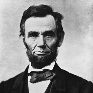
Abraham LincolnOne of the most profound landmarks honoring a President that inspires such emotion in so many; President Lincoln was arguably one of the most significant figures in our nation's history. A legendary statesman who represents “the virtues of tolerance, honesty, and constancy in the human spirit.”

Located on the west end of Washington D.C.'s National Mall, the memorial stands as a neoclassical testament to the 16th President, and is situated on the Reflecting Pool near the Vietnam Veterans Memorial and Korean War Veterans Memorial. The Lincoln Memorial itself was designed by Henry Bacon, and inspired by ancient Greek temples. It stands 190 feet long, 119 feet wide, and 100 feet tall. Surrounded by ornate fluted Doric columns, there are 36 of them, one for each of the 36 states in the Union at the time of his death.


Inside, there are carved inscriptions of President Lincoln's Second Inaugural Address and the Gettysburg Address. As a focal point, in the central hall there is an impressive statue of Lincoln made of Georgia white marble sitting in contemplation on a pedestal of Tennessee marble. It stands an imposing 19 feet tall and weighs 175 tons.


The memorial was built over a period of years in the early 1900s, and the completed structure was dedicated before more than 50,000 people on May 30, 1922. Lincoln's only surviving child, Robert Todd Lincoln, was present for the ceremony. It is ironic that despite Lincoln's “Great Emancipator” reputation, the dedication ceremonies were strictly segregated, as was the practice still at the time.


Important Historical Events


Marian Anderson, the famous African American contralto, was granted permission by the Department of the Interior, with the help of then-first lady Eleanor Roosevelt, to perform at the Lincoln Memorial in 1939 after being denied the right to sing at Constitution Hall previously.


But perhaps of most significant importance is that the Lincoln Memorial was the backdrop to Martin Luther King, Jr.'s seminal “I Have a Dream” speech in 1963, in which he spoke on the steps of the Memorial in front of over 200,000 people.


About the Man


Abraham Lincoln is a titan within the fabric the nation's heritage. From humble beginnings as a poor boy on the frontier, reading books by candlelight after working long hours on the farm, he educated himself about the state of the world. Brought up on a hearty mix of physical labor with a keen intellect, Lincoln used his love for the written word, his strong work ethic, and his ability to speak plainly and directly to people to fast-propel first his legal, then his political career.


As President, Lincoln thought secession illegal, and was willing to use force to defend Federal law and the Union. But the Emancipation Proclamation was probably his greatest achievement that declared forever free those slaves within the Confederacy in 1863.


His assassination on April 14, 1865 marked a watershed moment in the nation's history, just as the Civil War was ending.


The Lincoln Memorial is open 24 hour a day; more than seven million people visit it per year.


Click here to see the Lincoln Memorial poster.


Rob Decker is a photographer and graphic artist who had the rare privilege of studying under Ansel Adams in Yosemite National Park when he was just 19 years old. Now, Rob is on a journey to explore and photograph all 61 of America's National Parks. He's creating WPA-style posters to help people celebrate their own national park adventures — as well as encourage others to get out and explore!


Join the growing community of 75k+ National Park enthusiasts to receive insider deals and updates.


See why 75k+ National Park fans have already joined...


Source: https://national-park-posters.com/blogs/national-park-posters/the-lincoln-memorial

attachement

Friday, June 25, 2021

Mesa Verde National Park – Tales of an Ancient People


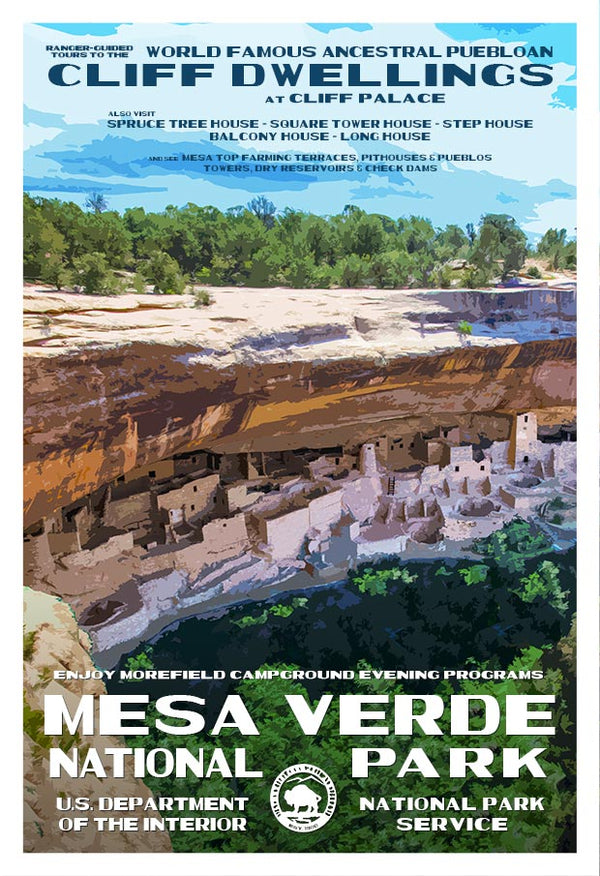
Ancient cliff dwellings of elaborate stone communities, deep canyons, the vibrant history of the Ancestral Pueblo people, and archaeological sites more than 700 years old are what you will find at this stunning National Park. In late June, we celebrate the anniversary of its birth as a National Park. President Theodore Roosevelt brought Mesa Verde into being on June 29, 1906, to “preserve the works of man.”

Within its over 52,000 acres, perhaps the most inspiring cliff dwelling in the park is Cliff Palace. It is by far the largest, where visitors can envision themselves here hundreds of years ago in a simpler time. You'll find over 4,000 archeological sites, 600 of which are documented cliff dwellings of pueblos, masonry towers, and farming structures. The exact number of dwellings within the park is still unknown. To visit here is to leave your modern self behind and journey back in time using all five senses with an amazing story of life in earlier times.


The Meaning of Mesa Verde


The phrase “Mesa Verde” in Spanish means “green table,” stemming from the juniper trees and other foliage in the area. Rising high above the surrounding countryside and unoccupied for many centuries, only a few of the sites have been excavated, and many of the sites have been weakened by natural forces. Indeed, some were ravaged by looters before it gained national Park status.


Mesa Verde is the only cultural park in America's National Park System.


A Bit of History


In the year 1276 A.D., drought struck this region for over 20 years, and so one by one, the villages dissipated and were abandoned in search of a more dependable water supply. By the year 1300, the Ancestral Puebloan population was gone from the Mesa Verde.


Then, in 1765, Don Juan de Rivera led the first exhibition by white men into the area under orders from New Mexico governor Tomas Velez Cachupin. In 1874, prospector John Moss led photographer W.H. Jackson into areas where they discovered the cliff dwellings in the canyon. Other explorers found more cliff dwellings in later years.


In 1886, the first known suggestion that this area should be set aside as a National Park was touted in the Denver Tribune Republican. In 1891, Baron Gustaf E. A. Nordenskiold of the Academy of Sciences was the first-ever scientist to visit the cliff dwellings. He gathered about 600 artifacts which are now in the National Museum in Helsinki, Finland.


After the turn of the 20th century, several bills were introduced for the creation of the park. None passed until 1906 when the creation of “Mesa Verde National Park” was introduced by the 59th Congress in 1905.


Today, visitors can expect to be able to enter any of the sites only in the company of a park ranger. For those who are a bit more independent, over 20 mesa top sites are available with amazing viewpoints which may be visited unaccompanied.


Preservation of the deep cultural heritage of 26 tribes, as well as the park's natural and cultural resources, is the focal point of the stewards of Mesa Verde National Park, where research by the park's management staff is ongoing. These dwellings represent some of the best-preserved ruins in North America. They range in size from one-room storage units to labyrinths of more than 150 rooms.


Click here to see the Mesa Verde National Park poster.


Rob Decker is a photographer and graphic artist who had the rare privilege of studying under Ansel Adams in Yosemite National Park when he was just 19 years old. Now, Rob is on a journey to explore and photograph all of America's National Parks. He's creating WPA-style posters to help people celebrate their own national park adventures — as well as encourage others to get out and explore!


Join the growing community of 75k+ National Park enthusiasts to receive insider deals and updates.


See why 75k+ National Park fans have already joined...


Source: https://national-park-posters.com/blogs/national-park-posters/mesa-verde-national-park-tales-of-an-ancient-people

attachement

Thursday, June 24, 2021

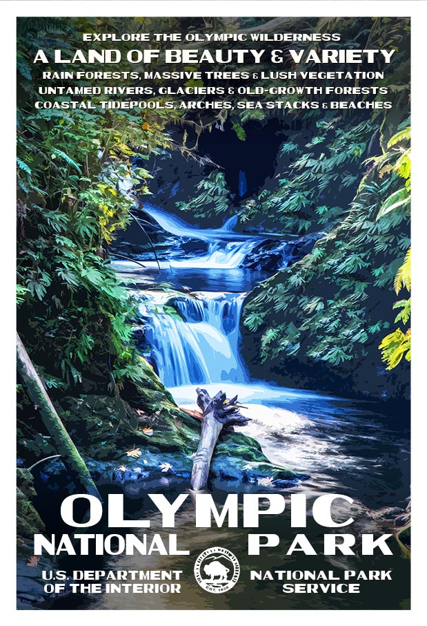
Best Things to do in Olympic National Park


With its incredible range of precipitation and elevation, diversity is the hallmark of Olympic National Park. Encompassing nearly a million acres, the park protects a vast wilderness, thousands of years of human history, and several distinctly different ecosystems. Located on Washington's Olympic Peninsula, the park has four regions, including 70 miles of wild Pacific coastline, alpine areas, old-growth temperate rain forests and the forests of the drier east side.


My name is Rob Decker and I'm a photographer and graphic artist with a single great passion for America's national parks! I've been to 50 of our 61 national parks — and Olympic National Park has so many different areas, there are tons of things to see and do! You can hike in the mountains, kayak or canoe in a lake or river, play in the tide pools, relax in the hot springs...and so much more! I've explored many areas of Olympic National Park — so I'm ready to help! If this is your first time to the park, or your returning after many years, here are some of the best things to do in Olympic National Park!


Exploring the Pacific Coastline


The coastal portion of the park is a rugged, sandy beach along with a strip of adjacent forest. It is 60 miles long but just a few miles wide. While some beaches are primarily sand, others are covered with heavy rock and very large boulders.


The most popular piece of the coastal strip is the 9-mile Ozette Loop. The Park Service runs a registration and reservation program to control usage levels of this area. From the trailhead at Ozette Lake, a 3-mile leg of the trail is a boardwalk-enhanced path through near primal coastal cedar swamp. Once you arrive at the ocean, you can continue out on the headland trails for spectacular views and sunsets. Some of the best places to enjoy the Olympic coast include:


  • Rialto Beach

  • Second Beach

  • Third Beach

  • James Pond

  • Kalaloch

  • Beach 4

  • Ruby Beach


Tidepool Activities


The most popular tidepools areas are at Kalaloch's Beach 4 and Mora's Hole in the Wall. Rangers offer programs at both locations. Second Beach, Third Beach, Ruby Beach and many other coastal wilderness locations are also excellent places to view intertidal life in the park.


Explore Olympic's Rivers by Kayak and Canoe


There are many kayak and canoe options in Olympic National Park's rivers and lakes. Here's a quick rundown of some of the most popular spots to see the park from the water.


Paddle The Rivers of Olympic National Park


Elwha River (Class II-IV) This river can be paddled most of the year, but the best season is in the spring or early summer. The most common put-in sites are in the lower portions of Glines Canyon and Altair Campground.


Hoh River (Class II-III) This river offers scenic views of old-growth rainforest, but is frequented with log jams. Always scout ahead before paddling to avoid hazards. The most popular put-in locations are at the Hoh Campground and near the park entrance station on the Hoh River Road.


Queets River (Class II-III) Queets River is a great place to experience secluded rain forests during higher water levels. In late summer, the river is often blocked by large debris and water that is too low for paddling. Log jam hazards may exist throughout the year. Popular put-in sites are the Queets Campground above Sam's Rapid and the Hartzell Boat Launch.


Quinault River (Class II-V) For expert kayakers willing to hike into the backcountry, the Quinault River offers challenging water. From the Graves Creek trailhead, hike 2.5 miles to Pony Bridge. This 3 mile route is through a gorge and has a mandatory portage at Dolly Falls. For calmer waters, a popular launch site is near-end of the North Shore Road at the bridge.


Sol Duc River (Class III-V) For experienced kayakers, a 1.2 mile hike up the North Fork Trail in the Sol Duc Valley to the launch site offers fun water above Salmon Cascades. For experts interested in rapids, put-in at Salmon Cascades Overlook.


Enjoy The Lakes of Olympic National Park


Lake Crescent


Big, deep, and blue, Lake Crescent offers a scenic paddling experience, particularly in the early morning when winds are most likely to be calm. Winds often come up in the afternoon and can quickly create waves of a foot or more. Boat launches include Storm King Ranger Station and Fairholme. Kayaks and canoes can be rented at concession operated Log Cabin Resort and Lake Crescent Lodge.


Lake Ozette Near the coast and filled with summer water lilies, Lake Ozette offers a secluded paddle journey. Two boat launches exist at the Ozette Ranger Station and Ozette Campground. Kayak and Canoes can also access a few backcountry campsites. Sudden weather changes are common in the Ozette area -- always check the forecast and plan for the possibility of sudden, strong winds and waves.


Lake Quinault In a rainforest valley, Lake Quinault boasts mountain views and old-growth forests. Afternoon winds are common here, so always be prepared. Two boat launches are found on the U.S. Forest Service operated Falls Creek and Willaby Campgrounds. Boat rentals are available at the concession operated Lake Quinault Lodge.


Fishing in Olympic National Park


Olympic National Park protects over 70 miles of Pacific Coast, 600 lakes, and 4,000 miles of rivers and streams that support some of the most extensive runs of wild salmon, trout, and char remaining in the Pacific Northwest.


Only catch and release fishing is allowed, which improves native fish populations by allowing more fish to remain and reproduce in the ecosystem. This practice provides an opportunity for increasing numbers of anglers to enjoy fishing and to successfully catch fish. Releasing native fish caught while in a national park will help to ensure that enjoyment of this recreation opportunity will last for generations to come. Fishing gear is perhaps the most important factor affecting whether a fish will survive being caught and released. Use artificial lures or flies. Use of bait is prohibited in all park waters. Use rod, reel, and line of sufficient strength to quickly land the fish Use properly sized single circle or barbless hooks.


Visit The Hoh Rainforest


Throughout the winter season, rain falls frequently in the Hoh Rain Forest, contributing to the yearly total of 140 to 170 inches (or 12 to 14 feet!) of precipitation each year. The result is a lush, green canopy of both coniferous and deciduous species. Mosses and ferns that blanket the surfaces add another dimension to the enchantment of the rainforest.


The Hoh Rain Forest is located in the stretch of the Pacific Northwest rainforest which once spanned the Pacific coast from southeastern Alaska to the central coast of California. The Hoh is one of the finest remaining examples of temperate rainforest in the United States and is one of the park's most popular destinations. The Hoh lies on the west side of Olympic National Park, about a two-hour drive from Port Angeles and under an hour from Forks. The Hoh Rain Forest is accessed by the Upper Hoh Road, off of Highway 101.


See Olympic National Park on Foot


Day hikes of varying length and difficulty are found throughout the park. Some are universally accessible while others are more challenging. Because of the diverse nature of the park, and depending on how much time you're able to spend in the park, you'll want to choose one or more areas to explore.


Before You Go...


  • Even on short hikes, be prepared for changeable weather. Carry food, water, raingear and extra layers of clothing.

  • Do not drink water directly from streams. Boil water or use a water filter or other treatment that kills or filters giardia and cryptosporidium. Iodine tablets do not kill cryptosporidium.

  • Stay on trails to avoid injury to yourself and the park's vegetation.

  • Pack out all trash, including food waste.


Wildlife Viewing


Birds


Many bird species share Olympic's skies. Bald eagles, northern pygmy owls, black oystercatchers and sooty grouse are among the 300 species of birds found in the diverse habitats of the park.


Deer


Black-tailed deer can be encountered in nearly all areas of the park. Deer often roam in the mountainous and forested locations within the park and tend to be more active during the morning and evening.


Olympic Marmots


Spot these charismatic animals at Olympic's higher elevations. Trails near Hurricane Ridge and alpine trails make prime destinations for marmot sightings during the summer.


Roosevelt Elk


Most elk sightings occur in Olympic's lower valleys and rainforests. Elk encounters occur throughout the day, but are most common during dusk or dawn.


Salmon


Olympic's rivers are home to all five species of Pacific salmon, as well as anadromous steelhead and bull trout. Although there are salmon migrations throughout the year, fall is the best time to view the salmon's dramatic upstream journey. Most rivers in the park host a fall salmon run, but the Salmon Cascades Overlook in the Sol Duc Valley provides one of the best views from late September to Early October.


Whales


The Olympic coast offers many opportunities to view whales during their migration seasons of April - May and October - November. Prime whale watching sights include Kalaloch, Rialto, and Shi Shi Beaches.


Mountain Goats


Although not native, mountain goats can been seen high elevation areas of the park and may be encountered along alpine hiking trails. They occasionally roam near Hurricane Ridge Visitor Center.


Black Bears


Black Bears are seldom sighted in areas with high human presence, such as roads and Visitor Centers. Most sightings, while rare, occur along backcountry trails.


Exploring Olympic National Park in Winter


At an elevation of 5,242 feet, Hurricane Ridge is Olympic's alpine destination in winter. Typically snow-covered, Hurricane Ridge provides opportunities for snowshoeing, cross-country and downhill skiing, snowboarding, tubing and more. Hurricane Ridge's winter season is generally mid-December through the end of March.

Olympic National Park | National Park Posters


Click here to see the Olympic National Park poster


Rob Decker is a photographer and graphic artist with a single passion for our national parks! Rob is on a journey to explore and photograph each of our national parks and to create WPA-style posters to celebrate the amazing landscapes, vibrant culture and rich history that embody America's Best Idea!


Click here to learn more about Rob and the National Park Poster Project


Source: https://national-park-posters.com/blogs/national-park-posters/best-things-olympic-national-park

attachement

Independence National Historical Park – the Seat of American Democracy


In the heart of Philadelphia where the roots of American Democracy first took hold, we celebrate everything in our nation we hold dear. Independence National Historical Park was built on the spirit of revolution in America, where visitors can experience the story of freedom.


Few ideas capture the hearts and imaginations of humans that they take the shape of physical objects with a universal meaning. At least for Americans, no other symbols of individual freedom quite compare with the Liberty Bell.


Encompassing 55 acres and 20 urban blocks, these are the grounds where the dream of a free country of sovereign citizens came to fruition. The Liberty Bell, Independence Hall (a UNESCO World Heritage Site), Congress Hall, the Benjamin Franklin Museum, the National Constitution Center, and the Independence Visitor Center are just a few of the places to visit in this historical park – and all are free.


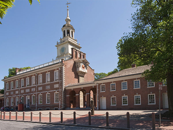
Independence Hall, where both the Declaration of Independence and the United States Constitution were debated and signed


The linchpin of this L-shaped park is Independence Hall, a regal 18th-century Georgian edifice set in a 5-acre square in Philadelphia's oldest commercial district. This is also the site of Benjamin Franklin's residence amidst a colonial landscape with historic churches, cemeteries, glorious gardens, and various monuments.


Here on these grounds is where both the Declaration of Independence and the Constitution were both deliberated and written, and on which the foundations of our country rest. Philadelphia was the nation's capital from 1790 to 1800, and it was also here that the concept of governance based on the rights of individual citizens was first tested.


The Story Behind It All


Created by Congress in 1948, President Harry S. Truman signed Public Law 795 on June 28th, effectively creating the park. In 1950, the National Park Service began administering the park, but it wasn't officially established until 1956. Before its establishment, the area suffered a decline, and many buildings not built in the 18th and 19th centuries were demolished in an effort to create a colonial-centric park. Other historic buildings were meticulously restored.


The result is a proud reference to historical origins while also retaining a modern edge; a mix of red brick buildings knit together with cobblestone alleys and richly articulated pedestrian areas, pristine lawns, and lovely brick walks.


The bell that eventually became the Liberty Bell was originally made in Great Britain, and recast in 1753 to adorn the State House in Philadelphia. It was used as a chime to call members of the Pennsylvania Assembly to meetings. Eventually, it became a symbol of freedom to Civil Rights Advocates, abolitionists, suffragists, immigrants, Native Americans, war protestors, and others who sought a symbol of freedom.


The Liberty Bell was originally made to hang in the Pennsylvania State House. Today that building is known as Independence Hall and can be seen through the window behind the bell.


It took the cooperation, effort, and devotion of the City of Philadelphia, the National Park Service, and countless private citizens to cultivate this area for the enlightenment and enjoyment of all those who come here.


Click here to see the Independence National Historical Park poster.


Rob Decker is a photographer and graphic artist who had the rare privilege of studying under Ansel Adams in Yosemite National Park when he was just 19 years old. Now, Rob is on a journey to explore and photograph all of America's National Parks. He's creating WPA-style posters to help people celebrate their own national park adventures — as well as encourage others to get out and explore!


Join the growing community of 75k+ National Park enthusiasts to receive insider deals and updates.


See why 75k+ National Park fans have already joined...


Source: https://national-park-posters.com/blogs/national-park-posters/independence-national-historical-park-the-seat-of-american-democracy

attachement

Best Things to Do in Blue Ridge Parkway National Park


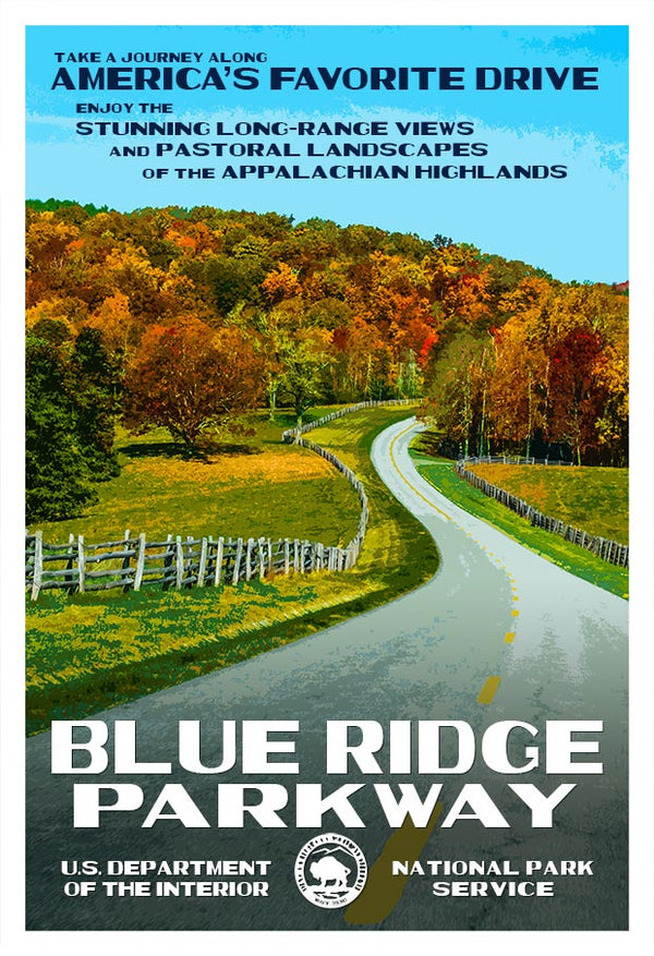
Touted as “America's most scenic drive,” no one can argue that The Blue Ridge Parkway earns one of the top spots in terms of beauty. This is the epitome of what it means to go on a road trip.


This national park is best experienced at a slow pace. One can take in the Appalachian Highlands' pastoral views, revel in rugged mountain scenery, and be drawn in by amazing long-range vistas. It is 469 miles of pure relaxation, with hundreds of scenic overlooks to stop the car and stretch the legs.


The park has a convenient wayfinding tool, the parkway mileposts that mark each mile along the route. You can orient yourself by knowing that if the marker is on your left, you are traveling north – if it is on your right side, you are traveling south.


Humpback Rocks Visitor Center


Located at milepost 5.8, a few miles from the Northern Entrance in Waynesboro, this visitor's center is an excellent way to start your Blue Ridge Parkway journey. With a gift shop and information desk, the friendly folks here will set you up with your National Park Passport Stamp, maps, and fun things to do along the way. Follow the short, paved trail from the visitor center to the Outdoor Farm Museum. Tour a log home and see exactly how farm life was in the Appalachians of yesteryear.


Dive into Appalachian History


The mountains here are a billion years old – among the oldest in the world. About 12,000 years ago, native peoples such as the Cherokee, Iroquois, Siouan Manhoacs, and Shawnee settled here. Then in the 1700s, white settlers arrived and quickly began farming the fertile land. There are several historical places along the Parkway where you can delve much deeper into the history of the mountains and the people who lived here.


The Hiking is Endless


One could spend weeks hiking the Blue Ridge Parkway and still not see it all. Rough Ridge Trail, located at milepost 302.8, is a gem. This 1.8-mile out-and-back trail runs near Blowing Rock, and from the rocks at the top of a ridge, you can get a wonderful view of Linn Cove Viaduct.


The waterfall hikes here are numerous. Falling Cascades at milepost 83.1 is a great 1.4-mile loop trail and just the thing for enjoying the deep cool forest. Linville Falls at milepost 316.4 is spectacular and the more popular of the falls in the area, plunging more than 90 feet into the massive Linville Gorge. Linville Falls has a 4-mile loop trail leading to three different overlooks for views of the waterfall. There are several well-traveled trails here – all worth exploring if you have the time.


Crabtree Falls is a steep, moderately strenuous loop trail, but well worth the effort if you can swing it. Dropping more than 70 feet, it spills over the rocks below in dramatic fan-like patterns. When the rhododendrons and mountain laurels are in bloom, it is a special treat. Looking Glass Falls at milepost 412.2 is about 10 miles off the parkway, but worth the small side trip, as wading and swimming are allowed here.


Peaks of Otter


Located at milepost 86, there is a lot to do here, and an excellent spot to spend a night or two. Along with the visitor center, there is a lodge on the edge of Abbott Lake, featuring a stunning view of Sharp Top Mountain, its restaurant serves delicious meals with views of the mountain and lake. There is also a campground opposite the lodge. Hike any number of numerous trails, such as the easy 1-mile Abbott Lake Loop Trail, the 1.8-mile Johnson Farm Loop Trail, or the 3.3-mile Harkening Hill Trail, just to name a few.


Mabry Mill


At milepost 176.1, this iconic destination features a short trail leading to stairs going across the aqueduct feeding water to the wheel, winding through several small buildings, an old wagon, and through the forest. On some weekends, the mill is open for visitors to take a peek. Then stop in the Mabry Mill Restaurant for a wonderful home-cooked meal in a cozy dining space.


Linn Cove Viaduct


Just off of milepost 304, discover this engineering marvel completed in 1987 which has won numerous design awards. Coming in at 1,243 feet long, the bridge was built with segmented concrete hugging the face of Grandfather Mountain in North Carolina. This is one of the most photo-worthy sections of the Blue Ridge Parkway. Stop by the bridge museum and visitor center located at the south end of the viaduct.


Richland Balsam Overlook


Milepost 431.4 offers this overlook; the highest point in the Blue Ridge Parkway. One lone sign marks its significance, and the landscape is full of evergreen trees as far as the eye can see. Hearty hikers will enjoy the 1.5-mile loop trail to the summit of Richland Balsam, which stands at 6,410 feet.


The Wildlife is Plentiful


The landscape on either side of the Blue Ridge Parkway is ripe with unique habitats for so many plants and animals; 50 species of mammals, 150 bird species, and 40 reptile species. Species that have long been endangered or threatened are making a comeback here; peregrine falcons, river otters, beaver, and black bears.


Speaking of which, there's a good chance you'll see at least one bear in your travels along the Blue Ridge Parkway. Just remember to give them plenty of space, and they'll leave you alone. If a bear changes its behavior when you are in sight, it means you are too close, and slowly move on. Remember to never feed them or leave food at your campsite for them to find.


Know Before You Go


No matter what time of year, you'll want to check road conditions before heading on your adventure. America's Favorite Drive is designed to be taken at a slow leisurely pace. Be sure to adhere to all speed limits and drive carefully. Stop often to get out and enjoy the scenery. During peak times, expect heavy traffic and delays. Fall foliage season is a big one, lasting from mid to late October.


With over 200 amazing overlooks, there is room enough for everyone. If you come to an overlook full of cars and visitors, keep going, as there is another one just around the bend.


And don't forget the nearby communities. They offer their own wonderful experiences and events, not to mention a nice variety of food and lodging options.


If you opt for camping or lodging inside the park, be sure to make reservations. The Blue Ridge Parkway has eight campgrounds to choose from. Come prepared with a sense of adventure, remember to recreate responsibly, and follow the Leave No Trace principles.


Most of all, enjoy the view!


Click here to see the Blue Ridge Parkway poster.


Rob Decker is a photographer and graphic artist who had the rare privilege of studying under Ansel Adams in Yosemite National Park when he was just 19 years old. Now, Rob is on a journey to explore and photograph all of America's National Parks. He's creating WPA-style posters to help people celebrate their own national park adventures — as well as encourage others to get out and explore!


Join the growing community of 75k+ National Park enthusiasts to receive insider deals and updates.


See why 75k+ National Park fans have already joined...


Source: https://national-park-posters.com/blogs/national-park-posters/best-things-to-do-in-blue-ridge-parkway-national-park

attachement

The Washington Monument – First in War, First in Peace, and First in the hearts of his countrymen.


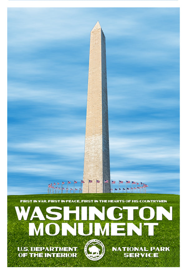
Standing as a gigantic obelisk in the heart of Washington DC's National Mall, the Washington Monument is a proud commemoration of the nation's first President.


Designed by Robert Mills and completed by Thomas Casey in conjunction with the U.S. Army Corps of Engineers, the Washington Monument was completed in two phases. From 1848-1854, a private Washington National Monument Society chose Mills' design and began raising money for its construction, beginning with its cornerstone, a 24,500-pound block of pure white marble.


For its time, it was an ambitious, expensive, and some might say audacious design, which created several complications during its construction. The geometric layout of the city's streets and green spaces reserved a place of prominence for the monument, with an intersection of lines radiating out and south from the White House, west of the Capitol.


A Challenging Task


Around 1854, with support and funds running out, construction ground to a halt. In 1861, Mark Twain described the unfinished obelisk as “a hollow, oversized chimney.” Public support was drawn more towards efforts around the Civil War than creating an expensive monument for a president long gone. Then from 1876-1884, public construction finally began anew when President Ulysses S. Grant authorized construction to resume the project until the monument was complete.


Built to resemble an Egyptian obelisk, the idea was meant to evoke the timelessness of ancient civilizations. It beautifully captures the respect, awe, and gratitude we as a nation feel for our most essential Founding Father.


When it was completed on December 6, 1884, some 36,000 blocks of marble led to the monument holding the title of the tallest structure in the world at the time, standing at just over 555 feet. Workers placed a 9-inch aluminum pyramid atop the tower of white marble to finish off the regal structure. Following the dedication ceremony, over 10,000 people climbed the 900 steps leading to the top of the monument. Today, an elevator makes the trip much easier, with over 800,000 visitors to the monument annually.


In 1910, the city of Washington D.C. passed a law restricting the height of any buildings in the city, thereby ensuring the monument will forever remain the tallest structure in the nation's capital. It is a fitting tribute to the leader known as “the Father of His Country.”


George Washington's political and military leadership proved indispensable to the founding of the United States. Outlasting Britain's superior military might, he rallied people from each of the thirteen divergent states as commander of the Continental Army. Then, as President, his outstanding leadership provided a great precedent for others that would follow him. The Washington Monument serves as a stunning symbol; a constant reminder of his monumental achievements.


Click here to see the Washington Monument poster.


Rob Decker is a photographer and graphic artist who had the rare privilege of studying under Ansel Adams in Yosemite National Park when he was just 19 years old. Now, Rob is on a journey to explore and photograph all 61 of America's National Parks. He's creating WPA-style posters to help people celebrate their own national park adventures — as well as encourage others to get out and explore!


Join the growing community of 75k+ National Park enthusiasts to receive insider deals and updates.


See why 75k+ National Park fans have already joined...


Source: https://national-park-posters.com/blogs/national-park-posters/the-washington-monument-first-in-war-first-in-peace-and-first-in-the-hearts-of-his-countrymen

attachement

Best Things to Do at Sleeping Bear Dunes National Lakeshore


Mother Nature makes a grand display in Michigan's lower peninsula, with immense windswept dunes and a sparkling lake in Leelanau County. Your adventure card will be well played when you discover everything from panoramic vistas to the historic village of Glen Haven and more.


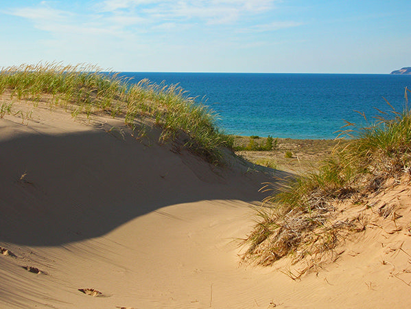
View of Lake Michigan over the dunes at Sleeping Bear Point Trail


What is so striking about this area is the monumental expanse of water that is Lake Michigan. It is much like an ocean, with the stark difference being this is a freshwater lake. But one thing is for certain: Sleeping Bear Dunes National Lakeshore will leave you breathless. Not only does it straddle 35 miles along one of the largest lakes on the planet, the area is home to 21 much smaller lakes, all with their own appeal, not least of which are fishing, hiking, picnicking, and other fun outdoor activities.


Start at Phillip A. Hart Visitor Center


As with most any National Park, it pays to gather some good information for your upcoming adventures. Get oriented to everything the lakeshore has to offer, load up on maps, and see an introductory slide show. Strike up a conversation with a friendly ranger and ask for advice on what to do that is in line with your interests.


Go for the Most Scenic of Drives


Pierce Stocking Scenic Drive is a 7.4-mile circuit journey through several ecosystems. From maple and beech forests to rolling meadows full of shrubs to mountainous landscapes overlooking Lake Michigan, there are a dozen informational stops along the way to stretch the legs. Many have gorgeous views, but all have enough entertaining information to immerse oneself in Dune-ology and come away with a greater appreciation for the beauty and ecology of the National Dunes area.


Challenge Yourself with a Climb at Sleeping Bear Dunes


Visitors stand atop the Pyramid Point overlook and take in the view of the azure waters


The Dune Climb beckons those who wish to take on a 300-foot-tall wall of sand. Scaling this huge, sandy playpen is strenuous, to be sure, but when you reach the top, the reward is great: a stunning vista of Leelanau Country dotted by several lakes. If you want to feel like a kid again, get a running start back down the dunes, then launch yourself airborne to land softly in the sand. Or take it further and continue an epic hike on the Dunes Trail. For those who wish to take it down a notch, a lovely picnic area is available at the bottom – bring a packed lunch and prepare for some great people watching. The Sleeping Bear Heritage Trail is another option, just north from the base of the dune.


Glen Haven Historic District


This living historical village boasts a fair number of educational sites. Visit the iconic red Canning company building and Cannery Boathouse Museum, which houses the largest public exhibit of small craft from the Great Lakes. The U.S. Coastguard Station Maritime Museum, a working 1920's blacksmith shop, and General Store are must-do's. There is a small logging village that has been restored to its 1920's glory. Rife with cultural heritage, the beach in front of the boathouse museum is one of the most popular.


Delight in the Inland Lakes


In addition to the mammoth Lake Michigan, 21 lakes are within the boundary of Sleeping Bear Dunes National Lakeshore. Anglers may well be overwhelmed by the sheer number of options available to them, no matter if you choose to charter a boat, paddle out in a kayak, or stand in shallow waters – there are many perfect fishing spots to be had.


A kayaker paddling, surrounded by trees in vivid fall colors


Lakes such as Glen Lake, Otter Lake, and Bass Lake provide amazing spots for catching bluegill, trout, and perch, among others. Deep water anglers can hire a boat and tackle Lake Michigan herself; indeed, many of the lakes allow boats for fishing, but some do not. Be sure to check ahead, as several of the lakes prohibit motorized boats.


Explore an Isolated Island


In the town of Leland, catch the Mishe-Mokwa (a/k/a Mother Bear) ferry at the Manitou Island Transit to South Manitou Island; a wonderful place to roam with the island's towering lighthouse, shipwrecks, giant cedars, and remote beaches. But before you board the ferry, be sure to stop at The Village Cheese Shanty, where for over 40 years they've been nourishing patrons with 60 imported cheeses, fresh sandwiches, and local cherry products. They will gladly pack your lunch to go – as there are no stores on the island.


Glide, Hike, or Snowshoe


Any time of year is the right time to visit Sleeping Bear Dunes. Thirteen distinct hiking trails run throughout many woodland areas, with overlooks such as the soaring Empire Bluffs, and wide expanses of Lake Michigan perfect for a stellar photograph. In the winter, guided snowshoe hikes take place every Saturday in January and February, where the guide will share their knowledge of entertaining park facts. An adrenaline-pumping adventure awaits for those that want to try their hand at hang gliding over the lake.


Take in a Glorious Sunset


With so many miles of west-facing beaches at Sleeping Bear Dunes National Lakeshore, it's no wonder that the sunsets are tailor-made for this area. One great stop is along the Pierce Stocking Scenic Drive at Stop Nine, the Lake Michigan Overlook. Grab a spot on the amphitheater of sand, where the tall dunes provide the perfect setting for watching the golden sun dip into the liquid horizon of Lake Michigan. If you need a romantic spot, this is it.


Rob Decker is a photographer and graphic artist who had the rare privilege of studying under Ansel Adams in Yosemite National Park when he was just 19 years old. Now, Rob is on a journey to explore and photograph all 61 of America's National Parks. He's creating WPA-style posters to help people celebrate their own national park adventures — as well as encourage others to get out and explore!


Join the growing community of 75k+ National Park enthusiasts to receive insider deals and updates.


See why 75k+ National Park fans have already joined...


Source: https://national-park-posters.com/blogs/national-park-posters/best-things-to-do-at-sleeping-bear-dunes-national-lakeshore

attachement

Tuesday, June 22, 2021

Celebrate Biscayne National Park's Anniversary


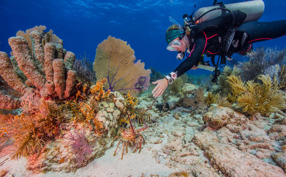
Established on June 28, 1980, Biscayne National Park is the largest marine park in the National Park System and protects a rare combination of aquamarine waters, emerald islands, and fish-bejeweled coral reefs. Here too is evidence of 10,000 years of human history, from pirates and shipwrecks to pineapple farmers and presidents. Outdoor enthusiasts can boat, snorkel, camp, watch wildlife…or simply relax in a rocking chair gazing out over the bay. In the early 20th century the islands became secluded destinations for wealthy Miamians who built getaway homes and social clubs. Mark C. Honeywell's guesthouse on Boca Chita Key was the area's most elaborate private retreat, and featured a mock lighthouse.


Biscayne National Park | National Park Posters


If you are visiting for a day, you should sign up in advance for guided educational eco experiences with the Biscayne National Park Institute that can include sailing, snorkeling, paddling and exploring the islands. Programs range from a few hours to a full day, and highlight the park's amazing wildlife, rich history, and awe-inspiring marine ecosystems. The true beauty of Biscayne National Park is that it offers a different experience for everyone. No matter what you're interested in, you can learn more about the habitats and history of the park.


Biscayne National Park | Jones Lagoon


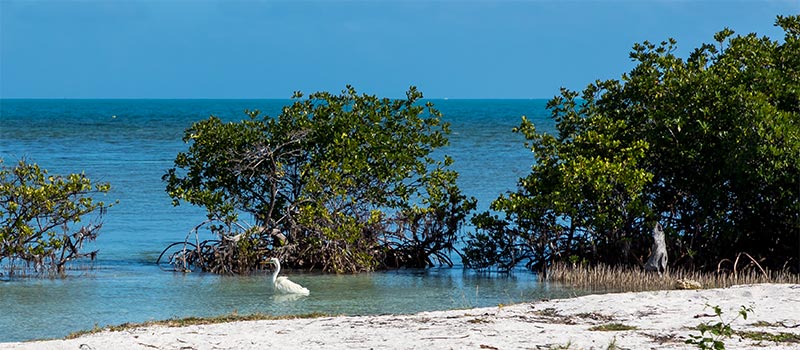
Biscayne National Park is located just south of Miami in southern Florida. The park preserves Biscayne Bay and its offshore barrier reefs. Ninety-five percent of the park is water! The shore of the bay is primarily an extensive mangrove forest. The offshore portion of the park includes the northernmost region of the Florida Reef, one of the largest coral reefs in the world. Biscayne National Park is situated in a subtropical climate, which ensures sunshine year-round. Winters are normally dry and mild, with occasional fronts bringing wind and little rain. Summertime brings hot and humid weather with scattered afternoon thunderstorms.


The reefs have claimed ships from Spanish times through the 20th century -- with more than 40 documented wrecks within the park's boundaries. The park's islands were farmed during the 19th and early 20th centuries, but their rocky soil and periodic hurricanes made agriculture difficult to sustain.


Egret, Boca Chita Key | Biscayne National Park


The park protects four distinct ecosystems: the shoreline mangrove swamp, the shallow waters of Biscayne Bay, the coral limestone keys and the offshore Florida Reef. The shoreline swamps of the mainland and island margins provide a nursery for larval and juvenile fish, mollusks and crustaceans. The bay waters harbor immature and adult fish, seagrass beds, sponges, soft corals, and manatees. The keys are covered with tropical vegetation including endangered cacti and palms, and their beaches provide nesting grounds for endangered sea turtles. Offshore reefs and waters harbor more than 200 species of fish, pelagic birds, whales and hard corals. The park also has a small population of threatened American crocodiles and a few American alligators.


The Biscayne National Park Poster measures 13″ x 19″ and is an original work by Robert Decker. Posters are printed on “Conservation,” a 100% recycled, domestically produced paper stock with soy-based inks. From start to finish, each poster is 100% American Made.


Click here to see the Biscayne National Park poster.


Source: https://national-park-posters.com/blogs/national-park-posters/celebrate-biscayne-national-parks-anniversary

attachement

Monday, June 14, 2021

Great Smoky Mountains National Park


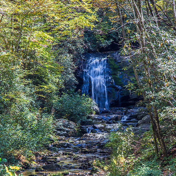
With an unbelievable swath of land stretching over 500,000 acres and a view that lasts for days, Great Smoky Mountains National Park promises cascading waterfalls, roaming wildlife, lush forests, and so much more. It's no wonder this is the country's most-visited national park.


Great Smoky Mountains National Park | Robert B. Decker


The town of Gatlinburg is often the gateway to this glorious national treasure, where visitors can make their way to a well-known park path to explore everything the area has to offer. From there you can hook right on to the Appalachian Trail, walk through meadows of wildflowers, or sojourn to one of many waterfalls. It's all right here for the outdoor adventurer.


Great Smoky Mountains National Park | Robert B. Decker


This is one of the planet's few International Biosphere Reserves, where black bears and wildflowers bloom uninhibited by encroaching land development. The Great Smoky Mountains National Park straddles Tennessee and North Carolina, and the ridgeline of the Great Smoky Mountains, part of the Blue Ridge Mountains; a division of the larger Appalachian Mountain chain.


Great Smoky Mountains National Park | Robert B. Decker


It preserves a culture rich in Southern Appalachian history, which includes a far-reaching human history, dating back to the prehistoric Paleo Indians. One of the park's objectives is to protect the historic structures, artifacts, and landscapes, which tells the story of the indigenous people who once called these lands home.


How Great Smoky Mountains NP Came to Be


It was not an easy task for this region to become a national park. Certainly not as easy as it was for other national parks, as they were already owned by the government where no one lived. But for this area, hundreds of farmers and timber-related companies already laid claim to the land. It took the efforts of thousands of people, much time, and money for it to become a reality. The idea was first floated in the late 1890s, and North Carolina introduced a bill to establish the area as a national park, but it failed.


Fast forward to the 1920s, when persistent supporters in Knoxville, Tennessee, and Asheville, North Carolina, along with auto clubs like AAA who wanted good roads through gorgeous scenery, pushed the idea through Congress once again. Finally, in May of 1926, President Calvin Coolidge signed a bill that started the process of the Great Smoky Mountains National Park to come to fruition. Money was raised to purchase the land from private owners or public companies, which was no small feat. It took several years and millions of dollars to make it happen.


Finally, by 1934, Tennessee and North Carolina transferred the deeds for some 300,000 accumulated acres to the federal government. Then came the arduous task of developing facilities and restoring early settlers' buildings as attractions to the park. It was formally dedicated by President Franklin Roosevelt in September, 1940.


An Environment that Nature Allowed to Let Thrive


Thousands of plant and animal species have been documented in the park, with more being discovered every year. The last Ice Age did not quite get this far south, and as such, the various flora and fauna had a better chance to thrive and diversify.


Great Smoky Mountains National Park | Robert B. Decker


So come with your binoculars, enjoy the show, and explore everything that Great Smoky Mountains National Park has to offer.


Click here to see the Great Smoky Mountains National Park poster.


Rob Decker is a photographer and graphic artist who had the rare privilege of studying under Ansel Adams in Yosemite National Park when he was just 19 years old. Now, Rob is on a journey to explore and photograph all 61 of America's National Parks. He's creating WPA-style posters to help people celebrate their own national park adventures — as well as encourage others to get out and explore!


Join the growing community of 75k+ National Park enthusiasts to receive insider deals and updates.


See why 75k+ National Park fans have already joined...


Source: https://national-park-posters.com/blogs/national-park-posters/about-great-smoky-mountains-national-park

attachement

Wednesday, June 9, 2021

Celebrate Big Bend National Park's Anniversary


Established June 12th, 1944, Big Bend National Park is located in a remote part of Southern Texas and borders Mexico along 118 miles of the Rio Grande. It has national significance as the largest protected area of Chihuahuan Desert topography and ecology in the United States. It contains more than 1,200 species of plants, more than 450 species of birds, 56 species of reptiles, and 75 species of mammals. The Rio Grande corridor is also a migration highway for many species passing through the desert. Elevation contrast create varied microclimates that further enhance the diversity of plant and animal life.


The national park covers 801,163 acres and is home to an abundant variety of Cretaceous and Cenozoic fossil organisms, and the park has artifacts estimated to be 9,000 years old. Historic buildings and landscapes offer graphic illustration of life along the international border in the 19th century.


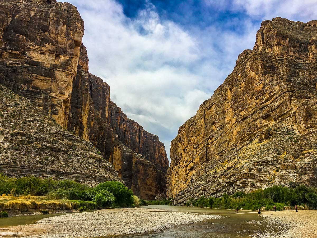
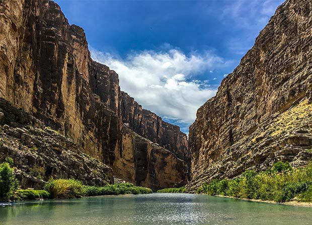
Santa Elena Canyon | Big Bend National Park


For more than 1,000 miles, the Rio Grande/Río Bravo forms the boundary between Mexico and the United States, and Big Bend National Park administers approximately 118 miles along that boundary. The park was named after a large bend in the river and Texas—Mexico border. One of the park's best known features is Santa Elena Canyon. Split by the Rio Grande, on one side, the United States; the other, Mexico.


Because the Rio Grande serves as an international boundary, the park faces unusual constraints while administering and enforcing park rules, regulations, and policies. In accordance with the Treaty of Guadalupe Hidalgo, the park's territory extends only to the center of the deepest river channel as the river flowed in 1848. The rest of the land south of that channel, and the river, lies within Mexican territory. The park is bordered by the protected areas of Parque Nacional Cañon de Santa Elena and Maderas del Carmen in Mexico.


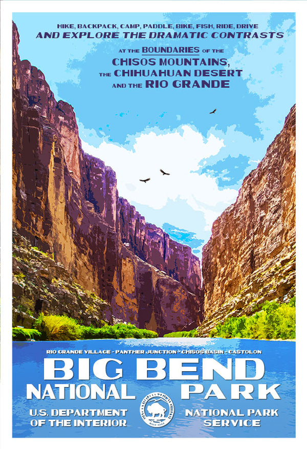
Click here to see the Big Bend National Park poster.


Rob Decker is a photographer and graphic artist who had the rare privilege of studying under Ansel Adams in Yosemite National Park when he was just 19 years old. Now, Rob is on a journey to explore and photograph all of America's National Parks. He's creating WPA-style posters to help people celebrate their own national park adventures — as well as encourage others to get out and explore!


Click here to learn more about Rob and The National Park Poster Project!


Source: https://national-park-posters.com/blogs/national-park-posters/celebrate-big-bend-national-parks-anniversary

attachement

Best Things To Do in Big Bend National Park


Big Bend National Park offers nearly limitless opportunities for scenic driving, hiking, camping, backpacking, mountain biking, horseback riding, bird watching, wildlife observation, and stargazing. Additionally, the Rio Grande borders the park for 118 miles providing options for half-day floats to extended excursion by raft, canoe, or kayak.


My name is Rob Decker and I'm a photographer and graphic artist with a single great passion for America's National Parks! I've been to 51 of our 61 National Parks — and Big Bend is one well worth the visit. I have explored many areas of the park — so I'm ready to help! So if this is your first time to the park, or your returning after many years, here are some of the best things to do in Big Bend National Park!


Scenic Drives


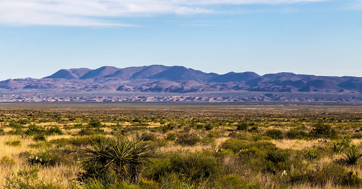
Chiahauan Desert


100 miles of paved roads and 150 miles of dirt roads connect the desert to the mountains and the river and offer exceptional ways to explore the park by vehicle. Here are the top five scenic drives — on paved roads!


Chisos Basin Road – 6 miles


A drive to the Chisos Basin is an excellent way to experience the transition between arid desert and cooler mountain habitats. As this scenic, winding road rises over two thousand feet above the desert floor, it offers breath-taking vistas of the mountain peaks and the erosion-formed basin area. The Chisos Basin has a visitor center, campground, lodge, restaurant, camp store, and access to miles of hiking trails.


Ross Maxwell Scenic Drive – 30 miles


A trip along the Ross Maxwell Scenic Drive highlights the geologic splendor Big Bend is famous for, and offers many scenic overlooks and exhibits along the way. Sotol Vista, Mule Ears Overlook, and Tuff Canyon are all worthwhile stops. Continue the drive to the magnificent Santa Elena Canyon, where limestone cliffs rise 1,500′ above the Rio Grande. A short trail leads into the canyon


Panther Junction to Rio Grande Village – 21 miles


The drive to Rio Grande Village traverses ancient limestone and has marvelous vistas across the river to the magnificent Sierra del Carmen escarpment. In twenty miles, the road descends nearly two thousand feet. There are several worthwhile stops and highlights along the way. Dugout Wells includes a desert nature trail and a shady oasis, nice for picnicking and birding. A soak in the Historic Hot Springs is also a popular activity.


Persimmon Gap to Panther Junction – 28 miles


This road connects the north entrance to park headquarters at Panther Junction. From Persimmon Gap, the road descends a long, gentle, gravel slope to Tornillo creek and Tornillo Flat. The Rosillos Mountains rise to the west; to the east the Dead Horse Mountains dominate the skyline.


Maverick Entrance Station to Panther Junction – 23 miles


This drive, through striking desert scenery, has excellent views of the surrounding mountains. Several roadside exhibits describe wildlife that might be seen along the drive. Junctions for the Chisos Basin road and Ross Maxwell Scenic Drive are located along this route.


Hiking


Day Hikes


Big Bend is a hiker's paradise containing the largest expanse of roadless public lands in Texas. More than 150 miles of trails offer opportunities for day hikes or backpacking trips.


Desert Hikes


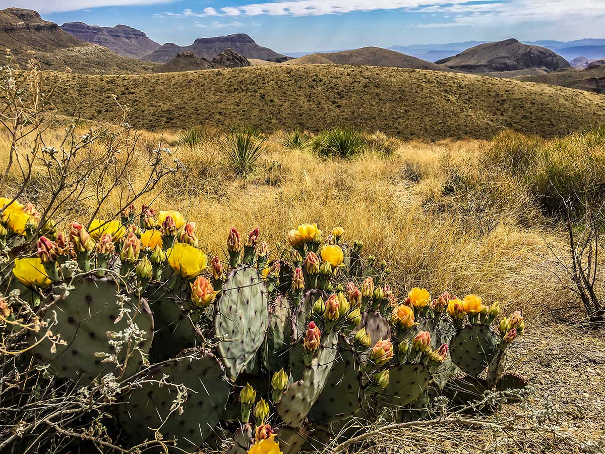
Prickly Pear Cactus


The Chihuahuan Desert covers about 80% of the park and surrounds the Chisos Mountains. Bare, rocky ground and sparse vegetation are hallmarks of the desert, but there is plenty of life here. Look for termite nests along plant stems, exoskeletons of millipedes, animal scat, and rodent and reptile tunnels. Bird life is plentiful, especially in the morning; look for nests hidden in yuccas and cacti. In the spring, bluebonnets, paintbrush, bi-color mustard, desert marigold, yucca, ocotillo, and cacti blossoms add color to the desert landscape.


Mountain Hikes


The Chisos Mountains contain some of the most rewarding day hikes in Big Bend, especially during the summer months when it is too hot to hike at lower elevations in the park. It is not uncommon to see tracks and scat of black bear, mountain lions, and gray fox along Chisos Mountains trails. Carmen Mountain white-tailed deer, rock squirrels, whiptail lizards, spotted towhees, tufted titmice, and Mexican jays are also common in these mountains.


River Hikes


The Rio Grande creates a distinct environment in Big Bend National Park. Countless bird species can be found in the riverbank vegetation. The river provides water for many desert animals; look along the muddy shoreline for tracks, signs, and scat.


Backpacking


Backpacking in the Desert


The most remote areas of Big Bend National Park are best left to experienced backpackers. Each year, park rangers respond to desert emergencies when hikers are not prepared for the heat and extreme conditions of the desert. Due to the complex topography and vague trails/routes, a topographic map and a compass/gps are necessary for some hikes. Not for novices, you will need to be fully equipped and physically prepared to pack your gear and water into the desert and camp primitively.


River Trips


Santa Elena Canyon


Floating the Rio Grande


Big Bend offers a variety of river adventures. Enjoy a day trip, or plan an extended float through spectacular limestone canyons. If you have the time and a spirit of adventure, you may want to consider a river trip. Seeing the park's canyons from the middle of the Rio Grande can be an incredible experience. There are many possibilities including half-day floats or multi-day excursions. Floating the Rio Grande can take you through miles of canyons up to 1,500 feet deep, where the sunlight may reach the bottom only briefly on winter days. As in other parts of the park, your ears may tell you more than your eyes. Listen for beavers crawling through the brush;you might catch a glimpse as one slides down the riverbank into the water. Turtles, especially red-eared sliders, often sun themselves on rocks and logs just above the waterline. Great blue herons and green kingfishers are just some of the many birds you may see flying along the river.


Bicycling


Lightly traveled roads and varied terrain make Big Bend a premier bicycling location. Over 100 miles of paved roads and 150 miles of backcountry dirt roads provide challenges for riders of all types and abilities. Bicyclists must be extremely cautious and well-prepared, but bicycling allows outstanding panoramic views unobstructed by a windshield. It also allows the bicyclist to see and hear some of the smaller wonders of Big Bend from a more intimate viewpoint.


Bird Watching


Big Bend's position near the 100th meridian in the middle of the continent and along a migration route makes the park ideal for bird diversity throughout the year. Northern species migrate here for the warm winter climate, while birds from the tropics range this far north to breed in the spring. One of Big Bend's highlights, the Colima warbler, is a predominantly Mexican species that only nests in the United States in the Chisos Mountains from April to September.


Fishing


Sometimes visiting a National Park can seem as though time is not on your side and the pace of “have to see everything” takes over. Perhaps fishing, which might seem unusual in a desert park, could be just what the “ranger” ordered. This activity is less harried, relaxing, and most of all, edible. Fishing the Rio Grande is something that is fun for visitors of all ages. And best of all it's free, and requires no Texas fishing license. All that is required is a fishing permit which may be obtained at any open visitor center. So if a lazy day by the Rio Grande is something you might enjoy, ask a ranger about fishing opportunities here in the park


Stargazing


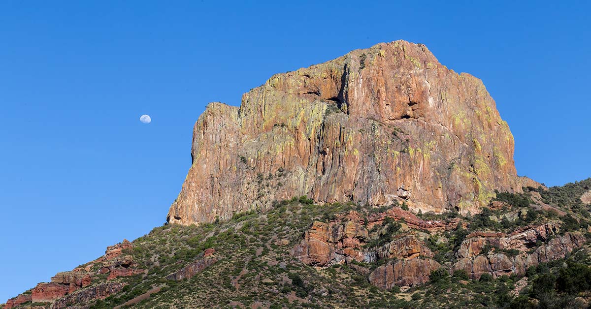
El Capitan


On the clearest nights, more than 2,500 stars are visible to the naked eye! Big Bend is known as one of the outstanding places in North America for stargazing. In fact, it has the least light pollution of any other National Park unit in the lower 48 states. One factor that makes this possible is simply the sparse human occupation of this region.


Click here to see the Big Bend National Park poster.


Rob Decker is a photographer and graphic artist who had the rare privilege of studying under Ansel Adams in Yosemite National Park when he was just 19 years old. Now, Rob is on a journey to explore and photograph all of America's National Parks. He's creating WPA-style posters to help people celebrate their own national park adventures — as well as encourage others to get out and explore!


Click here to learn more about Rob and The National Park Poster Project!


Source: https://national-park-posters.com/blogs/national-park-posters/best-things-to-do-in-big-bend-national-park

attachement