Friday, September 25, 2020

Celebrate Sequoia National Park's Anniversary September 25th


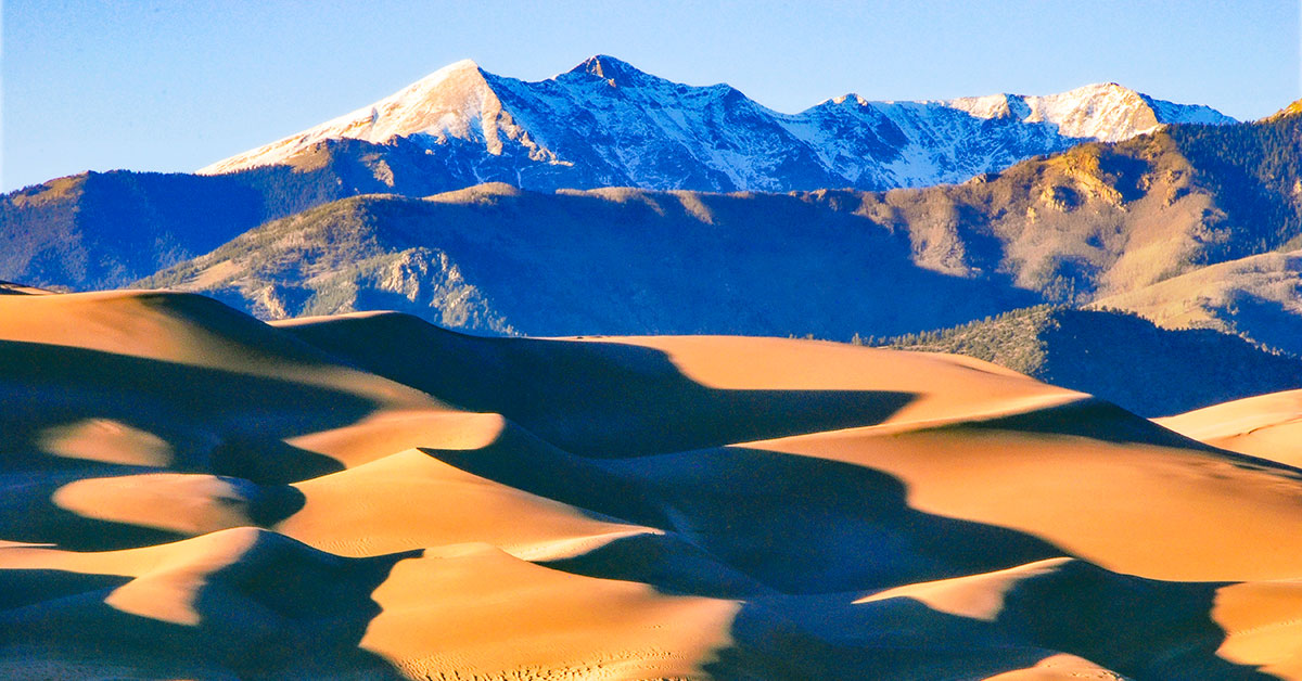
Sequoia National Park is a testament to nature's size, beauty, and diversity -- huge mountains, rugged foothills, deep canyons, vast caverns, and the world's largest trees. Located in the southern Sierra Nevada east of Visalia, California, Sequoia National Park was established on September 25, 1890.


The park spans 404,064 acres and encompasses a vertical relief of nearly 13,000 feet. The highest point in the contiguous 48 United States, Mount Whitney, at 14,505 feet above sea level is located within the park. The park is famous for its giant sequoia trees, including the General Sherman tree, the largest tree on Earth. The General Sherman tree grows in the Giant Forest, which contains five out of the ten largest trees in the world. The Giant Forest is connected by the Generals Highway to Kings Canyon National Park's General Grant Grove, home to the General Grant tree among other giant sequoias. The park's giant sequoia forests are part of 202,430 acres of old-growth forests shared by Sequoia and Kings Canyon National Parks.


General Sherman Tree, Sequoia National Park | National Park Posters


Many park visitors enter Sequoia National Park through its southern entrance near the town of Three Rivers at Ash Mountain at 1,700 ft. The lower elevations around Ash Mountain contain the only National Park Service-protected California Foothills ecosystem, consisting of blue oak woodlands, foothills chaparral, grasslands, yucca plants, and steep, mild river valleys. The region is also home to abundant wildlife: bobcats, foxes, ground squirrels, rattlesnakes, and mule deer are commonly seen in this area, and more rarely, reclusive mountain lions and the Pacific fisher are seen as well. The last California grizzly was killed in this park in 1922.


At higher elevations in the front country, between 5,500 and 9,000 feet, the landscape becomes montane forest-dominated coniferous belt. Found here are Ponderosa, Jeffrey, sugar, and lodgepole pine trees, as well as abundant white and red fir. Found here too are the giant sequoia trees, the most massive living single-stem trees on earth. Visitors often see mule deer, Douglas squirrels, and American black bears, which sometimes break into unattended cars to eat food left by careless visitors.


The vast majority of the park is roadless wilderness; no road crosses the Sierra Nevada within the park's boundaries. 84 percent of Sequoia and Kings Canyon National Parks is designated wilderness and is accessible only by foot or by horseback. Sequoia's backcountry offers a vast expanse of high-alpine wonders. Covering the highest-elevation region of the High Sierra, the backcountry includes Mount Whitney on the eastern border of the park, accessible from the Giant Forest via the High Sierra Trail. On a traveler's path along this 35-mile backcountry trail, you'll pass through about 10 miles of montane forest before reaching the backcountry resort of Bearpaw Meadow, just short of the Great Western Divide.


Continuing along the High Sierra Trail over the Great Western Divide via Kaweah Gap, you pass from the Kaweah River Drainage, with its characteristic V-shaped river valleys, and into the Kern River drainage, where an ancient fault line has aided glaciers in the last ice age to create a U-shaped canyon that is almost perfectly straight for nearly 20 miles. On the floor of this canyon, at least two days hike from the nearest road, is the Kern Canyon hot spring, a popular resting point for weary backpackers. From the floor of Kern Canyon, the trail ascends again over 8,000 ft. to the summit of Mount Whitney. At Mount Whitney, the High Sierra Trail meets with the John Muir Trail and the Pacific Crest Trail, which continue northward along the Sierra crest and into the backcountry of Kings Canyon National Park.


Click here to see the Sequoia National Park poster.


Rob Decker is a photographer and graphic artist with a single great passion for our National Parks! When he was just 19, he studied under Ansel Adams in Yosemite. Now he's on a journey to create original, WPA-style artwork for each of our national parks!


Click here to learn more about Rob's work and The National Park Poster Project.


Source: https://national-park-posters.com/blogs/national-park-posters/celebrate-sequoia-national-parks-anniversary-september-25th

attachement

Wednesday, September 23, 2020

Best Things To Do at Devils Tower National Monument


Devils Tower National Monument boasts one of Earth's most impressive geological features that protrudes out of the prairie surrounding the Black Hills. It is considered sacred by Northern Plains Indians and indigenous people. Hundreds of parallel cracks make it one of the finest crack climbing areas in North America. Devils Tower entices us to learn more, explore more and define our place in the natural and cultural world. President Theodore Roosevelt proclaimed Devils Tower as the first national monument on September 24, 1906.


My name is Rob Decker and I'm a photographer and graphic artist with a single great passion for America's National Parks! Devils Tower National Monument is a unique place and well worth the visit - if you're in the South Dakota/Wyoming area. So if this is your first time to the tower, or your returning after many years, here are some things you should know about Devils Tower National Monument!


Climbing


Hundreds of parallel cracks divide Devils Tower into large hexagonal columns. These features make it one of the finest traditional crack climbing areas in North America. The cracks vary in length and width: some are wide enough to fit your entire body, others barely have room for your fingers; the longest crack extends nearly 400 feet upwards.


Crack climbing is a specialized technique used on many routes at Devils Tower
NPS photo / Lucas Barth


Technical difficulty ratings range from 5.7 to 5.13; many modern climbers consider the oldest routes (Durrance and Wiessner) harder than their original ratings. The majority of routes at the Tower are not bolt protected and require the appropriate selection of camming devices or other temporary anchors. The few bolted face climbs that exist were established in the 1980s and 1990s; the condition of some bolts reflect that era.


Hiking the Less-Traveled Trails


Practice social distancing with a hike on some of the quieter trails. These hikes offer solitude as well as spectacular views of the Tower.


Joyner Ridge Trail


Trail winding through prairie grass with small trail sign in foreground and pine trees in background


Access the Joyner Ridge Trail from the Joyner Ridge trailhead parking lot or connect to it from the Red Beds Trail.

NPS photo


Along the north boundary of the park is a 1.5-mile (2.4 km) loop trail that follows Joyner Ridge and dips down into the draw below. Access the trailhead by taking the dirt road from the main park road as you head to or leave from the visitor center parking lot.


  • 1.5 mile (2.4 km) loop

  • Trail Access: Joyner Ridge trailhead parking area or Red Beds Trail via 0.6-mile (1 km) connector trail

  • Significant elevation change along eastern portion, dropping from or climbing to the ridge

  • Offers scenic views of Tower, prairie, and surrounding landscape

  • Dirt road access to trailhead/small parking lot


Red Beds Trail


View of a green river valley with boulders and pine trees in the foreground and mountain ridges in the background


Red Beds Trail offers diverse views of the Tower and the surrounding landscape.
NPS photo


For those seeking a more traditional hiking experience, this 2.8-mile (4.8 km) loop will offer great views of the Tower and surrounding Belle Fourche River valley.


  • 2.8 mile (4.5 km) loop

  • Trail access: visitor center parking lot or all other park trails

  • Parts of this trail are steep, as it climbs up and down between the river valley and visitor center

  • Offers stunning views of the Tower and surrounding geologic formations


South Side Trail


Prairie dog standing up in green grass with dirt hiking trail in background


Feeling watched? Prairie dogs like to keep an eye on passersby.

NPS photo


This trail begins from the amphitheater and proceeds through the prairie dog town 0.6 miles (1 km) to link into Red Beds Trail. South Side Trail can be used with Red Beds to hike to the visitor center from the picnic area parking lot.


  • 0.6 mile (1 km) trail

  • Trail Access: picnic area parking lot or Red Beds Trail

  • One road crossing

  • Walk through prairie dog town with slight/no elevation change

  • Moderate/steep elevation change once you cross the park road

  • Connects to Red Beds Trail


Valley View Trail


River meandering through grass with cement pilons and trees in the background


Valley View Trail is a nice stroll through prairie dog town with picturesque views of the river.

NPS photo


Beginning from the amphitheater, this trail winds through prairie dog town and offers picturesque views of the Belle Fourche River. With little/no change in elevation, this is a gentle trail for stretching your legs.


  • 0.6 mile (1 km) trail

  • Trail Access: picnic area parking lot or Red Beds Trail

  • One road crossing

  • Slight/no elevation change

  • Walk through prairie dog town and see gorgeous views of the Belle Fourche River

  • Connects to Red Beds Trail


Tower Trail


A bench overlooking a valley


There are numerous benches to relax along the Tower Trail, as well as waysides which tell about the natural and cultural history of the park.

NPS photo


The paved, 1.3-mile (2 km) Tower Trail starts across the parking area from the visitor center. A short, steep section leads to you a junction that you can take either way to walk around the base of the Tower.


As you walk the Tower Trail, you will notice cloths or small bundles attached to the trees. These are Native American prayer cloths and represent the spiritual connection many tribes have with the Tower. Please do not touch, disturb or remove these prayer cloths. Some consider it culturally insensitive to photograph these prayer cloths.


  • 1.3 mile (2 km) loop

  • Paved

  • Trail Access: visitor center parking lot or Red Beds Trail

  • Stretches of moderate elevation change

  • Offers close-up views of the Tower and boulder field, as well as sweeping views of the surrounding landscape

  • Most popular hike in the park, can get very crowded


Night Sky Viewing


As darkness falls on Devils Tower, a different kind of light illuminates the night sky. That light comes from objects in deep space, and transforms the night from a place of darkness into a place of wonder.


Night sky and Milky Way over Devils Tower
NPS / Devin Cherry


The night sky inspires human lives too. Oral histories about the Tower incorporate tribal star knowledge. Astronomers and night sky photographers seek out the darkness of parks like Devils Tower National Monument, islands of night in an ever-brighter world. What inspiration can you find as you enjoy the darker side of the first national monument?


In Lakota, Devils Tower is known as "mato tipi la paha" or "The Hill of the Bear's Lodge." More commonly called Mato Tipila (Bear Lodge). Through their oral traditions, Lakotas have passed on their knowledge of the stars to current generations. In addition to other known Lakota constellations, "Mato Tipila" shines brightly in the northern hemisphere. The fact that it shares the name of the geographic feature known as Devils Tower is no coincidence


Ranger Programs


Ranger programs are offered Memorial Day through Labor Day, with some programs continuing in September. Times and availability will vary, so check the visitor center for the most updated information. The online event calendar is a good place to check for programs and events happening at the park.


Click here to see the Devils Tower National Monument poster.


Devils Tower National Monument Sticker | National Park Posters


Click here to see the Devils Tower National Monument Sticker.


Rob Decker is a photographer and graphic artist who had the rare privilege of studying under Ansel Adams in Yosemite National Park when he was just 19 years old. Now, Rob is on a journey to explore and photograph all of America's National Parks. He's creating WPA-style posters to help people celebrate their own national park adventures — as well as encourage others to get out and explore!


Source: https://national-park-posters.com/blogs/national-park-posters/best-things-to-do-at-devils-tower-national-monument

attachement

Tuesday, September 22, 2020

Autumnal Equinox


In 2020, the autumnal equinox—also called the September equinox or fall equinox—arrives on Tuesday, September 22nd. Fall begins in the Northern Hemisphere and is a reminder that summer is now officially behind us.


The equinox, which happens around Sept. 22 or 23 every year, is a rather fleeting astronomical event. It happens at a precise moment when the sun's direct rays are straight over Earth's equator. This year's equinox is at 9:30 a.m. Eastern time on September 22nd. Based on the astronomical definition of seasons, the autumnal equinox marks the first day of fall (in the Northern Hemisphere). However, according to the meteorological definition of seasons, which is based on temperature cycles and the Gregorian calendar, the first day of fall is September 1st.


The word is derived from the Latin words aequus (equal) and nox (night). On the day of an equinox, daytime and nighttime are of approximately equal duration all over the planet. But the exact amount of daylight depends on your distance from the equator. At higher latitudes, such as northern Alaska, the sun is up for more than 12 hours and 20 minutes on the equinoxes.


The autumnal equinox is roughly the halfway point between our longest and shortest days of the year. Over the next three months, you'll notice the sun rising and setting closer to the southern horizon. And the sun will trace a shorter and lower path across the sky. This will end with the December or Winter solstice, when days start to grow longer and nights shorter.


The fall season also brings an opportunity for celebration! Many festivals are associated with autumn around the world, like the Alba White Truffle Festival in Italy, Diwali in India, Bonfire Night in the UK, Thanksgiving in United States, and Halloween, which is celebrated all over the world!


Here are some of my favorite national parks that I've visited in the fall...


Click here to see the Blue Ridge Parkway poster.


Click here to see the Grand Teton National Park poster.


Click here to see the Great Smoky Mountains National Park poster.


Click here to see the Lassen Volcanic National Park poster.


Click here to see the Shenandoah National Park poster.


Source: https://national-park-posters.com/blogs/national-park-posters/autumnal-equinox

attachement

Thursday, September 17, 2020

National Park Stickers | WPA-Style Images of your favorite National Parks


These vintage-style WPA National Park Stickers are printed in full-color on white polypropylene with a UV laminate for scuff resistance and outdoor durability. Of course, they can be used indoors, too!


Slap these stickers on your laptop, water bottle, longboard, helmet, notebook, camper, cooler, luggage, locker - anywhere you want to show your national park pride! Or be the envy of everyone at the trailhead by displaying this sticker on your water bottle or vehicle!


Catalog your journeys with these iconic National Park designs - by photographer and graphic artist, Robert B. Decker - turned into 3" x 4.25" stickers!


Rob's national park stickers are the prefect way to commemorate your latest adventure -- so, start your collection today! Plus, you'll feel good knowing that proceeds from your purchase help support our national parks! Click here to learn how Rob donates 10% of annual profits to organizations that support our national parks!


Click Here To See the National Park Stickers!


National Park Stickers | WPA-style stickers of your favorite National Parks


Parks Included in the Collection:


  • Acadia National Park

  • Arches National Park

  • Badlands National Park

  • Bryce National Park

  • Canyonlands National Park

  • Crater Lake National Park

  • Denali National Park

  • Devils Tower National Monument

  • Glacier National Park

  • Golden Gate Naitonal Recreation Area

  • Grand Canyon National Park

  • Grand Teton  National Park

  • Great Smoky National Park

  • Joshua Tree National Park

  • Mount Rainier National Park

  • Muir Woods National Monument

  • Olympic National Park

  • Redwood National Park

  • Rocky Mountain National Park

  • Shenandoah National Park

  • Worth Protecting

  • Yellowstone National Park

  • Yosemite National Park

  • Zion National Park


Shop These National Park Stickers Now!


Source: https://national-park-posters.com/blogs/national-park-posters/national-park-stickers-wpa-style

attachement

Saturday, September 12, 2020

Celebrate Great Sand Dunes National Park's Anniversary - September 12th


One of Colorado's lesser known national parks is Great Sand Dunes National Park & Preserve. The tallest dunes in North America are the centerpiece in a diverse landscape of grasslands, wetlands, conifer and aspen forests, alpine lakes, and tundra. Here you can experience this diversity through hiking, sand sledding, splashing in Medano Creek, wildlife watching, and more! The park and preserve are always open, so you can also experience night skies and nocturnal wildlife.


Great Sand Dunes National Park | National Park Posters


Wednesday, September 9, 2020

Celebrate Canyonlands National Park's Anniversary September 12th


Canyonlands National Park was established on September 12th, 1964, which preserves 337,598 acres of colorful canyons, mesas, buttes, fins, arches, and spires in the heart of southeast Utah's high desert. Water and gravity have been the prime architects of this land, sculpting layers of rock into this rugged landscape.

In the early 1950s, Bates Wilson, then superintendent of Arches National Monument, began exploring the area to the south and west of Moab, Utah. After seeing what is now known as the Needles District of Canyonlands National Park, Wilson began advocating for the establishment of a new national park that would include the Needles. Additional explorations by Wilson and others expanded the areas proposed for inclusion into the new national park to include the confluence of Green and Colorado rivers, the Maze District, and Horseshoe Canyon.

In 1961, Secretary of the Interior Stewart Udall was scheduled to address a conference at Grand Canyon National Park. On his flight to the conference, he flew over the Confluence (where the Colorado and Green rivers meet). The view apparently sparked Udall's interest in Wilson's proposal for a new national park in that area and Udall began promoting the establishment of Canyonlands National Park.

In 1962, the Canyonlands park bill was introduced by Utah Democratic Senator Frank Moss. Also that year, the U.S. Department of the Interior published a paper entitled A Proposed Canyonlands National Park containing this evocative passage:

"Rock -- carved, colored and clothed by weather -- controls the character of our land. Nowhere is the relationship between earth's framework and the forces that shape it more dramatic than in the plateau and canyon country of the American Southwest."

On September 12, 1964, after several years of debate, President Lyndon B. Johnson established Canyonlands as a new national park. Bates Wilson became the first superintendent of the new park. He is often referred to as the "Father of Canyonlands." Canyonlands expanded to its current size of 337,598 acres on November 12, 1971 when the Maze, the Land of Standing Rocks, as well as Davis and Lavender canyons were added to the park.

While each district shares a primitive desert atmosphere, each retains its own character and offers different opportunities for exploration and adventure. Though they appear close on a map, there are no roads that directly link the districts. Traveling between them requires two to six hours by car as there are few places to cross the rivers. Get directions. Most people find it impractical to visit more than one area in a single trip.

Click Here to See the Canyonlands National Park Poster!

If you're interested in other Canyonlands National Park gear, check out the men's and women's t-shirts, cell phone cases, neck gaiters and field journals. They're all perfect for showing off your Canyonlands National Park pride!

Canyonlands National Park T-Shirt | National Park Gear

Click here to see the Canyonlands National Park T-Shirt

Canyonlands National Park iPhone Mockup | National Park Gear

Click here to see the Canyonlands National Park iPhone cases.

Click here to see the Canyonlands National Park Samsung cases.

Canyonlands National Park Field Journal | National Park Gear

Click here to see the Canyonlands National Park field journal 

Rob Decker is a photographer and graphic artist who studied under Ansel Adams in Yosemite National Park when he was just 19 years old. Now, he's creating iconic WPA-style posters for each of our National Parks. Click Here to learn more about his story and The National Park Poster Project.


Source: https://national-park-posters.com/blogs/national-park-posters/celebrate-canyonlands-national-parks-anniversary-september-12th