Mesa Verde National Park was established in 1906 to preserve and interpret the archeological heritage of the Ancestral Pueblo people who made it their home for over 700 years, from 600 to 1300 CE. Today, the park protects nearly 5,000 known archeological sites, including 600 cliff dwellings. These sites are some of the most notable and best preserved in the United States.
My name is Rob Decker and I'm a photographer and graphic artist with a single great passion for America's National Parks! I've been to 51 of our 62 National Parks — and Mesa Verde is a unique park, given its historical and archeological significance. I have explored most areas of the park — so I'm ready to help! So if this is your first time to the park, or your returning after many years, here are some of the best things to do in Mesa Verde National Park!
Self-Guided Tours
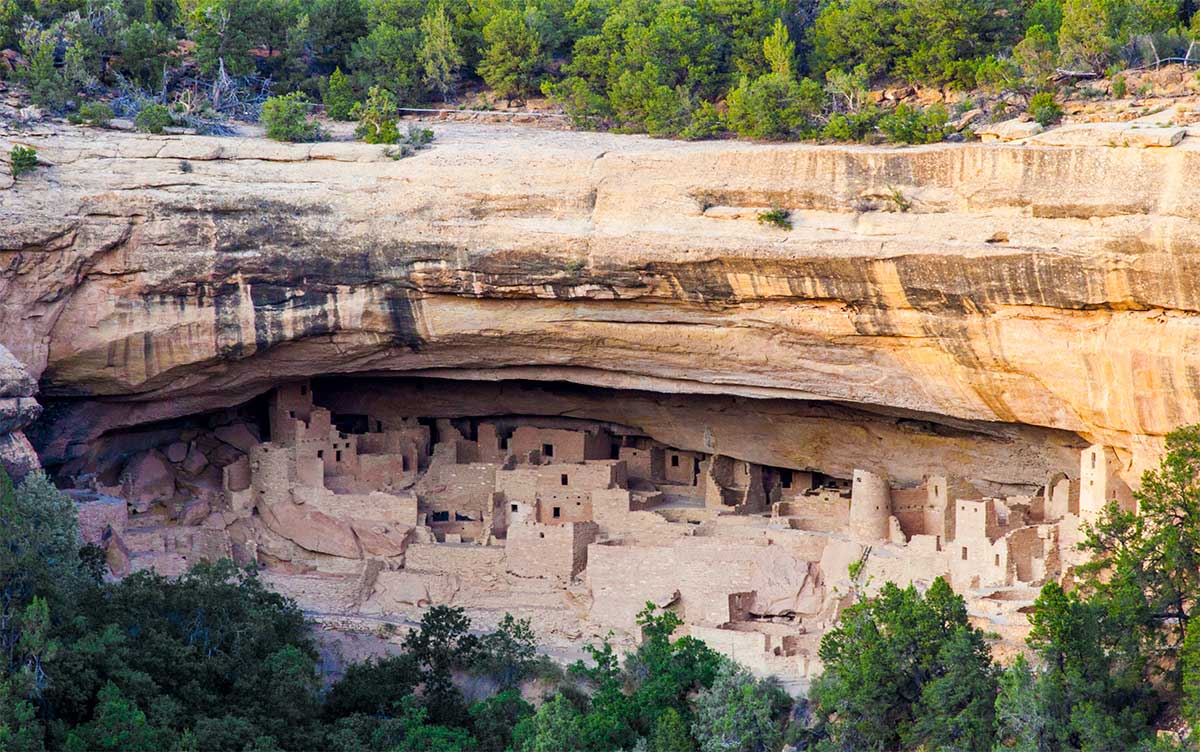
Spruce Tree House - Best-Preserved Cliff Dwelling
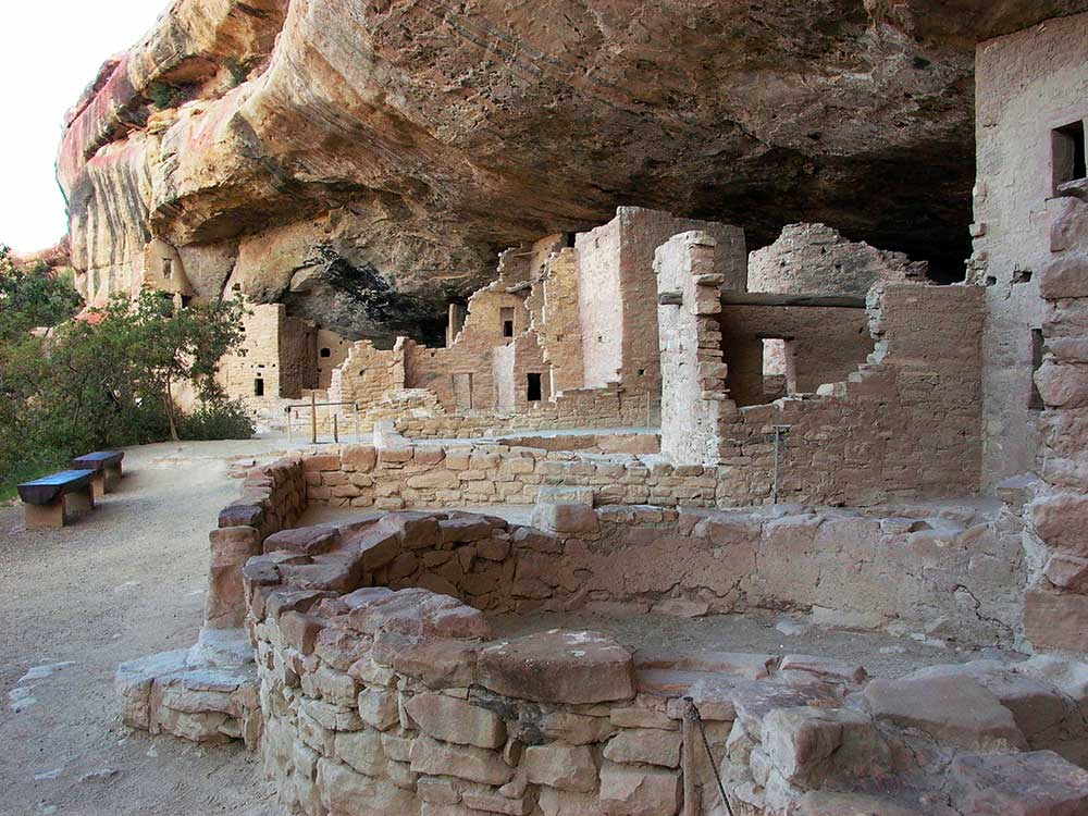
You can observe Spruce Tree House from viewpoints near the Chapin Mesa Archeological Museum. Rangers are available at the overlook to answer questions and share information.
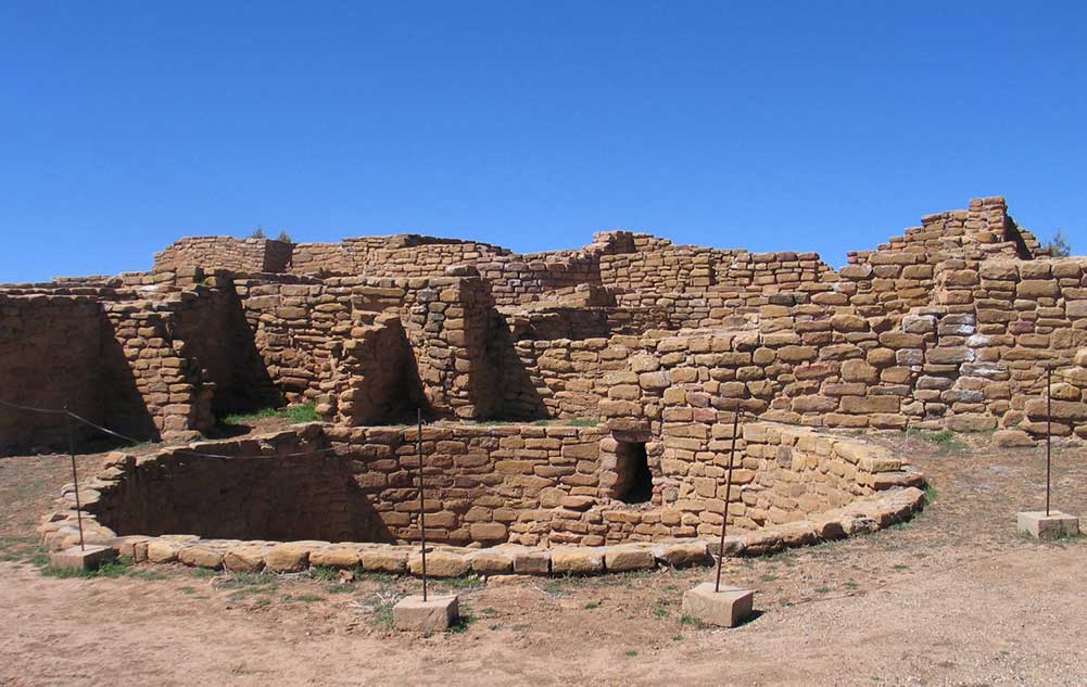
Mesa Top Loop Road - Auto Tour - 700 Years of Mesa Verde History
A 6-mile driving tour with short, paved trails. Twelve easily-accessible sites, including surface dwellings and cliff dwelling overlooks. Highlights include Square Tower House, Sun Point Overlook, and views of Cliff Palace from Sun Point and Sun Temple stops.
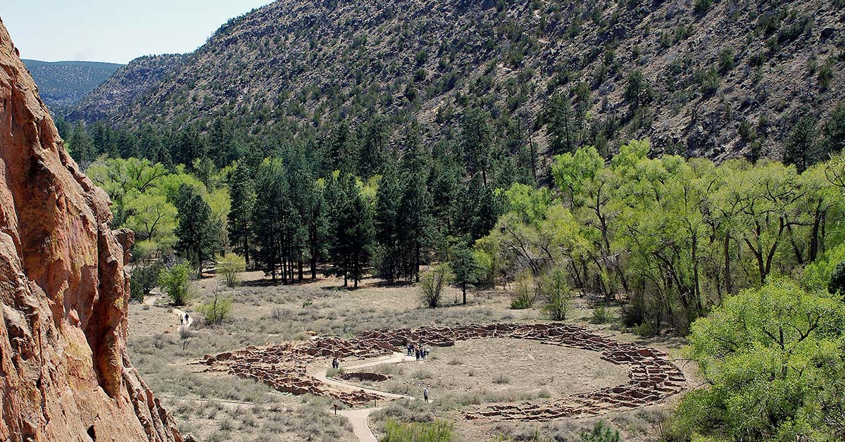
Far View Sites Complex - Five Mesa Top Villages & Far View Reservoir
Far View House plus four other villages and a dry reservoir on a level 3/4-mile (1.2 km) unpaved trail. Four miles north of the Chapin Mesa Archeological Museum.
Step House - Pithouse, Petroglyphs and Cliff Dwelling
A 100 foot descent and ascent on a winding path. Total walking distance is about one mile (1.6 km) round-trip. Allow 45 minutes to one hour. Trail begins near the Wetherill Mesa Kiosk.
Badger House Trail - Trail to Four Mesa Top Sites
The 2.25 mile round-trip trail through Badger House Community surface sites begins at Wetherill Mesa Kiosk. Your walk through this area is a journey through 600 years of prehistory. Combination gravel and paved trail.
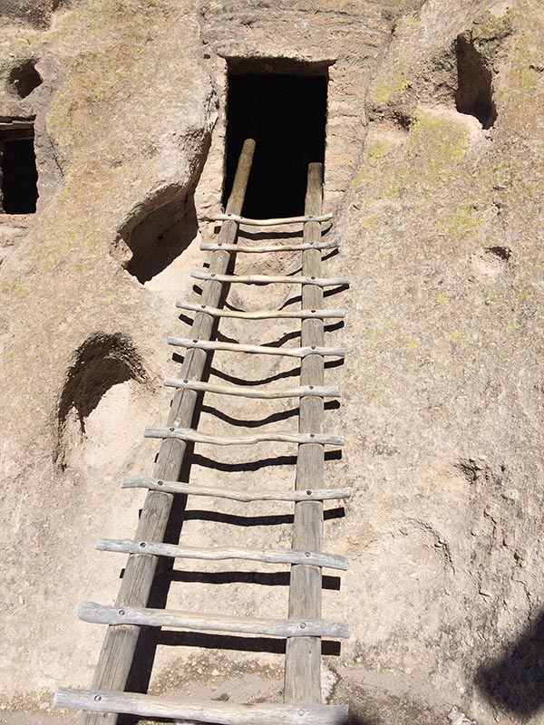
Cliff Dwelling Guided Tours
Cliff Palace, Balcony House, and Long House can only be visited by taking a ranger-guided tour which are very popular. A tour of Long House, on Wetherill Mesa, can be taken on the same day as a Cliff Palace or Balcony House tour. Tours can be strenuous. There are no height or age restrictions for tours, but children must be capable of walking the extent of the trails, climbing ladders, and negotiating steps independently. All infants must be carried in backpacks while on tours and adults carrying children in backpacks must be able to maintain mobility and balance. Tour tickets for Balcony House, Cliff Palace, and Long House must be purchased in person. Tour tickets sell out quickly, but can be purchased up to two days in advance.
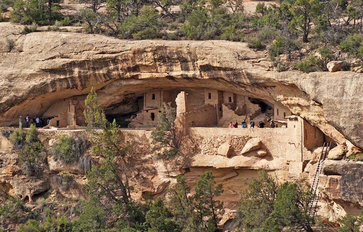
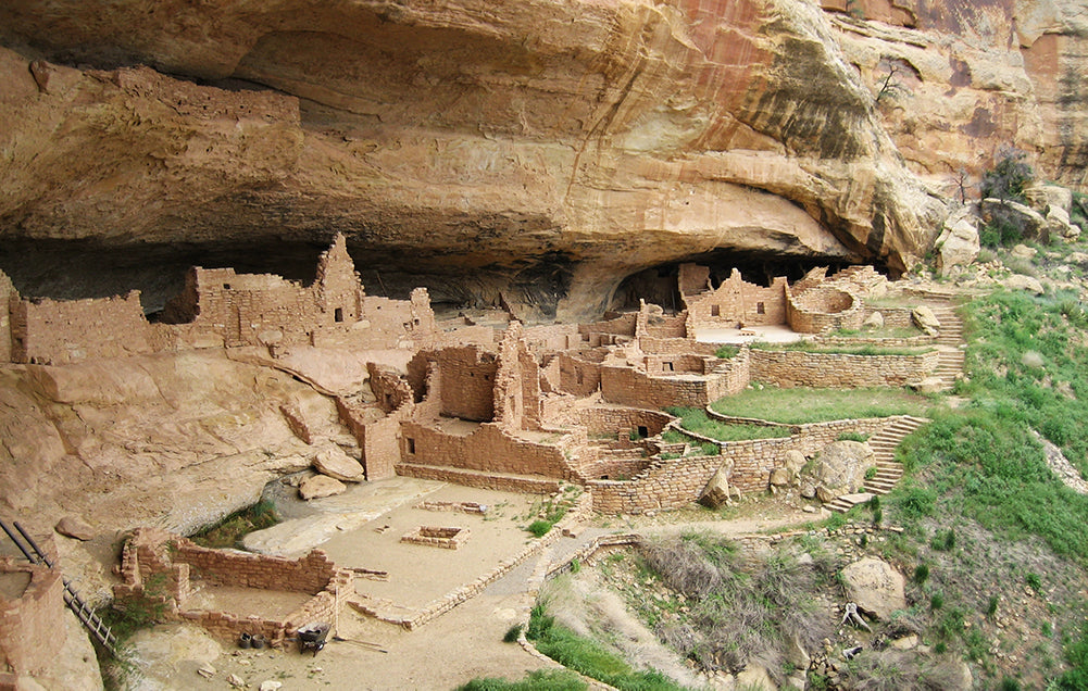
Cliff Palace - Mesa Verde's Largest Cliff Dwelling
This one-hour, ranger-guided tour involves climbing five, 8-10 foot ladders, on a 100 foot vertical climb. Total walking distance is about 1/4-mile, round-trip. The tour begins at Cliff Palace Overlook, an 23-mile, one-hour drive from the Visitor and Research Center.
Cliff Palace Twilight Tours
Enjoy an intimate, leisurely encounter with Mesa Verde's largest cliff dwelling. Dramatic sun lighting will appeal to both amateur and professional photographers as well as those seeking a deeper connection with this extraordinary archeological treasure.
Balcony House - Adventurous Cliff Dwelling Tour
This one-hour, ranger-guided tour involves climbing a 32-foot ladder, crawling through a 12-foot long tunnel, and climbing up a 60-foot open rock face with two 10-foot ladders to exit the site. The tour begins at the Balcony House parking area, a 25-mile, 1-1/4 hour drive from the Visitor Center.
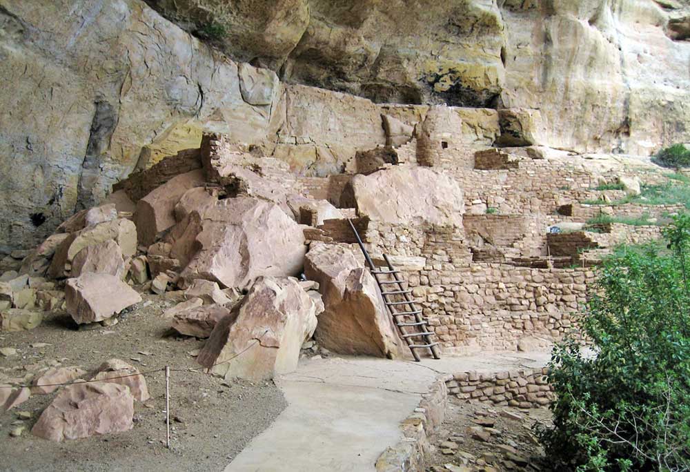
Long House - Mesa Verde's Most In-Depth Tour
Starting at the Wetherill Mesa information kiosk, this two-hour ranger-guided tour involves hiking at least 2.25 miles round-trip, and climbing two 15-foot ladders within the site. The hike has an elevation gain of about 130 feet. The tour ends at the Long House trailhead, giving you the choice of returning to the kiosk or exploring more of Wetherill Mesa on your own. Allow about 2.5 hours (total) for tour and return to kiosk.
Half-Day Guided Bus Tours
Mid-April to mid-October Mesa Verde National Park concessioner, Aramark Leisure, conducts guided bus tours that offer modern views of the Ancestral Pueblo people. Tours include the 700 Years and Far View Explorer Tours. Tickets may be purchased at the Mesa Verde Visitor and Research Center, Far View Lodge and Terrace, and Morefield Campground.
Balcony House Sunrise Tour
Rise before dawn, and experience the magic of Balcony House at sunrise! For centuries, Pueblo farmers have been observing the sky and the change of seasons. Take the Sunrise Tour of Balcony House at summer solstice or fall equinox and join in the long tradition of skywatching in Mesa Verde. On this 90-minute tour, you will climb a 32-foot ladder, crawl through and 18-inch wide and 12-foot long tunnel, and climb up a 60-foot open cliff face with stone steps and two 10-foot ladders to exit.
Cliff Palace Early Bird Tour
Looking for an early morning adventure? This daily, early bird tour offers the benefits of a smaller group size, cooler temperatures, and the ability to reserve a tour of Cliff Palace in advance with online reservations! On this 60-minute tour, you will descend uneven stone steps and climb four ladders, with an elevation change of 100 feet. Total walking distance is 1/4 mile.
Evening Programs
Morefield Campground Evening Program
In 1907, archeologist Jesse Fewkes began the first evening campfire talks in the history of the National Park Service at Mesa Verde. That tradition continues today. Enjoy a free, 45-60 minute presentation each evening by rangers at the Morefield Amphitheater (weather permitting). The amphitheater is located at the end of the road in Morefield Campground. Bring a flashlight. Program is free and offered each evening.
Bird Watching
Mesa Verde National Park is home to several distinct habitats. The types of species which you will encounter depends on the habitat present. If you are an avid birder, make sure to purchase a copy of the brochure, "Checklist of the Birds." This will help you locate where species are found in the park. The listing of birds in this page will get you started as a bird watcher in Mesa Verde. Take the Petroglyph Point or Spruce Canyon Trail and look for warblers, flycatchers, woodpeckers, jays, hawks, chickadees, titmice, and other species. The Knife Edge Trail also has good birding. If you are lucky, you may see a peregrine falcon or a golden eagle soar from its nest out across the Montezuma Valley. During the summer months, you can walk the Soda Canyon Overlook Trail near Balcony House, or the short trail to the Park Point lookout. The Park Point area is a good place to see hawks, towhees, grouse and eagles, in addition to the many species listed above. In the fall, you may want to take the Knife Edge Trail early in the morning to catch migrating warblers and hummingbirds feeding on the Indian Paint Brush. During winter months, be on the lookout for chickadees, nuthatches, an occasional brown creeper, canyon wrens, woodpeckers, flickers, and jays during your Spruce Tree House tour. Turkey vultures usually arrive in late March and leave in early October, so the large black birds you see will likely be common ravens or the vivid black-billed magpie.
Photography
Picture Taking Tips
Some cliff dwellings are open only from late spring through early fall. During the off-season, photos may be taken from the overlooks above the cliff dwellings, weather permitting. Most of the cliff dwellings are best photographed in mid-to-late afternoon. If you have an adjustable lens we suggest you close your lens down at least 1/2 stop from what the photo meter indicates (spot meters excepted). For example, in black and white photography the front walls of Cliff Palace will give your meter a false light reading. We suggest you bracket your settings on Cliff Palace exposures.
Best Times to Photograph by Season
June to September - 3:45 p.m. to 6:00 p.m. October to November - 2:30 p.m. to 5:30 p.m. December to March - 2:00 p.m. to 5:00 p.m. April to May - 2:30 p.m. to 5:30 p.m. During mid and late fall and early and mid spring the sun is lower in the southern sky and more light strikes the cliff dwellings. Winter light is generally less bright. On overcast days the soft light allows for photos to be taken that will show good details and subtle colors. During the winter months there is less vegetation obstructing views from the overlooks after the scrub oak has lost its leaves for the season.
Stargazing
While not offered as a guided activity, Mesa Verde National Park provides wonderful opportunities for stargazing. Since there are no large cities in the Four Corners region, there is very little artificial light to detract from the stars in the night sky. Most nights the skies are clear and full of stars. On a clear night, you can see the Milky Way. The locations recommended for stargazing in the park are listed below:
Far View Lodge
The only lodging available in the park from mid-April to mid-October. Each room has a balcony where guests can see for miles. For visitor safety, this area is well-lit. You may want to seek out a darker place, if this obstructs your view of the stars.
Morefield Campground
The only place to camp in the park from mid-May to mid-October. Located in the Morefield Valley, this is an especially place good for looking at stars since there is little artificial light. Join a ranger at the Morefield Amphitheater for the nightly (Memorial Day through Labor Day) campfire program. Bring a flashlight for the walk back to your campsite.
Montezuma or Mancos Overlooks
These are really the best areas in the park for stargazing. If you are staying outside of the park or want to get away from artificial lights, both of these overlooks along the Main Park Road provide views of the twinkling lights of the valley towns and the stars above. Unfortunately, these areas are not available for overnight camping.

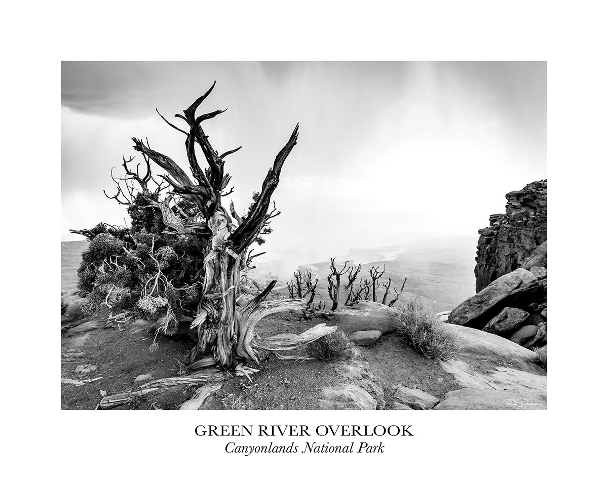
Click here to see the Mesa Verde National Park poster.
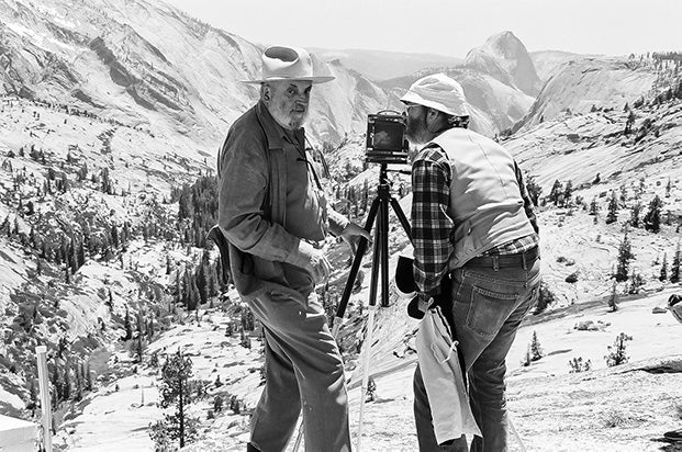
Rob Decker is a photographer and graphic artist who had the rare privilege of studying under Ansel Adams in Yosemite National Park when he was just 19 years old. Now, Rob is on a journey to explore and photograph all of America's National Parks. He's creating WPA-style posters to help people celebrate their own national park adventures — as well as encourage others to get out and explore!
Source: https://national-park-posters.com/blogs/national-park-posters/best-things-to-do-in-mesa-verde-national-park