Tuesday, February 11, 2020

Bandelier National Monument


Bandelier National Monument, near Los Alamos, New Mexico, protects Ancestral Pueblo archeological sites, a diverse and scenic landscape, and the country's largest National Park Service Civilian Conservation Corps National Landmark District.


Bandelier was designated by President Woodrow Wilson as a National Monument on February 11, 1916, -- named for Adolph Bandelier -- a Swiss-American anthropologist who researched the cultures of the area and supported preservation of the sites.


Bandelier National Monument protects over 33,000 acres of rugged but beautiful canyon and mesa country as well as evidence of a human presence going back over 11,000 years.  Petroglyphs, dwellings carved into the soft rock cliffs, and standing masonry walls pay tribute to the early days of a culture that still survives in the surrounding communities.


Bandelier National Monument


The Ancestral Pueblo people lived here from approximately 1150 CE to 1550 CE. They built homes carved from the volcanic tuff and planted crops in mesatop fields. Corn, beans, and squash were central to their diet, supplemented by native plants and meat from deer, rabbit, and squirrel. Domesticated turkeys were used for both their feathers and meat while dogs assisted in hunting and provided companionship.


Bandelier National Monument


Over 70% of the Monument is wilderness, with over one mile elevation change, from about 5,000 feet along the Rio Grande to over 10,000 feet at the peak of Cerro Grande on the rim of the Valles Caldera, providing for a wide range of life zones and wildlife habitats. There are three miles of road, and more than 70 miles of hiking trails.


The park infrastructure was developed in the 1930s by crews of the Civilian Conservation Corps and is a National Historic Landmark for its well-preserved architecture. The National Park Service cooperates with surrounding Pueblos, other federal agencies, and state agencies to manage the park.


Learn how you can get this limited edition, WPA-style print.


Source: https://national-park-posters.com/blogs/national-park-posters/bandelier-national-monument

attachement

Tuesday, February 4, 2020

Canyonlands National Park


At Canyonlands National Park you can explore a wilderness of countless canyons and fantastically formed buttes carved by the Colorado River and its tributaries. Rivers divide the park into four districts: Island in the Sky, The Needles, The Maze, and the rivers themselves. These areas share a primitive desert atmosphere, but each offers different opportunities for sightseeing and adventure.


Soda Springs Basin, Canyonlands National Park


A must-see is the sunrise over the towering depths of the canyons or perhaps at the famed Mesa Arch at Canyonlands National Park. Here you can explore a wilderness of countless canyons and fantastically formed buttes carved by the Colorado River and its tributaries. Rivers divide the park into four districts: Island in the Sky, The Needles, The Maze, and the rivers themselves. These areas share a primitive desert atmosphere, but each offers different opportunities for sightseeing and adventure.


Canyonlands preserves the natural beauty and human history throughout its four districts, which are divided by the Green and Colorado rivers. While the districts share a primitive desert atmosphere, each retains its own character and offers different opportunities for exploration and adventure. Author Edward Abbey, a frequent visitor, described the Canyonlands as "the most weird, wonderful, magical place on earth—there is nothing else like it anywhere."


Green River Overlook, Canyonlands National Park


Though they appear close on a map, there are no roads that directly link the districts. Traveling between them requires two to six hours by car as there are few places to cross the rivers. Get directions. Most people find it impractical to visit more than one area in a single trip.


Canyonlands National Park preserves 337,598 acres of colorful canyons, mesas, buttes, fins, arches, and spires in the heart of southeast Utah's high desert. Water and gravity have been the prime architects of this land, sculpting layers of rock into the rugged landscape you see today.


Monument Basin, Canyonlands National Park


In the early 1950s, Bates Wilson, then superintendent of Arches National Monument, began exploring the area to the south and west of Moab, Utah. After seeing what is now known as the Needles District of Canyonlands National Park, Wilson began advocating for the establishment of a new national park that would include the Needles. Additional explorations by Wilson and others expanded the areas proposed for inclusion into the new national park to include the confluence of Green and Colorado rivers, the Maze District, and Horseshoe Canyon.


In 1961, Secretary of the Interior Stewart Udall was scheduled to address a conference at Grand Canyon National Park. On his flight to the conference, he flew over the Confluence (where the Colorado and Green rivers meet). The view apparently sparked Udall's interest in Wilson's proposal for a new national park in that area and Udall began promoting the establishment of Canyonlands National Park.


In September 1964, after several years of debate, President Lyndon B. Johnson established Canyonlands as a new national park. Bates Wilson became the first superintendent of the new park. He is often referred to as the "Father of Canyonlands."


Click Here to See the Canyonlands National Park Poster!


Rob Decker is a photographer and graphic artist who studied under Ansel Adams in Yosemite National Park when he was just 19 years old. Now, he's creating iconic WPA-style posters for each of our National Parks. Click Here to learn more about his story and The National Park Poster Project.


Source: https://national-park-posters.com/blogs/national-park-posters/canyonlands-national-park

attachement

Thursday, January 30, 2020

The Valentine's Day Gift Guide


Looking for a Unique Valentines Day Gift? Here are Some Great Ideas for Your Sweetheart!


National Park Posters


WPA-Style Posters of Your Favorite National Park. Inspired by the iconic WPA artwork of the 1930s and 40s, our National Park posters are designed to celebrate our American heritage. Each numbered, signed and dated poster is printed on “Conservation,” a 100% recycled stock with soy based inks. From start to finish, these posters are 100% American Made! Posters are 13" x 19".


$40.00    Click Here to See the Posters


Artist Proofs


Grand Teton National Park Artist Proof


These Limited Edition prints are in High Demand! Artist Proofs are the first 25 posters pulled from each print run, are numbered 1-25, and are dated and signed. They feature the color bars used by the pressman to make sure registration and colors stay consistent throughout the print run and are 13" x 20". My signature attests that I have personally inspected and approved each print — and further verified that no unsigned or unnumbered copies within the limited edition are known to exist.


$55.00    Click Here to See the Artist Proofs


Collections


Artist Pick Collection | National Park Posters


From the original Kickstarter Collection -- to the State, Regional and Annual Collections, you can select from 2 - 12 of your favorite posters and get deep discounts! These collections make the perfect holiday gift for the national park lover on your list! They are the perfect way to bring their favorite National Parks into their home or office. All posters are numbered, signed and dated.


$60.00 - $255.00    Click Here to See all the Collections


Worth Protecting Stickers


Worth Protecting Sticker


The Worth Protecting sticker is 3″ x 4″ and printed on white polypropylene with a UV laminate. The sticker is based off of the ever-so-popular “Worth Protecting” poster, created in the style of the Works Progress Administration (WPA). Stickers can be slapped on outdoor gear, vehicles and more so you can voice your desire to protect America's National Parks. For indoor or outdoor use!


$5.95    Click Here to See the Worth Protecting Stickers


Postcards 


National Park Postcards


Limited on wall space? Postcards are the perfect solution. Just find a frame for 4" x 6" photo prints, and you can make a custom display of your favorite parks! Postcards are also great for sending to friends, use in PostCrossings, Save the Date or other announcements!


$18.00     Click Here to See the Postcards


America's National Parks Map


The ultimate bucket list! A great way to mark off the national parks you've already visited, or those you dream about seeing! This 19" x 13" map features all 61 of America's National Parks!


$30.00    Click Here to See the Map


Gift Cards - It Might Be the Perfect Valentines Day Gift


Get them a gift they'll love by letting them pick their favorite National Park Poster, Artist Proof, Collection, Postcard Set or Stickers.


Available in a wide range of denominations!


$25.00 and Up    Click Here to Get a Gift Card


Source: https://national-park-posters.com/blogs/national-park-posters/the-valentines-day-gift-guide

attachement

Monday, January 27, 2020

Best Things To Do In Rocky Mountain National Park


Rocky Mountain National Park's 415 square miles encompass and protect some of the world's most spectacular mountain environments. Trail Ridge Road – which crests at over 12,000 feet offers awe-inspiring overlooks to see these subalpine and alpine worlds. With more than 350 miles of hiking trails, and wildflowers, wildlife, and starry nights -- in a world of superlatives, Rocky is on top!


My name is Rob Decker and I'm a photographer and national park enthusiast. In fact, I've been to more than 50 of our amazing national parks. Rocky Mountain National Park is literally in my backyard, and I have explored almost every area of the park — so I'm ready to help! Whether this is your first time to Rocky Mountain, or if you are returning after many years and would like to be re-introduced to the park — this list of the best things to do is just for you!


Hiking


Moraine Park, Rocky Mountain National Park


Rocky Mountain National Park has 355 miles of hiking trails. They range from flat lakeside strolls to steep mountain peak climbs. If you are new to the park, consult with rangers at the visitor centers. They can provide advice about trails which are appropriate to different fitness and experience levels. As you plan your hike, keep in mind that park elevations range from 7,500 to over 12,000 feet. Even very fit individuals coming from lower elevations may experience altitude problems. Symptoms include headaches, shortness of breath, insomnia and rapid heartbeat. To minimize symptoms drink plenty of fluids, avoid alcohol, don't skip meals and get plenty of rest. 


Fishing


Fishing Lily Lake, Rocky Mountain National Park


Sport fishing is permitted in Rocky Mountain National Park. Fishing activities are balanced with efforts to restore and perpetuate natural aquatic environments and life. Fishing was popular with early settlers and visitors in the Rocky Mountains. In an attempt to improve the sport, many streams and lakes were stocked with non-native species of trout. The National Park Service stocked non-native Yellowstone cutthroat trout as late as 1969. The only trout native to the park are the greenback cutthroat and the Colorado River cutthroat. These efforts to enhance recreational opportunities in National Park areas were reconsidered in the 1970s. Since 1975, native greenback cutthroat and Colorado River cutthroat trout are being restored to park waters and exotic or non-native fish are being removed.


Wildlife Viewing


Rocky Mountain National Park visitors have a passion for viewing wild animals, especially the big ones. With an elk herd numbering between 600 to 800 in the winter, about 350 bighorn sheep, numerous mule deer and a small population of moose calling the park home, it's no surprise that wildlife watching is rated the number-one activity by a vast majority of Rocky's three million annual visitors.


Elk Bugling, Rocky Mountain National Park


Wildlife Viewing Tips


The park's great large-animal population makes it one of the country's top wildlife watching destinations. Here are a few park favorites:

  • Elk can be seen anytime, a popular viewing period being the fall rut, or mating season. Look for elk in meadows and where meadow and forest meet.

  • Bighorn sheep are commonly seen at Sheep Lakes from May through mid-August.

  • Moose frequent willow thickets along the Colorado River in the Kawuneeche Valley on the park's west side.

  • Otters were reintroduced into the Colorado River area and are doing fairly well. These animals are difficult to spot.

  • Mule deer are common and can be seen anywhere. They are most often found at lower elevations in open areas.

  • Bats feed over lakes and ponds at dawn and dusk.

  • Marmots and pikas favor rocky areas. Marmots are best seen on the alpine tundra along Trail Ridge Road. Pikas - small, light-colored mammals - are common in rock piles. Listen for their sharp, distinctive bark and watch for movement.

  • Clark's nutcrackers, Steller's jays, golden eagles and prairie falcons can be seen along Trail Ridge Road.

  • White-tailed ptarmigans, some of the most sought-after birds in Rocky Mountain National Park, are common but difficult to spot. For best results, hike on the tundra and look carefully. Ptarmigans usually remain still, relying on their natural camouflage for protection.

  • American dippers, or water ouzels, can be found along most streams. Listen for their loud call, similar to the rapid clicking of two stones together, as they fly up and down their territories.


Big Horn Sheep, Rocky Mountain National Park


Despite their good intentions, some wildlife watchers are loving park animals to death. Feeding junk food to wildlife reduces its ability to survive the long mountain winter. When they panhandle near roadsides, animals fall easy prey to automobiles. As they become habituated to humans and lose their natural fear, the animals become aggressive and may be destroyed. Harassing or feeding wildlife is illegal in all national parks.


Horseback Riding


Horseback Riding, Rocky Mountain National Park


Horses have been part of Rocky Mountain Park's tradition since its designation in 1915. Recreational pack animal use is balanced with other recreational uses such as hiking. Packing is managed to maintain the natural resources and unique ecosystems in the park. Horses, mules, ponies, llamas, and burros are allowed on park trails. No goats are allowed on park trails. For overnight camping, stock is permitted at established backcountry campsites designated for stock use. There are two stables located within the park: Glacier Creek Stables and Moraine Park Stables. There are many stables outside the park. Find contact information for the various stables in the area. There are two Estes Park stables open in the winter: Sombrero Stables and Aspen Lodge Stables. Approximately 260 miles of trails are open to commercial and private horse use, which makes up about 80% of the total trail network in the park.


Wilderness Camping


Rocky Mountain National Park offers some unique camping experiences and here are some things to consider when choosing your wilderness campsite. The first step in planning your trip: decide where you want to camp and for how long. I suggest purchasing a Rocky Mountain National Park topographic map to choose a destination and route. Then, use the Wilderness Campsite Map and Wilderness Designated Site Details to select wilderness campsites. Remember to consider the abilities of the least experienced member of your party and the distance and elevation gain from the trailhead to your destination.


Elevation


Rocky Mountain National Park is a high elevation park. If you live at sea level, it will take you several days to become acclimated. Most trails begin above 8,000 feet and climb abruptly higher. If you are not acclimated, you can get acute mountain sickness. Rangers recommend spending at least one night at 7,000–8,000 feet prior to setting out. This will allow your body to begin to adjust to the elevation.


Weather and Clothing


When you visit or call the park, discuss your plans with a ranger. Find out if snow has melted from the trails and destinations where you hope to hike. Check the weather forecast before starting your trip. Mountain weather changes very quickly. Within just a few hours, bright sunny skies may give way to raging storms. High winds often occur in the high country. Wind chill accelerates the lowering of body temperature which can result in hypothermia. Proper clothing is your first line of defense against cold. Plan to dress in layers so you can regulate your temperature by bundling up or peeling down. Be sure to pack rain and storm gear. Remember, you assume complete responsibility for your own safety and that of your group while hiking in Rocky Mountain National Park.


Ranger-Led Evening Programs


All evening programs are free and open to the public and are held at several locations throughout the park during evening hours. Both the Beaver Meadows Visitor Center and Kawuneeche Visitor Center are in non-fee areas of the park.


East Side Locations:


Beaver Meadows Visitor Center Auditorium (Hwy 36) is located approximately three miles west of the town of Estes Park. Evening programs are held mid- May through mid-June and intermittently throughout the year.


Aspenglen Campground Amphitheater is located at the Fall River Entrance (Hwy 34) approximately 4 miles from downtown Estes Park. Evening programs will resume mid-June, 2019.


Glacier Basin Campground Amphitheater is located along Bear Lake Road approximately 8 miles from downtown Estes Park.Evening programs will resume mid-June, 2019.


Moraine Park Campground Amphitheater is located along Bear Lake Road approximately 5 miles from downtown Estes Park. Evening programs will resume mid-June, 2019.


West Side Locations:


Kawuneeche Visitor Center Auditorium is located approximately one mile north of the town of Grand Lake (Hwy 34). Evening programs are held on Saturday nights throughout the summer. Please stop at a the visitor center for more information on specific topics.


Timber Creek Campground Amphitheater is located in the Kawuneeche Valley (Hwy 34) approximately eight miles from the Grand Lake Entrance. Evening programs are held throughout the summer and into September. Please stop at a the Kawuneeche visitor center for more information on specific topics.


Kids Activities


Bear Lake, Rocky Mountain National Park


Kids are born naturalists. They access the natural world by asking questions, which sometimes come in bunches. Introducing children to the outdoors can begin at any time, but why not begin early? And why not start them out in Rocky Mountain National Park, one of the country's premier outdoor wonderlands. Infants can be carried in a front pack, which can be tucked inside the jacket if it's chilly. Hike anywhere. Your kids will be enthralled by the stunning scenery and the fresh mountain air, so enthralled that he or she will fall asleep in short order. When they reach the toddler stage, children begin to more actively interact with nature. It is a time of observation, of making initial connections and stockpiling notes. It is a wonderful time to introduce them to one of the many discovery trips found around the park. A few suggestions.


  • Explore the edges of Bear Lake while enjoying the guidebook-guided trail tour that explains the area's natural and human history. Water holds an amazing variety of plant and animal life that will pique a child's curiosity.

  • Discover Rocky Mountain's amazing array of wildlife. At particular times during the summer (ask a park ranger), the bighorn sheep come down to Sheep Lakes. Kids especially enjoy watching them cross the road after the lambs are born.

  • Find a ponderosa pine forest and watch for Abert's squirrels. Their dark color and busy activities catch a toddler's eye for contrast and movement. Kids that are a bit older develop a more complex understanding of the world around them. While some children might enjoy expending energy hiking along a trail, most seem happiest thoroughly exploring a smaller area. On any hike with three to five year olds, it's a good idea to include a magnifying glass in the backpack. Textures of trees, plants, bugs and rocks are exciting close-up. In the early summer, enjoy the amazing floral colors found along the trail to Cub Lake.

  • Have the youngsters keep an eye out for hummingbirds that may be visiting the flowers. Watch for beaver along the way in the Cub Creek drainage. Beaver dams are easy to spot in this area and stream banks are ideal places to look for animal tracks.

  • The park has a "Rocky's Junior Ranger Program" for children in kindergarten through eighth grade. Emphasis is placed on park preservation, flora and fauna facts, and environmental education. When kids complete the Junior Ranger booklet, they earn a badge. Check at a visitor center for information.


Fairy Primrose, Rocky Mountain National Park


These are but a few of the things you can do at Rocky Mountain National Park. Check with the park rangers when you arrive to see what activities are available, what wildlife might be easiest to see, or where the wildflowers are blooming. I've created three posters for Rocky Mountain National Park -- one that features a view of Moraine Park, one for Cub Lake, and one for the iconic Longs Peak.


Click here to see the Rocky Mountain National Park, Cub Lake poster.


Click here to see the Rocky Mountain National Park, Moraine Park poster.


Click here to see the Rocky Mountain National Park, Longs Peak poster.


Rob Decker is a photographer and graphic artist who had the rare privilege of studying under Ansel Adams in Yosemite National Park when he was just 19 years old. Now, Rob is on a journey to explore and photograph all 61 of America's National Parks. He's creating WPA-style posters to help people celebrate their own national park adventures -- as well as encourage others to get out and explore!


Source: https://national-park-posters.com/blogs/national-park-posters/best-things-to-do-in-rocky-mountain-national-park

attachement

Tuesday, January 21, 2020

Wind Cave National Park


Wind Cave National Park is one of the oldest parks in the National Park system, and was established on January 9th, 1903. It was the first park created to protect a cave anywhere in the world.


Known for its displays of the calcite formation called boxwork, some 95 percent of the world's discovered boxwork formations are found in Wind Cave. Considered a three-dimensional maze cave, it is recognized as the densest -- most passage volume per cubic mile -- cave system in the world. The cave is currently the sixth-longest in the world with 140.47 miles of explored cave passageways, with an average of four new miles of cave being discovered each year. Above ground, the park includes rolling hills, pine forests and the largest remaining natural mixed-grass prairie in the United States.


Boxwork Formation | Wind Cave National Park


The Lakota, Cheyenne, and other Native American tribes had known about the opening to Wind Cave and the winds that move in and out of it for centuries. The indigenous people who lived in the Black Hills region of South Dakota, spoke of a hole that blew air, a place they consider sacred as the site where they first emerged from the underworld.


Natural Entrance, Wind Cave National Park


Typically, air continually moves into or out of a cave, equalizing the atmospheric pressure of the cave and the outside air. When the air pressure is higher outside the cave than in it, air flows into the cave, raising cave's pressure to match the outside pressure. When the air pressure inside the cave is higher than outside it, air flows out of it, lowering the air pressure within the cave. Wind Cave, with only a few small openings "breathes" more obviously than a small cave with many large openings. Rapid weather changes, accompanied by rapid barometric changes, are a feature of Western South Dakota weather.


Wind Cave National Park | National Park Posters


Wind Cave National Park protects a diverse ecosystem with eastern and western plant and animal species. Some of the more notable animals include elk, bison, black-footed ferrets, pronghorn and prairie dogs. The Wind Cave bison herd is one of only four free-roaming and genetically pure herds on public lands in North America. The other three herds are the Yellowstone Park bison herd, the Henry Mountains bison herd in Utah and on Elk Island in Alberta, Canada.


Click here to learn more about Wind Cave National Park.


Source: https://national-park-posters.com/blogs/national-park-posters/wind-cave-national-park

attachement

Wednesday, January 8, 2020

White Sands National Park


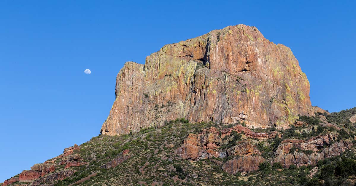
White Sand National Park: Like No Other Place Else on Earth


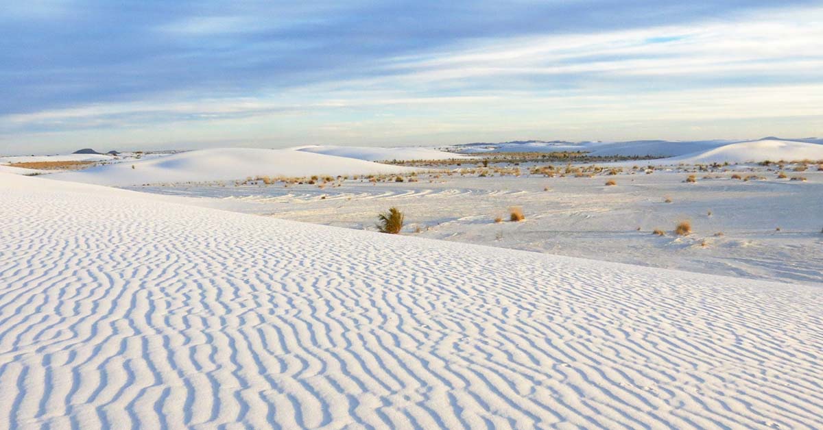
At White Sand Dunes National Park, great wave-like dunes of gypsum sand engulf 275 square miles of desert and preserves a piece of New Mexico's unique geology. In fact, the gypsum dune field is the largest of its kind on Earth. Gypsum is rarely found as sand because it dissolves in contact with water. But, the isolation and weather patterns of the Tularosa Basin creates a truly unique experience for intrepid park explorers. Visitors can hike, enjoy ranger-led educational programs and even try sand sledding! White Sands was established as a national monument in 1933 and re-designated as a national park in December, 2019. 


Exploring White Sands National Park by Car


Dunes Drive is an eight-mile scenic drive that leads from the visitor center into the heart of the gypsum dunefield. The 16-mile round-trip drive takes approximately 45 minutes. You will want to allow additional time to explore the dunes, take photos, and/or learn about the natural and cultural history of the world's largest gypsum dunefield. Along the road, you will find outdoor exhibits, hiking trails, picnic areas and parking areas.


The first five miles of Dunes Drive are paved and the last three miles are a hard-packed gypsum sand road. The road is suitable for cars, motorcycles, recreational vehicles, and buses.


Missile Tests and Road Closures


From time to time, White Sands Missile Range performs missile tests that may close Highway 70 to traffic. Depending on the nature of the testing, Dunes Drive may also be closed during missile tests for visitor safety. During these times, the visitor center remains open. Visitors are invited to view the museum exhibits, watch the 17-minute orientation film, and peruse the park store and gift shop while Dunes Drive is closed.


Weather


Weather conditions can change drastically—from sudden downpours to dust storms. The road can be slippery when wet, especially during the winter. It may also be harder to spot frozen water. For your safety, decrease your speed and brake gently to avoid skidding. Dust storms can drastically reduce visibility. Do not drive during a dust storm.
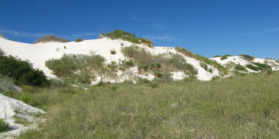
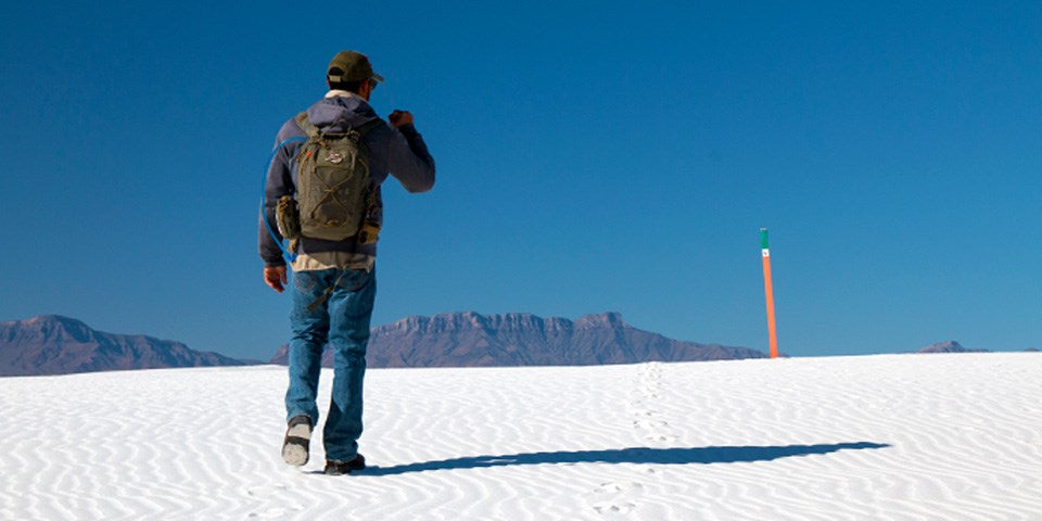

Hiking the Dunes 


There is no better way to experience the unique landscape of White Sands National Park than by venturing out onto any of our five established trails. Explore the dunes and enjoy the silence and solitude of the dunefield with its stunning views of the surrounding mountains. The trails vary in terms of difficulty and scenery. Plan ahead to ensure you have a great and safe hike.


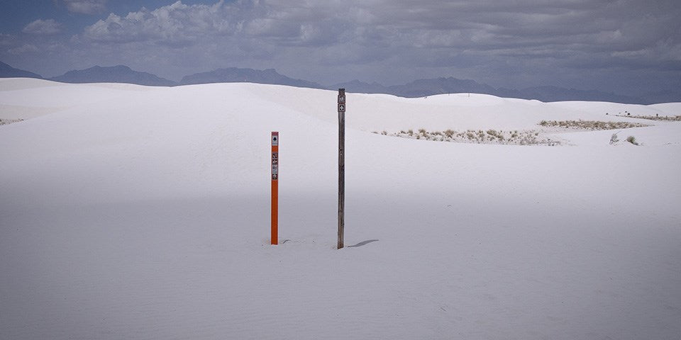
Each trail is marked with a specific colored post (i.e., green, blue, orange, or red) and a symbol (i.e., hearts, clubs, spades, or diamonds). You should familiarize yourself with these colors and symbols to help orient yourself to the trail before you start your hike. This information will be critical if you become lost. 


Interdune Boardwalk


Interdune Boardwalk


The Interdune Boardwalk is fully accessible for people using wheelchairs and strollers. Take an easy 0.4 mile round trip stroll through the dunes and learn about the science, geology, plants, and animals that make White Sands an unequaled natural wonder. The boardwalk is a great place to take a break under the shade canopy, listen for bird calls, observe lizards and enjoy the wildflowers. 


Playa Trail


Playa Trail


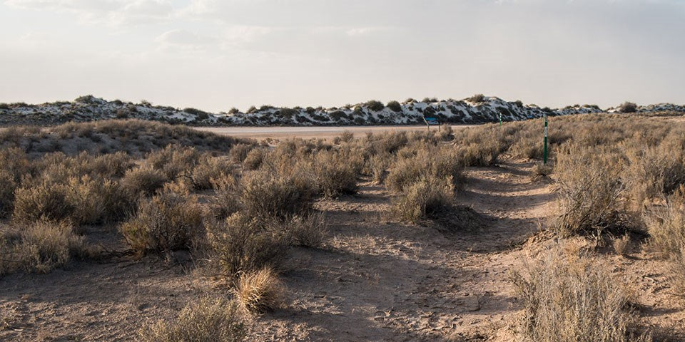
The Playa Trail is an easy, 0.5 mile round-trip, level trail with outdoor exhibits along the way to help you learn and explore this trail and the characteristics that make it special. On this self-guided trail, you will discover the importance of a playa undergoing constant change. Learn how this change creates habitats for plants and animals. It may be brown, white, filled with water, or have growing crystals. See what the playa looks like today! At the end of the trail, you have the opportunity to travel back in time and see what this area looked like 10,000 years ago and learn about the giants that once roamed this land. 


Dune Life Nature Trail


Dune Life Nature Trail


The Dune Life Nature Trail is a moderate, one-mile self-guided loop hike. Though not difficult, this hike does require hikers to climb two steep dunes with loose sand. Follow the blue trail markers with a club symbol. Meet Katy the Kit Fox and learn about her friends on this family-oriented trail. Look for tracks of the animals that call these dunes their home. Kit foxes, badgers, birds, rodents, and reptiles all live in this area. 


Backcountry Camping Trail


Backcountry Nature Trail


The Backcountry Camping Trail is a moderate, 2-mile round-trip hike. Though backpackers hike the trail most frequently, it is also open to visitors who want a shorter hike through the heart of the dunes. Follow the orange trail markers with a spade symbol into an area of beautifully varied dunes and vegetation. The trail requires hikers to climb over several steep dunes and loose sand. There is no shade, no water, and no toilet facility along this trail. 


Alkali Flat Trail 


Alkali Flat Trail


The Alkali Flat Trail is a strenuous, 5-mile round-trip hike. Follow the red trail markers with a diamond symbol. The Alkali Flat Trail skirts the edge of what is now the final remnant of Lake Otero. This trail is not flat! You will be hiking up and down dunes the entire way. Go only if you are prepared. There is no shade, no water, and no toilet facility along this trail. 


Native Plant Garden Trail


Native Plant Garden Trail


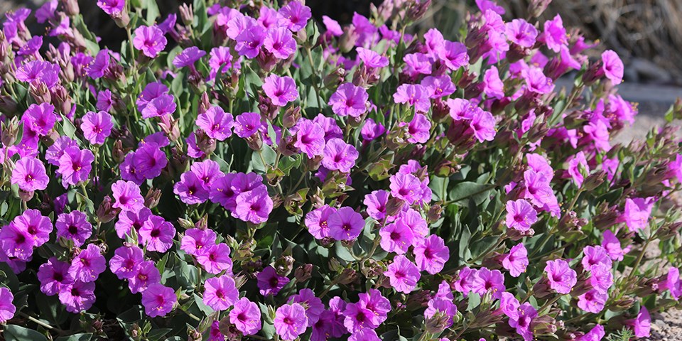
Although White Sands is located in the arid Chihuahuan desert, it is also a place of amazing life and diversity. Learn about some of the native plants of the Chihuahuan desert by taking a walking tour of our native plant garden located in front of the visitor center. 


The best time for touring the native plant garden is from mid-March through late November. Many plants are dormant during the winter months. Most wildflowers begin blooming around the middle of April. Soaptree yuccas are the star of the spring flowers and typically blooms in late April through May. Some plants may continue to bloom throughout the summer, such as the Colorado four o' clock. Many plants, including the ocotillo, burst into bloom after monsoon rains. Fall colors can begin to appear as early as October and last through November. This is the time when the Rio Grande cottonwood trees begin to turn a beautiful orange and the skunkbush sumac start to turn a vibrant red.


Bicycling


Bicycling at White Sands is truly a unique experience—nowhere else in the world can you ride a bike on a hard-packed gypsum sand road through the heart of an immense gypsum dunefield! This distinctive experience requires one to be prepared and alert.


What kind of bike is best for Dunes Drive?


Rangers are frequently asked this question, and the response is, "It depends." The answer typically depends on the condition of the road. Dunes Drive is eight miles one-way. The first four miles are paved, and the rest of the road is hard-packed gypsum sand. Dunes Drive will frequently have a rough "washboard" surface, potholes, and sand drifts. These hazards make riding a bike on Dunes Drive challenging. Experienced riders on mountain and city/beach cruiser bikes with wide tires should be able to handle the varied road conditions and hazards. Road bikes with skinny street tires are not recommended on the sand-portion of Dunes Drive.


Sand Sledding


Sand Sledding


Sledding on the beautiful soft sand at White Sands National Park is a popular activity and great fun for children and adults alike. Unlike snow, sand is not slippery and sledding down the face of a dune can take some practice unless you have the correct equipment, know proper techniques and use safety precautions.


Waxed plastic snow saucers work best and can be purchased at the park's gift shop. Please call the gift shop at 575-479-1629 before arriving to confirm the availability of sleds. You may also bring your own sleds. Choose a dune with a gently sloping face and a level run-off at the end so that you can come to a halt safely. Be aware of where the dune slope meets the desert floor. While the dune sand is soft, the area at the base of the dune can be very hard, and unintentional injuries are surprisingly common. Make sure the sledding path does not cross the roadway or parking areas and is free from hazards such as vegetation, hard clumps of sand, or other obstructions.


Photographing the Dunes


With the shifting light, shadows, and truly out-of-this world landscape make White Sands a photographer's paradise. You do not need an expensive camera to capture the beauty of the dunes. Great pictures, however, require the same techniques and way of looking at things that pros have learned.


White Sands National Park


Every day at White Sands National Park will be different. Sometimes there are crystal clear views of the surrounding mountains and sometimes awesome cloud formations that change hues by the minute. The Sacramento Mountains to the east are especially beautiful just after the sun dips below the horizon where they are bathed in a pink afterglow.


If you see a good photo, take it. Don't get so wrapped up in all the technical aspects of taking the photo that you miss the opportunity. Go out, have fun, enjoy the dunes and remember "leave footprints and take only pictures."


Here are some things to consider:


  • Hike to the top of the tallest dune around and take in the bird's eye view. The tallest dunes are toward the end of Dunes Drive near the Alkali Flat trailhead.

  • Drop to your knees and look up. Yuccas against the sky and the delicacy of dune grasses are especially interesting from a low angle.

  • The patterns left in the sand by grasses and leaves blown by the wind are fascinating. Sometimes you will find the tiny tracks of a darkling beetle just waiting to be recorded, and sometimes you'll find the actual beetle. The interdunal areas are great places to find animal tracks and rugged, gnarly plant growth.

  • Most beginners tend to center objects and include the entire object in the frame. However, you'll end up with a more interesting photo when you shoot slightly off center and occasionally only include half of the object or two-thirds of it in the frame. This results in an unexpected look for the photo and in interesting composition.

  • Placing a plant or rock in the near foreground of your photo will help the viewer see the scale and distance in your photograph. Give the viewer an object which will help them understand size and distance of your intended subject.


The most important thing to remember is that the photographs you take are your own view of the subject and you have recorded these images for your own enjoyment.Taking good photographs is a way to record your memories of White Sands and other places you visit and to share those memories with family and friends.


A Bit of Trivia


White Sands National Park has been featured in a variety of films, including Four Faces West (1948), Hang 'Em High (1968), The Hired Hand (1971), My Name Is Nobody (1973), Bite the Bullett (1975), Young Guns II (1990), King Solomon's Mines (1950), The Man Who Fell to Earth (1976), and Transformers (2007).


Source: https://national-park-posters.com/blogs/national-park-posters/white-sands-national-park

attachement

Friday, December 6, 2019

Best Things To Do in Big Bend National Park


Big Bend National Park offers nearly limitless opportunities for scenic driving, hiking, camping, backpacking, mountain biking, horseback riding, bird watching, wildlife observation, and stargazing. Additionally, the Rio Grande borders the park for 118 miles providing options for half-day floats to extended excursion by raft, canoe, or kayak.


My name is Rob Decker and I'm a photographer and graphic artist with a single great passion for America's National Parks! I've been to 51 of our 61 National Parks — and Big Bend is one well worth the visit. I have explored many areas of the park — so I'm ready to help! So if this is your first time to the park, or your returning after many years, here are some of the best things to do in Big Bend National Park!


Scenic Drives


Chiahauan Desert


100 miles of paved roads and 150 miles of dirt roads connect the desert to the mountains and the river and offer exceptional ways to explore the park by vehicle. Here are the top five scenic drives — on paved roads!


Chisos Basin Road – 6 miles


A drive to the Chisos Basin is an excellent way to experience the transition between arid desert and cooler mountain habitats. As this scenic, winding road rises over two thousand feet above the desert floor, it offers breath-taking vistas of the mountain peaks and the erosion-formed basin area. The Chisos Basin has a visitor center, campground, lodge, restaurant, camp store, and access to miles of hiking trails.


Ross Maxwell Scenic Drive – 30 miles


A trip along the Ross Maxwell Scenic Drive highlights the geologic splendor Big Bend is famous for, and offers many scenic overlooks and exhibits along the way. Sotol Vista, Mule Ears Overlook, and Tuff Canyon are all worthwhile stops. Continue the drive to the magnificent Santa Elena Canyon, where limestone cliffs rise 1,500′ above the Rio Grande. A short trail leads into the canyon


Panther Junction to Rio Grande Village – 21 miles


The drive to Rio Grande Village traverses ancient limestone and has marvelous vistas across the river to the magnificent Sierra del Carmen escarpment. In twenty miles, the road descends nearly two thousand feet. There are several worthwhile stops and highlights along the way. Dugout Wells includes a desert nature trail and a shady oasis, nice for picnicking and birding. A soak in the Historic Hot Springs is also a popular activity.


Persimmon Gap to Panther Junction – 28 miles


This road connects the north entrance to park headquarters at Panther Junction. From Persimmon Gap, the road descends a long, gentle, gravel slope to Tornillo creek and Tornillo Flat. The Rosillos Mountains rise to the west; to the east the Dead Horse Mountains dominate the skyline.


Maverick Entrance Station to Panther Junction – 23 miles


This drive, through striking desert scenery, has excellent views of the surrounding mountains. Several roadside exhibits describe wildlife that might be seen along the drive. Junctions for the Chisos Basin road and Ross Maxwell Scenic Drive are located along this route.


Hiking


Day Hikes


Big Bend is a hiker's paradise containing the largest expanse of roadless public lands in Texas. More than 150 miles of trails offer opportunities for day hikes or backpacking trips.


Desert Hikes


Prickly Pear Cactus


The Chihuahuan Desert covers about 80% of the park and surrounds the Chisos Mountains. Bare, rocky ground and sparse vegetation are hallmarks of the desert, but there is plenty of life here. Look for termite nests along plant stems, exoskeletons of millipedes, animal scat, and rodent and reptile tunnels. Bird life is plentiful, especially in the morning; look for nests hidden in yuccas and cacti. In the spring, bluebonnets, paintbrush, bi-color mustard, desert marigold, yucca, ocotillo, and cacti blossoms add color to the desert landscape.


Mountain Hikes


The Chisos Mountains contain some of the most rewarding day hikes in Big Bend, especially during the summer months when it is too hot to hike at lower elevations in the park. It is not uncommon to see tracks and scat of black bear, mountain lions, and gray fox along Chisos Mountains trails. Carmen Mountain white-tailed deer, rock squirrels, whiptail lizards, spotted towhees, tufted titmice, and Mexican jays are also common in these mountains.


River Hikes


The Rio Grande creates a distinct environment in Big Bend National Park. Countless bird species can be found in the riverbank vegetation. The river provides water for many desert animals; look along the muddy shoreline for tracks, signs, and scat.


Backpacking


Backpacking in the Desert


The most remote areas of Big Bend National Park are best left to experienced backpackers. Each year, park rangers respond to desert emergencies when hikers are not prepared for the heat and extreme conditions of the desert. Due to the complex topography and vague trails/routes, a topographic map and a compass/gps are necessary for some hikes. Not for novices, you will need to be fully equipped and physically prepared to pack your gear and water into the desert and camp primitively.


River Trips


Santa Elena Canyon


Floating the Rio Grande


Big Bend offers a variety of river adventures. Enjoy a day trip, or plan an extended float through spectacular limestone canyons. If you have the time and a spirit of adventure, you may want to consider a river trip. Seeing the park's canyons from the middle of the Rio Grande can be an incredible experience. There are many possibilities including half-day floats or multi-day excursions. Floating the Rio Grande can take you through miles of canyons up to 1,500 feet deep, where the sunlight may reach the bottom only briefly on winter days. As in other parts of the park, your ears may tell you more than your eyes. Listen for beavers crawling through the brush;you might catch a glimpse as one slides down the riverbank into the water. Turtles, especially red-eared sliders, often sun themselves on rocks and logs just above the waterline. Great blue herons and green kingfishers are just some of the many birds you may see flying along the river.


Bicycling


Lightly traveled roads and varied terrain make Big Bend a premier bicycling location. Over 100 miles of paved roads and 150 miles of backcountry dirt roads provide challenges for riders of all types and abilities. Bicyclists must be extremely cautious and well-prepared, but bicycling allows outstanding panoramic views unobstructed by a windshield. It also allows the bicyclist to see and hear some of the smaller wonders of Big Bend from a more intimate viewpoint.


Bird Watching


Big Bend's position near the 100th meridian in the middle of the continent and along a migration route makes the park ideal for bird diversity throughout the year. Northern species migrate here for the warm winter climate, while birds from the tropics range this far north to breed in the spring. One of Big Bend's highlights, the Colima warbler, is a predominantly Mexican species that only nests in the United States in the Chisos Mountains from April to September.


Fishing


Sometimes visiting a National Park can seem as though time is not on your side and the pace of “have to see everything” takes over. Perhaps fishing, which might seem unusual in a desert park, could be just what the “ranger” ordered. This activity is less harried, relaxing, and most of all, edible. Fishing the Rio Grande is something that is fun for visitors of all ages. And best of all it's free, and requires no Texas fishing license. All that is required is a fishing permit which may be obtained at any open visitor center. So if a lazy day by the Rio Grande is something you might enjoy, ask a ranger about fishing opportunities here in the park


Stargazing


El Capitan


On the clearest nights, more than 2,500 stars are visible to the naked eye! Big Bend is known as one of the outstanding places in North America for stargazing. In fact, it has the least light pollution of any other National Park unit in the lower 48 states. One factor that makes this possible is simply the sparse human occupation of this region.


I've created a WPA-style poster for Big Bend National Park to celebrate the 75th Anniversary! 


Click here to see the Big Bend National Park poster.


Rob Decker is a photographer and graphic artist who had the rare privilege of studying under Ansel Adams in Yosemite National Park when he was just 19 years old. Now, Rob is on a journey to explore and photograph all 61 of America's National Parks. He's creating WPA-style posters to help people celebrate their own national park adventures — as well as encourage others to get out and explore!


Source: https://national-park-posters.com/blogs/national-park-posters/best-things-to-do-in-big-bend-national-park

attachement