Tuesday, January 21, 2020

Wind Cave National Park


Wind Cave National Park is one of the oldest parks in the National Park system, and was established on January 9th, 1903. It was the first park created to protect a cave anywhere in the world.


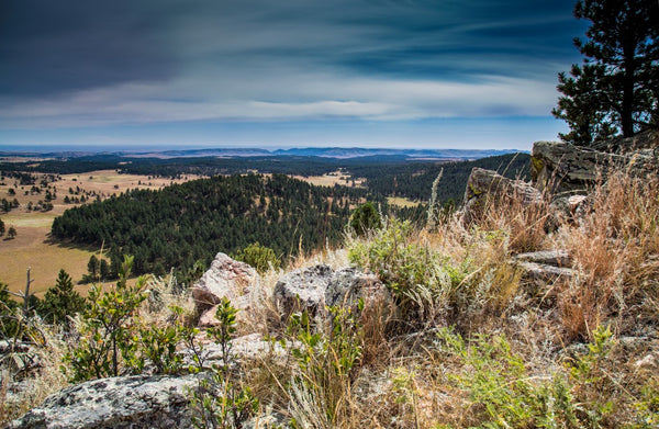
Known for its displays of the calcite formation called boxwork, some 95 percent of the world's discovered boxwork formations are found in Wind Cave. Considered a three-dimensional maze cave, it is recognized as the densest -- most passage volume per cubic mile -- cave system in the world. The cave is currently the sixth-longest in the world with 140.47 miles of explored cave passageways, with an average of four new miles of cave being discovered each year. Above ground, the park includes rolling hills, pine forests and the largest remaining natural mixed-grass prairie in the United States.


Boxwork Formation | Wind Cave National Park


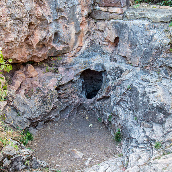
The Lakota, Cheyenne, and other Native American tribes had known about the opening to Wind Cave and the winds that move in and out of it for centuries. The indigenous people who lived in the Black Hills region of South Dakota, spoke of a hole that blew air, a place they consider sacred as the site where they first emerged from the underworld.


Natural Entrance, Wind Cave National Park


Typically, air continually moves into or out of a cave, equalizing the atmospheric pressure of the cave and the outside air. When the air pressure is higher outside the cave than in it, air flows into the cave, raising cave's pressure to match the outside pressure. When the air pressure inside the cave is higher than outside it, air flows out of it, lowering the air pressure within the cave. Wind Cave, with only a few small openings "breathes" more obviously than a small cave with many large openings. Rapid weather changes, accompanied by rapid barometric changes, are a feature of Western South Dakota weather.


Wind Cave National Park | National Park Posters


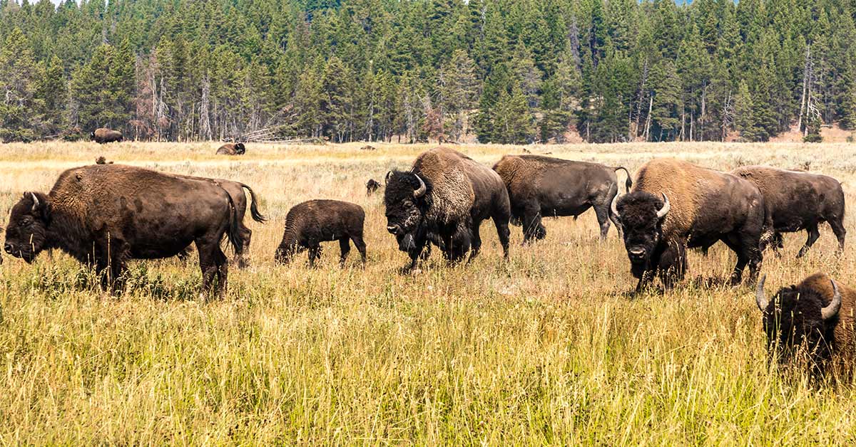
Wind Cave National Park protects a diverse ecosystem with eastern and western plant and animal species. Some of the more notable animals include elk, bison, black-footed ferrets, pronghorn and prairie dogs. The Wind Cave bison herd is one of only four free-roaming and genetically pure herds on public lands in North America. The other three herds are the Yellowstone Park bison herd, the Henry Mountains bison herd in Utah and on Elk Island in Alberta, Canada.


Click here to learn more about Wind Cave National Park.


Source: https://national-park-posters.com/blogs/national-park-posters/wind-cave-national-park

attachement

Wednesday, January 8, 2020

White Sands National Park


White Sand National Park: Like No Other Place Else on Earth


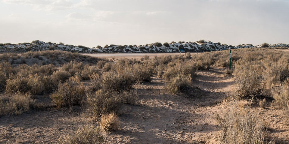
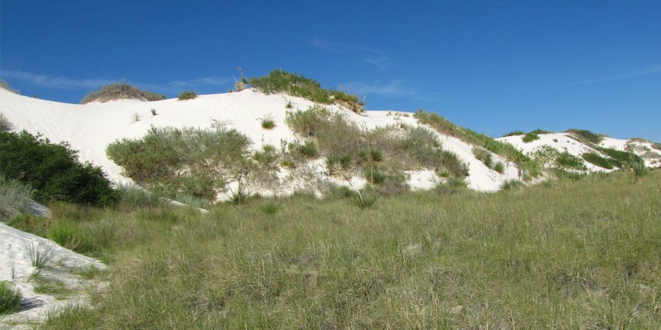
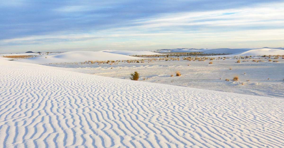
At White Sand Dunes National Park, great wave-like dunes of gypsum sand engulf 275 square miles of desert and preserves a piece of New Mexico's unique geology. In fact, the gypsum dune field is the largest of its kind on Earth. Gypsum is rarely found as sand because it dissolves in contact with water. But, the isolation and weather patterns of the Tularosa Basin creates a truly unique experience for intrepid park explorers. Visitors can hike, enjoy ranger-led educational programs and even try sand sledding! White Sands was established as a national monument in 1933 and re-designated as a national park in December, 2019. 


Exploring White Sands National Park by Car


Dunes Drive is an eight-mile scenic drive that leads from the visitor center into the heart of the gypsum dunefield. The 16-mile round-trip drive takes approximately 45 minutes. You will want to allow additional time to explore the dunes, take photos, and/or learn about the natural and cultural history of the world's largest gypsum dunefield. Along the road, you will find outdoor exhibits, hiking trails, picnic areas and parking areas.


The first five miles of Dunes Drive are paved and the last three miles are a hard-packed gypsum sand road. The road is suitable for cars, motorcycles, recreational vehicles, and buses.


Missile Tests and Road Closures


From time to time, White Sands Missile Range performs missile tests that may close Highway 70 to traffic. Depending on the nature of the testing, Dunes Drive may also be closed during missile tests for visitor safety. During these times, the visitor center remains open. Visitors are invited to view the museum exhibits, watch the 17-minute orientation film, and peruse the park store and gift shop while Dunes Drive is closed.


Weather


Weather conditions can change drastically—from sudden downpours to dust storms. The road can be slippery when wet, especially during the winter. It may also be harder to spot frozen water. For your safety, decrease your speed and brake gently to avoid skidding. Dust storms can drastically reduce visibility. Do not drive during a dust storm.


Hiking the Dunes 


There is no better way to experience the unique landscape of White Sands National Park than by venturing out onto any of our five established trails. Explore the dunes and enjoy the silence and solitude of the dunefield with its stunning views of the surrounding mountains. The trails vary in terms of difficulty and scenery. Plan ahead to ensure you have a great and safe hike.


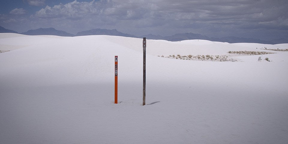
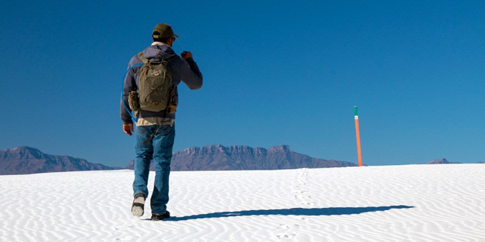
Each trail is marked with a specific colored post (i.e., green, blue, orange, or red) and a symbol (i.e., hearts, clubs, spades, or diamonds). You should familiarize yourself with these colors and symbols to help orient yourself to the trail before you start your hike. This information will be critical if you become lost. 


Interdune Boardwalk


Interdune Boardwalk


The Interdune Boardwalk is fully accessible for people using wheelchairs and strollers. Take an easy 0.4 mile round trip stroll through the dunes and learn about the science, geology, plants, and animals that make White Sands an unequaled natural wonder. The boardwalk is a great place to take a break under the shade canopy, listen for bird calls, observe lizards and enjoy the wildflowers. 


Playa Trail


Playa Trail


The Playa Trail is an easy, 0.5 mile round-trip, level trail with outdoor exhibits along the way to help you learn and explore this trail and the characteristics that make it special. On this self-guided trail, you will discover the importance of a playa undergoing constant change. Learn how this change creates habitats for plants and animals. It may be brown, white, filled with water, or have growing crystals. See what the playa looks like today! At the end of the trail, you have the opportunity to travel back in time and see what this area looked like 10,000 years ago and learn about the giants that once roamed this land. 


Dune Life Nature Trail


Dune Life Nature Trail


The Dune Life Nature Trail is a moderate, one-mile self-guided loop hike. Though not difficult, this hike does require hikers to climb two steep dunes with loose sand. Follow the blue trail markers with a club symbol. Meet Katy the Kit Fox and learn about her friends on this family-oriented trail. Look for tracks of the animals that call these dunes their home. Kit foxes, badgers, birds, rodents, and reptiles all live in this area. 


Backcountry Camping Trail


Backcountry Nature Trail


The Backcountry Camping Trail is a moderate, 2-mile round-trip hike. Though backpackers hike the trail most frequently, it is also open to visitors who want a shorter hike through the heart of the dunes. Follow the orange trail markers with a spade symbol into an area of beautifully varied dunes and vegetation. The trail requires hikers to climb over several steep dunes and loose sand. There is no shade, no water, and no toilet facility along this trail. 


Alkali Flat Trail 


Alkali Flat Trail


The Alkali Flat Trail is a strenuous, 5-mile round-trip hike. Follow the red trail markers with a diamond symbol. The Alkali Flat Trail skirts the edge of what is now the final remnant of Lake Otero. This trail is not flat! You will be hiking up and down dunes the entire way. Go only if you are prepared. There is no shade, no water, and no toilet facility along this trail. 


Native Plant Garden Trail


Native Plant Garden Trail


Although White Sands is located in the arid Chihuahuan desert, it is also a place of amazing life and diversity. Learn about some of the native plants of the Chihuahuan desert by taking a walking tour of our native plant garden located in front of the visitor center. 


The best time for touring the native plant garden is from mid-March through late November. Many plants are dormant during the winter months. Most wildflowers begin blooming around the middle of April. Soaptree yuccas are the star of the spring flowers and typically blooms in late April through May. Some plants may continue to bloom throughout the summer, such as the Colorado four o' clock. Many plants, including the ocotillo, burst into bloom after monsoon rains. Fall colors can begin to appear as early as October and last through November. This is the time when the Rio Grande cottonwood trees begin to turn a beautiful orange and the skunkbush sumac start to turn a vibrant red.


Bicycling


Bicycling at White Sands is truly a unique experience—nowhere else in the world can you ride a bike on a hard-packed gypsum sand road through the heart of an immense gypsum dunefield! This distinctive experience requires one to be prepared and alert.


What kind of bike is best for Dunes Drive?


Rangers are frequently asked this question, and the response is, "It depends." The answer typically depends on the condition of the road. Dunes Drive is eight miles one-way. The first four miles are paved, and the rest of the road is hard-packed gypsum sand. Dunes Drive will frequently have a rough "washboard" surface, potholes, and sand drifts. These hazards make riding a bike on Dunes Drive challenging. Experienced riders on mountain and city/beach cruiser bikes with wide tires should be able to handle the varied road conditions and hazards. Road bikes with skinny street tires are not recommended on the sand-portion of Dunes Drive.


Sand Sledding


Sand Sledding


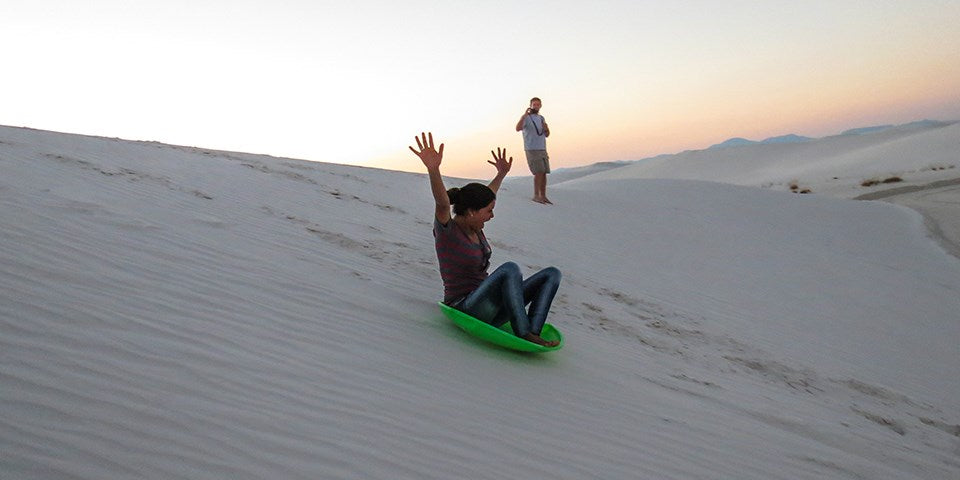
Sledding on the beautiful soft sand at White Sands National Park is a popular activity and great fun for children and adults alike. Unlike snow, sand is not slippery and sledding down the face of a dune can take some practice unless you have the correct equipment, know proper techniques and use safety precautions.


Waxed plastic snow saucers work best and can be purchased at the park's gift shop. Please call the gift shop at 575-479-1629 before arriving to confirm the availability of sleds. You may also bring your own sleds. Choose a dune with a gently sloping face and a level run-off at the end so that you can come to a halt safely. Be aware of where the dune slope meets the desert floor. While the dune sand is soft, the area at the base of the dune can be very hard, and unintentional injuries are surprisingly common. Make sure the sledding path does not cross the roadway or parking areas and is free from hazards such as vegetation, hard clumps of sand, or other obstructions.


Photographing the Dunes


With the shifting light, shadows, and truly out-of-this world landscape make White Sands a photographer's paradise. You do not need an expensive camera to capture the beauty of the dunes. Great pictures, however, require the same techniques and way of looking at things that pros have learned.


White Sands National Park


Every day at White Sands National Park will be different. Sometimes there are crystal clear views of the surrounding mountains and sometimes awesome cloud formations that change hues by the minute. The Sacramento Mountains to the east are especially beautiful just after the sun dips below the horizon where they are bathed in a pink afterglow.


If you see a good photo, take it. Don't get so wrapped up in all the technical aspects of taking the photo that you miss the opportunity. Go out, have fun, enjoy the dunes and remember "leave footprints and take only pictures."


Here are some things to consider:


  • Hike to the top of the tallest dune around and take in the bird's eye view. The tallest dunes are toward the end of Dunes Drive near the Alkali Flat trailhead.

  • Drop to your knees and look up. Yuccas against the sky and the delicacy of dune grasses are especially interesting from a low angle.

  • The patterns left in the sand by grasses and leaves blown by the wind are fascinating. Sometimes you will find the tiny tracks of a darkling beetle just waiting to be recorded, and sometimes you'll find the actual beetle. The interdunal areas are great places to find animal tracks and rugged, gnarly plant growth.

  • Most beginners tend to center objects and include the entire object in the frame. However, you'll end up with a more interesting photo when you shoot slightly off center and occasionally only include half of the object or two-thirds of it in the frame. This results in an unexpected look for the photo and in interesting composition.

  • Placing a plant or rock in the near foreground of your photo will help the viewer see the scale and distance in your photograph. Give the viewer an object which will help them understand size and distance of your intended subject.


The most important thing to remember is that the photographs you take are your own view of the subject and you have recorded these images for your own enjoyment.Taking good photographs is a way to record your memories of White Sands and other places you visit and to share those memories with family and friends.


A Bit of Trivia


White Sands National Park has been featured in a variety of films, including Four Faces West (1948), Hang 'Em High (1968), The Hired Hand (1971), My Name Is Nobody (1973), Bite the Bullett (1975), Young Guns II (1990), King Solomon's Mines (1950), The Man Who Fell to Earth (1976), and Transformers (2007).


Source: https://national-park-posters.com/blogs/national-park-posters/white-sands-national-park

attachement

Friday, December 6, 2019

Best Things To Do in Big Bend National Park


Big Bend National Park offers nearly limitless opportunities for scenic driving, hiking, camping, backpacking, mountain biking, horseback riding, bird watching, wildlife observation, and stargazing. Additionally, the Rio Grande borders the park for 118 miles providing options for half-day floats to extended excursion by raft, canoe, or kayak.


My name is Rob Decker and I'm a photographer and graphic artist with a single great passion for America's National Parks! I've been to 51 of our 61 National Parks — and Big Bend is one well worth the visit. I have explored many areas of the park — so I'm ready to help! So if this is your first time to the park, or your returning after many years, here are some of the best things to do in Big Bend National Park!


Scenic Drives


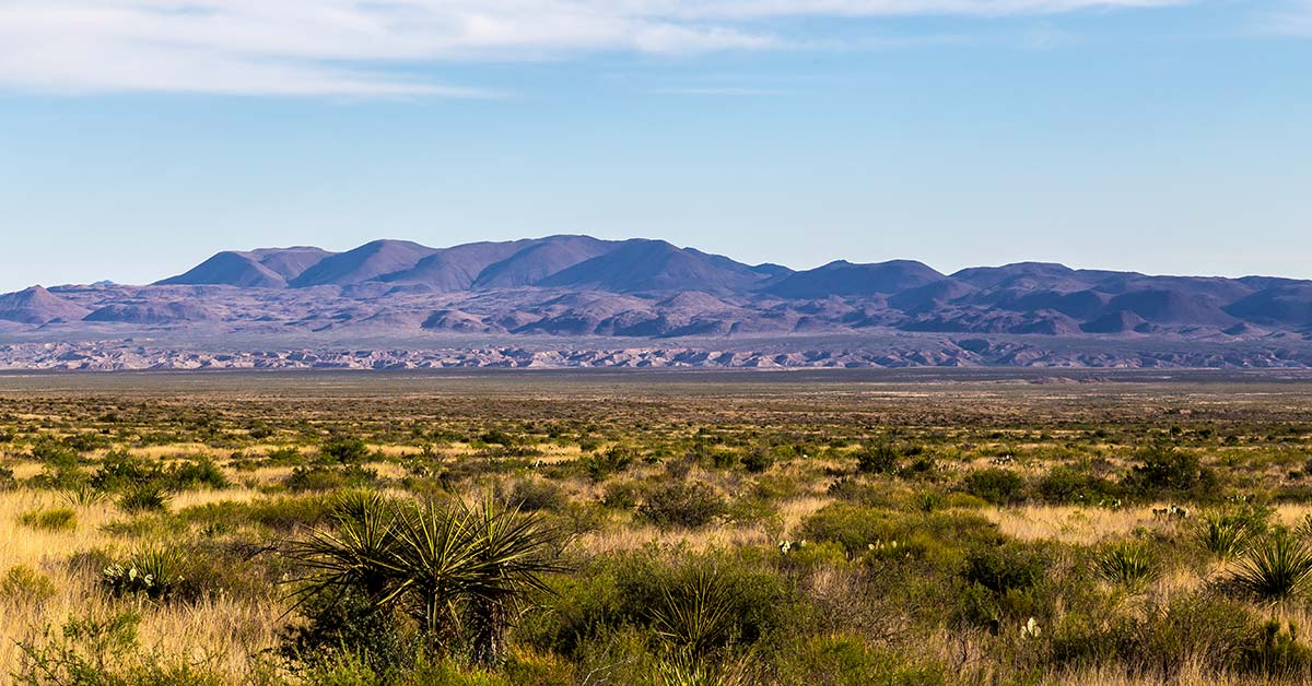
Chiahauan Desert


100 miles of paved roads and 150 miles of dirt roads connect the desert to the mountains and the river and offer exceptional ways to explore the park by vehicle. Here are the top five scenic drives — on paved roads!


Chisos Basin Road – 6 miles


A drive to the Chisos Basin is an excellent way to experience the transition between arid desert and cooler mountain habitats. As this scenic, winding road rises over two thousand feet above the desert floor, it offers breath-taking vistas of the mountain peaks and the erosion-formed basin area. The Chisos Basin has a visitor center, campground, lodge, restaurant, camp store, and access to miles of hiking trails.


Ross Maxwell Scenic Drive – 30 miles


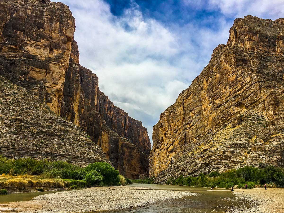
A trip along the Ross Maxwell Scenic Drive highlights the geologic splendor Big Bend is famous for, and offers many scenic overlooks and exhibits along the way. Sotol Vista, Mule Ears Overlook, and Tuff Canyon are all worthwhile stops. Continue the drive to the magnificent Santa Elena Canyon, where limestone cliffs rise 1,500′ above the Rio Grande. A short trail leads into the canyon


Panther Junction to Rio Grande Village – 21 miles


The drive to Rio Grande Village traverses ancient limestone and has marvelous vistas across the river to the magnificent Sierra del Carmen escarpment. In twenty miles, the road descends nearly two thousand feet. There are several worthwhile stops and highlights along the way. Dugout Wells includes a desert nature trail and a shady oasis, nice for picnicking and birding. A soak in the Historic Hot Springs is also a popular activity.


Persimmon Gap to Panther Junction – 28 miles


This road connects the north entrance to park headquarters at Panther Junction. From Persimmon Gap, the road descends a long, gentle, gravel slope to Tornillo creek and Tornillo Flat. The Rosillos Mountains rise to the west; to the east the Dead Horse Mountains dominate the skyline.


Maverick Entrance Station to Panther Junction – 23 miles


This drive, through striking desert scenery, has excellent views of the surrounding mountains. Several roadside exhibits describe wildlife that might be seen along the drive. Junctions for the Chisos Basin road and Ross Maxwell Scenic Drive are located along this route.


Hiking


Day Hikes


Big Bend is a hiker's paradise containing the largest expanse of roadless public lands in Texas. More than 150 miles of trails offer opportunities for day hikes or backpacking trips.


Desert Hikes


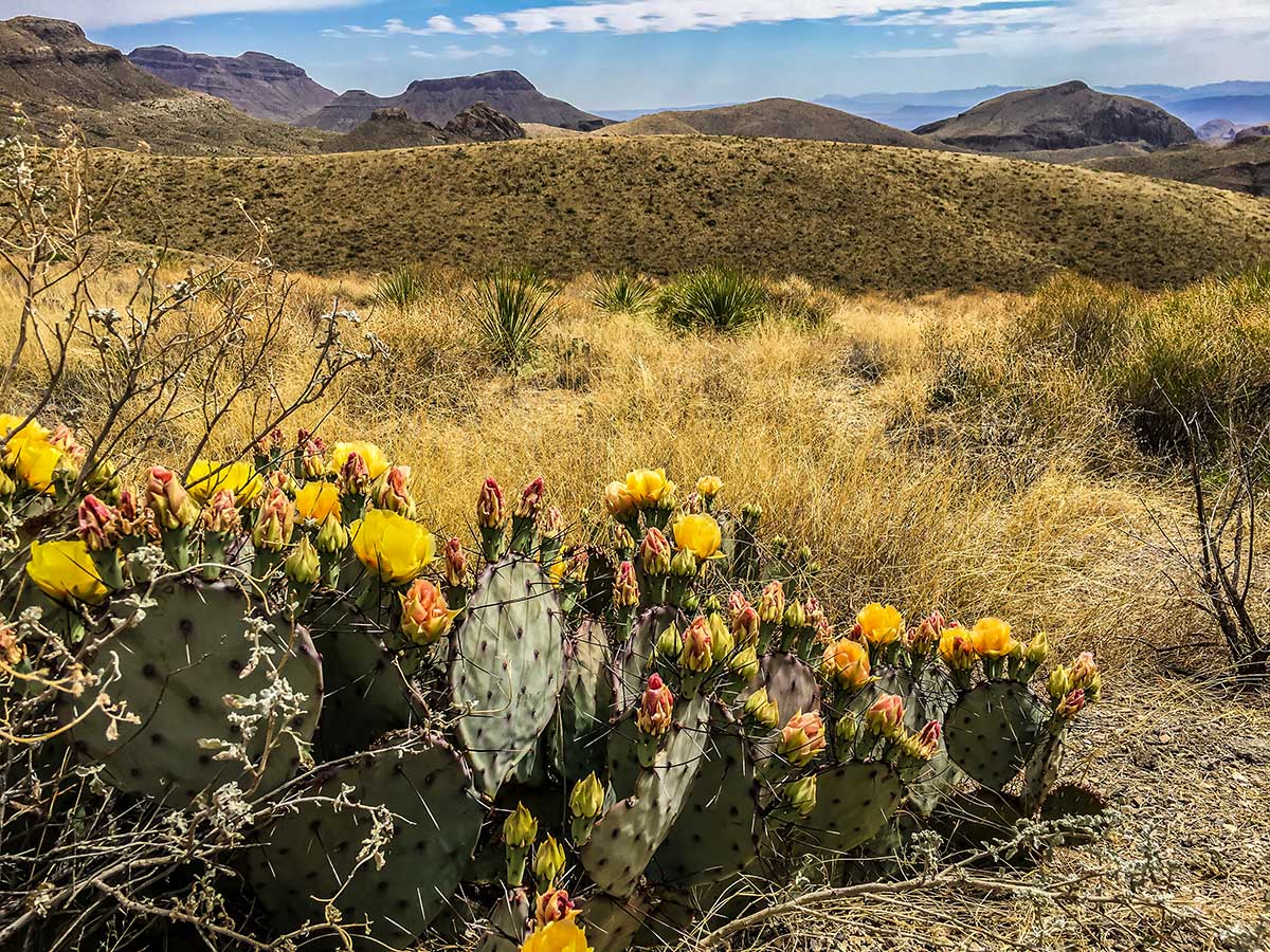
Prickly Pear Cactus


The Chihuahuan Desert covers about 80% of the park and surrounds the Chisos Mountains. Bare, rocky ground and sparse vegetation are hallmarks of the desert, but there is plenty of life here. Look for termite nests along plant stems, exoskeletons of millipedes, animal scat, and rodent and reptile tunnels. Bird life is plentiful, especially in the morning; look for nests hidden in yuccas and cacti. In the spring, bluebonnets, paintbrush, bi-color mustard, desert marigold, yucca, ocotillo, and cacti blossoms add color to the desert landscape.


Mountain Hikes


The Chisos Mountains contain some of the most rewarding day hikes in Big Bend, especially during the summer months when it is too hot to hike at lower elevations in the park. It is not uncommon to see tracks and scat of black bear, mountain lions, and gray fox along Chisos Mountains trails. Carmen Mountain white-tailed deer, rock squirrels, whiptail lizards, spotted towhees, tufted titmice, and Mexican jays are also common in these mountains.


River Hikes


The Rio Grande creates a distinct environment in Big Bend National Park. Countless bird species can be found in the riverbank vegetation. The river provides water for many desert animals; look along the muddy shoreline for tracks, signs, and scat.


Backpacking


Backpacking in the Desert


The most remote areas of Big Bend National Park are best left to experienced backpackers. Each year, park rangers respond to desert emergencies when hikers are not prepared for the heat and extreme conditions of the desert. Due to the complex topography and vague trails/routes, a topographic map and a compass/gps are necessary for some hikes. Not for novices, you will need to be fully equipped and physically prepared to pack your gear and water into the desert and camp primitively.


River Trips


Santa Elena Canyon


Floating the Rio Grande


Big Bend offers a variety of river adventures. Enjoy a day trip, or plan an extended float through spectacular limestone canyons. If you have the time and a spirit of adventure, you may want to consider a river trip. Seeing the park's canyons from the middle of the Rio Grande can be an incredible experience. There are many possibilities including half-day floats or multi-day excursions. Floating the Rio Grande can take you through miles of canyons up to 1,500 feet deep, where the sunlight may reach the bottom only briefly on winter days. As in other parts of the park, your ears may tell you more than your eyes. Listen for beavers crawling through the brush;you might catch a glimpse as one slides down the riverbank into the water. Turtles, especially red-eared sliders, often sun themselves on rocks and logs just above the waterline. Great blue herons and green kingfishers are just some of the many birds you may see flying along the river.


Bicycling


Lightly traveled roads and varied terrain make Big Bend a premier bicycling location. Over 100 miles of paved roads and 150 miles of backcountry dirt roads provide challenges for riders of all types and abilities. Bicyclists must be extremely cautious and well-prepared, but bicycling allows outstanding panoramic views unobstructed by a windshield. It also allows the bicyclist to see and hear some of the smaller wonders of Big Bend from a more intimate viewpoint.


Bird Watching


Big Bend's position near the 100th meridian in the middle of the continent and along a migration route makes the park ideal for bird diversity throughout the year. Northern species migrate here for the warm winter climate, while birds from the tropics range this far north to breed in the spring. One of Big Bend's highlights, the Colima warbler, is a predominantly Mexican species that only nests in the United States in the Chisos Mountains from April to September.


Fishing


Sometimes visiting a National Park can seem as though time is not on your side and the pace of “have to see everything” takes over. Perhaps fishing, which might seem unusual in a desert park, could be just what the “ranger” ordered. This activity is less harried, relaxing, and most of all, edible. Fishing the Rio Grande is something that is fun for visitors of all ages. And best of all it's free, and requires no Texas fishing license. All that is required is a fishing permit which may be obtained at any open visitor center. So if a lazy day by the Rio Grande is something you might enjoy, ask a ranger about fishing opportunities here in the park


Stargazing


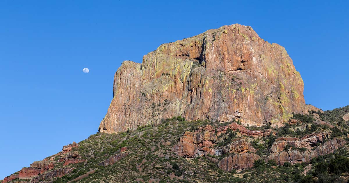
El Capitan


On the clearest nights, more than 2,500 stars are visible to the naked eye! Big Bend is known as one of the outstanding places in North America for stargazing. In fact, it has the least light pollution of any other National Park unit in the lower 48 states. One factor that makes this possible is simply the sparse human occupation of this region.


I've created a WPA-style poster for Big Bend National Park to celebrate the 75th Anniversary! 


Click here to see the Big Bend National Park poster.


Rob Decker is a photographer and graphic artist who had the rare privilege of studying under Ansel Adams in Yosemite National Park when he was just 19 years old. Now, Rob is on a journey to explore and photograph all 61 of America's National Parks. He's creating WPA-style posters to help people celebrate their own national park adventures — as well as encourage others to get out and explore!


Source: https://national-park-posters.com/blogs/national-park-posters/best-things-to-do-in-big-bend-national-park

attachement

Saturday, November 23, 2019

7 Amazing Holiday Gifts for the National Park Lover on your List!


Inspired by the iconic WPA artwork of the 1930s and 40s, our National Park posters are designed to celebrate our American heritage. Each numbered, signed and dated poster is printed on “Conservation,” a 100% recycled stock with soy based inks. From start to finish, these vintage-style posters are 100% American Made!


Perfect for the National Park Lover on Your Holiday Gift List!!!


Limited Edition National Park Posters


Yellowstone National Park | National Park Posters


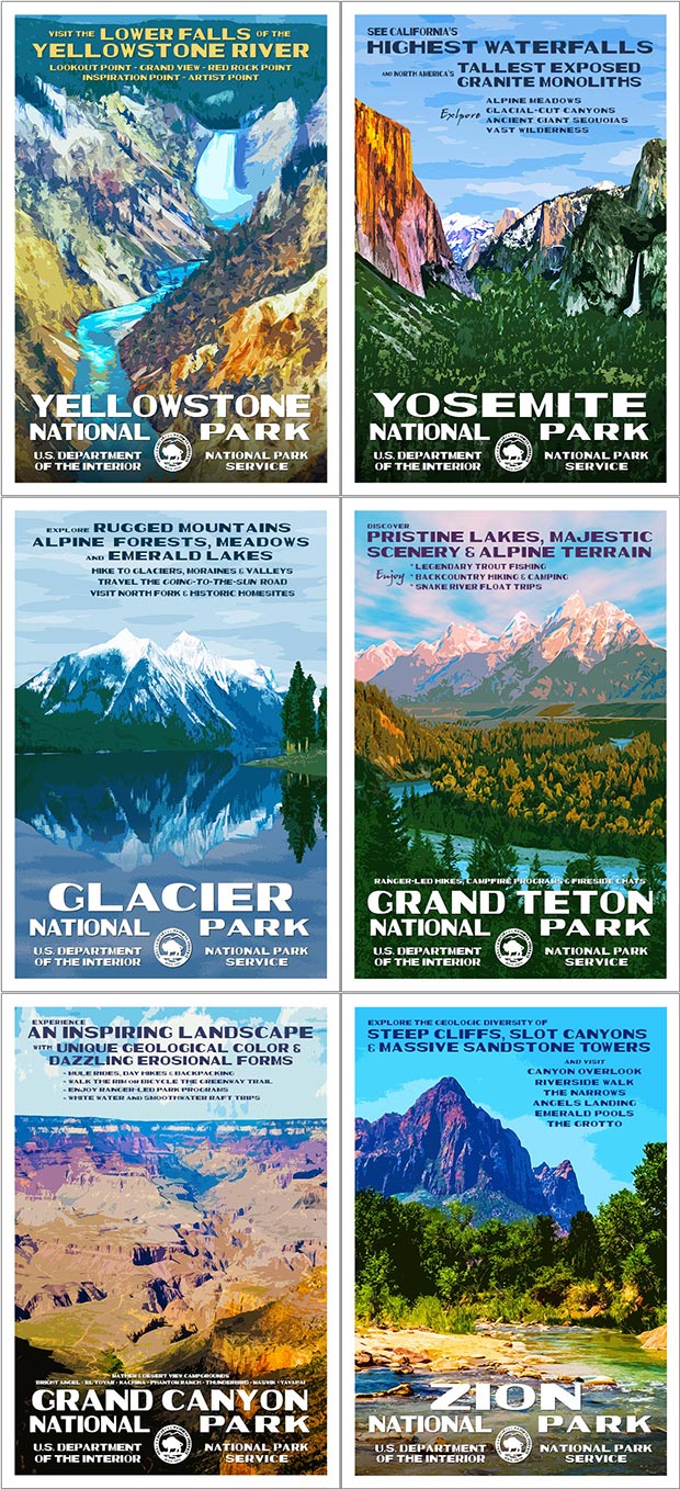
WPA-Style Posters of Your Favorite National Park. Inspired by the iconic WPA artwork of the 1930s and 40s, our National Park posters are designed to celebrate our American heritage. Each numbered, signed and dated poster is printed on “Conservation,” a 100% recycled stock with soy based inks. From start to finish, these posters are 100% American Made! Posters are 13" x 19".


$40.00    Click Here to See the Posters


Artist Proofs


Grand Teton National Park Artist Proof


These Limited Edition prints are in High Demand! Artist Proofs are the first 25 posters pulled from each print run, are numbered 1-25, and are dated and signed. They feature the color bars used by the pressman to make sure registration and colors stay consistent throughout the print run and are 13" x 20". My signature attests that I have personally inspected and approved each print — and further verified that no unsigned or unnumbered copies within the limited edition are known to exist.


$55.00    Click Here to See the Artist Proofs


State, Regional & Annual Collections


Artist Pick Collection | National Park Posters


From the original Kickstarter Collection -- to the State, Regional and Annual Collections, you can select from 2 - 12 of your favorite posters and get deep discounts! These collections make the perfect holiday gift for the national park lover on your list! They are the perfect way to bring their favorite National Parks into their home or office. All posters are numbered, signed and dated.


$60.00 - $255.00    Click Here to See all the Collections


Worth Protecting Stickers


Worth Protecting Sticker


Awesome stocking stuffers! The Worth Protecting sticker is 3″ x 4″ and printed on white polypropylene with a UV laminate. The sticker is based off of the ever-so-popular “Worth Protecting” poster, created in the style of the Works Progress Administration (WPA). Stickers can be slapped on outdoor gear, vehicles and more for people to voice their desire to protect America's National Parks. For indoor or outdoor use!


$5.95    Click Here to See the Worth Protecting Stickers


Postcard Sets 


National Park Postcards Framed


Limited on wall space? Postcards are the perfect solution. Just find a frame for 4" x 6" photo prints, and you can make a custom display of your favorite parks! Postcards are also great for sending to friends, use in PostCrossings, Save the Date or other announcements!


$18.00     Click Here to See the Postcards


America's National Parks Map


The ultimate bucket list! A great way to mark off the national parks you've already visited, or those you dream about seeing! This 19" x 13" map features all 61 of America's National Parks!


$30.00    Click Here to See the Map


National Parks Typography Poster


The U.S. National Parks Typography Poster is an original work by Robert Decker. It features the names of all 61 National Parks — all in the shape of the United States! The name of each park is styled in the classic 1935 National Park font, giving it a retro look-and-feel.


$30.00    Click Here to See the Poster


Source: https://national-park-posters.com/blogs/national-park-posters/7-amazing-holiday-gifts-for-the-national-park-lover-on-your-list

attachement

Tuesday, November 12, 2019

Best Things To Do In Grand Teton National Park


Known for its winding Snake River, miles of hiking trails, lakes and abundant wildlife, Grand Teton National Park is a perfect travel destination. Grand Teton National Park has something for everyone -- like Jenny Lake, the Craig Thomas Discovery & Visitor Center, and historic settlements like Menors Ferry and Mormon Row. If you're adventurous and enjoy climbing, hiking, wildlife watching and touring, or if you just want to take in some of the most spectacular scenery in the world -- this is a perfect place for you.


I'm a photographer and outdoor enthusiast and have been to more than 50 of our amazing national parks — including Grand Teton. I've explored many areas of the park — so I'm ready to help! Whether this is your first time to Grand Teton, or if you are returning after many years and would like to be re-introduced to the park — this list of the best things to do is just for you!


JUST A QUICK NOTE: Both Grand Teton National Park posters (shown below) are 90th Anniversary Limited Edition prints. Both are quite popular, and will likely sell out this holiday season. These Limited Edition posters will not be re-printed, so please order yours before they are gone forever! They also make great gifts for the Grand Teton National Park lover on your holiday list!!!


Wildlife Viewing


Grand Teton National Park | National Park Posters


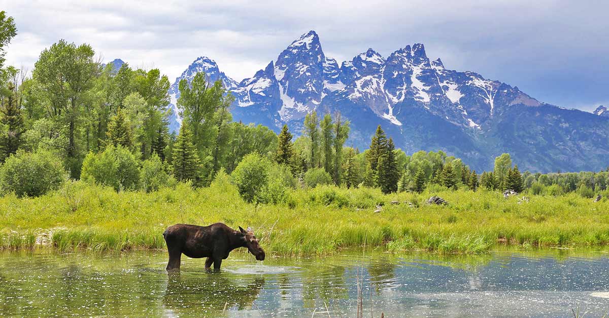
Grand Teton's wildlife viewing regularly ranks among the best in the United States. Bears, bison, elk, pronghorns, eagles, and more are regularly seen in the park. Want to see bears? These places change regularly, so just ask at a visitor center or activity desk once you're there. The Jackson Lake Lodge Activity Desk tracks the latest wildlife observations. Some of the best places are Willow Flats in front of the Jackson Lake Lodge, at Oxbow Bend or Elk Ranch Flats.


Take a Scenic Drive


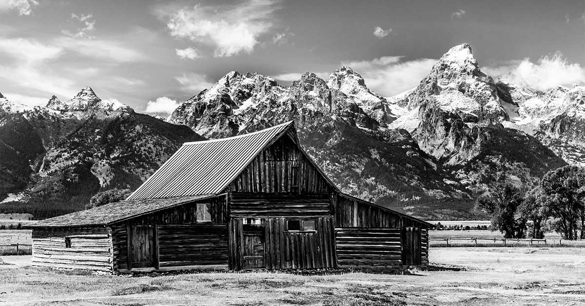
Mormon Row, Grand Teton National Park


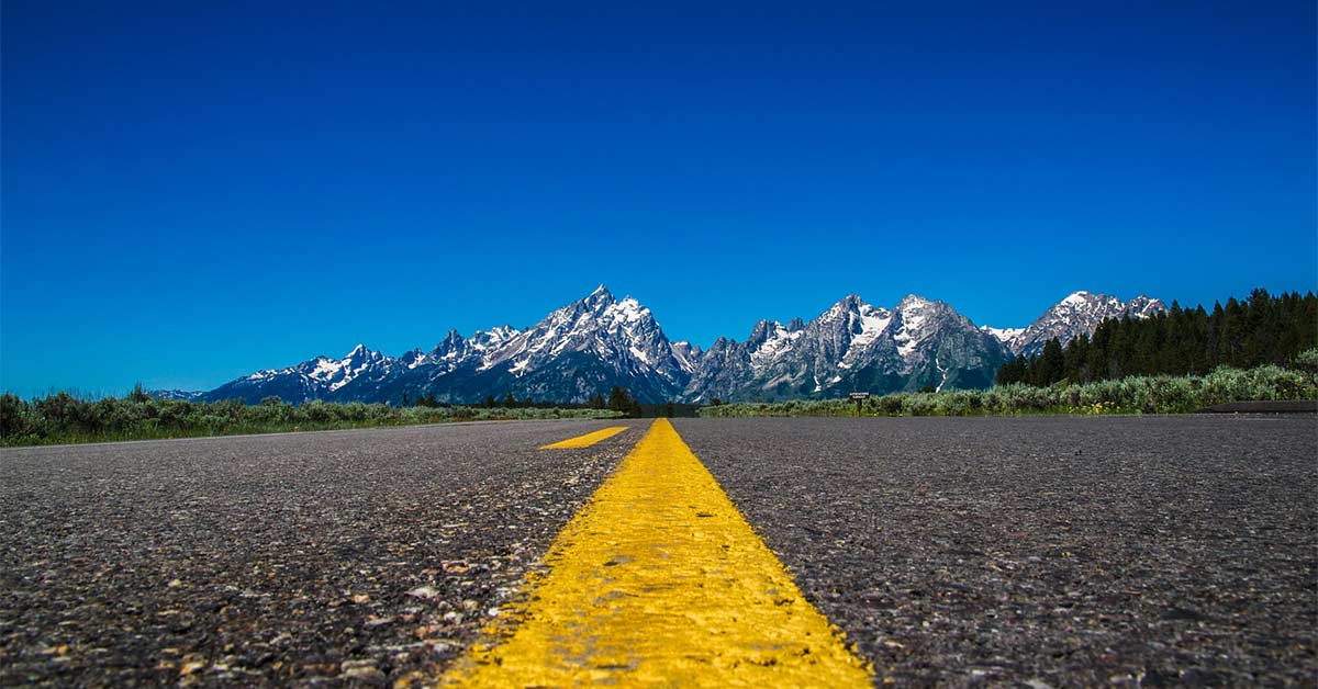
There are many places to take in the spectacular and epic views -- and you can do it on Grand Teton National Park's 42 Mile Scenic Loop Drive! If you're short on time or wanting an easier way to see many of the diverse scenic landscapes of the park, then this might be a great way for you to see the park. The loop consists of Teton Park Road, Jenny Lake Scenic Drive and Route 89. On this route you can visit Jenny Lake, the Craig Thomas Visitor Center in Moose, Schwabacher's Landing, Snake River Overlook, Cunningham's Cabin, Oxbow Bend, Signal Mountain Summit Road and more. Get that engine going for the ride of a lifetime!


Go Fishing


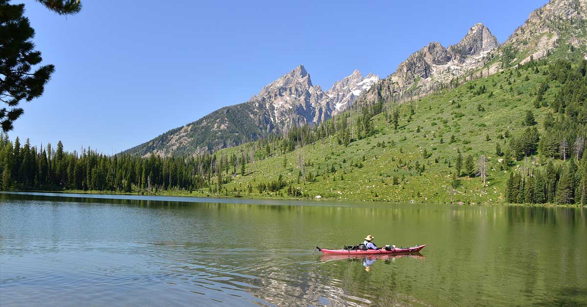
Oxbow Bend, Grand Teton National Park


Grand Teton National Park is world-renowned for it's amazing fishing. Rivers, lakes and ponds sparkle on the landscape and you can fish for cutthroat trout (named for the red slash under the lower jaw), the Utah chub in warm, shallow, slow-moving water or the mountain whitefish, which prefers cold, deep, fast-moving water. Fishing is a great way to have fun while experiencing the park's beauty. From Jenny Lake to the Snake River to Jackson Lake there are many opportunities for fishing -- and you can choose between a guided fishing trips or solo adventures.


Hike the Grand Teton Trails


With more than 200 miles of trails for hiking, Grand Teton National Park provides the perfect opportunity for those who want to get out and experience the most beautiful lakes, towering peaks, and stunning scenery up close. Rugged landscapes and sudden weather changes sometimes can bring on unexpected challenges, but with them come amazing views! Grand Teton National Park hosts numerous trails for all kinds of hikers -- beginners and experts alike. From easy, short hikes like Hidden Falls or Inspiration Point to more challenging ones like Death Canyon and Cascade Canyon -- there's a wide choice, but none will disappoint!


Enjoy Horseback Riding


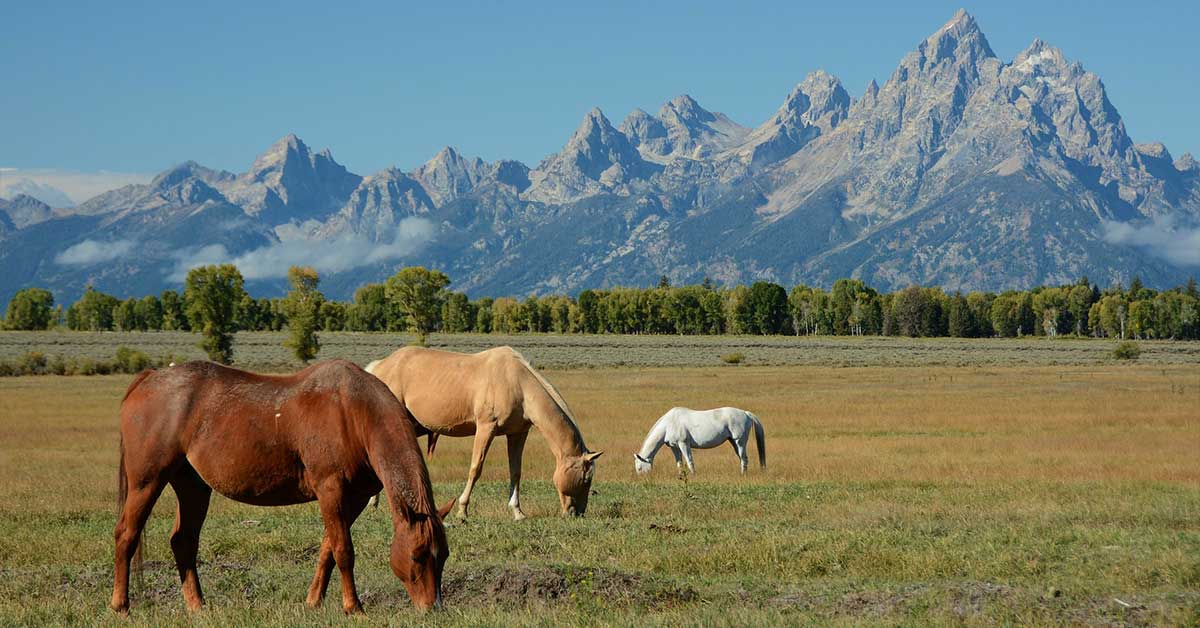
Horseback Riding, Grand Teton National Park


One of the best alternatives for hiking -- and a unique way to soak up those breathtaking views -- is to saddle up and spend an amazing morning or afternoon on horseback. Horseback riding is a great way to simply take it slow and let the joy and scenic views fill your soul. Horseback rides starting at Jackson Lake Lodge let you spend a morning or afternnon in the Grand Tetons -- and enjoy the same view as the early explorers. The Jackson Lake Lodge offers one-hour and two-hour horseback riding with breathtaking views of the Teton Range, Oxbow Bend, and the Snake River.


Conquer the Mountains with Climbing


The famous Grand Teton mountain range has been luring countless visitors and climbers from all over the world for generations. The park presents opportunities to conquer these magnificent peaks -- or just to learn more about the sport of rock climbing. While the experienced climbers are rubbing their hands together for an opportunity to reach the sky by climbing these iconic peaks, other groups like families, kids, and inexperienced climbers shouldn't shy away from participating. Various guides and experienced climbers are here to offer guided climbs, classes and easy daily climbs!


Engage in Water Activities


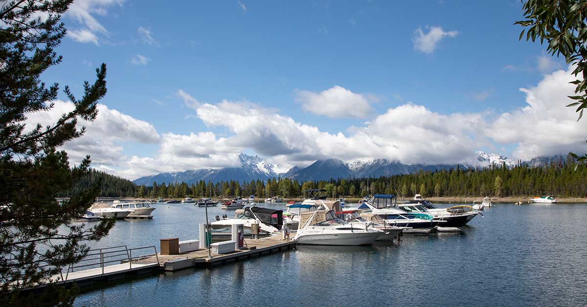
Boating, Grand Teton National Park


With all those enchanting lakes and beautiful rivers flowing through the park, most of these waterways of wilderness are accessible for travelers and visitors. One of the most popular, Jackson Lake, offers a stunning mountain backdrop and an excellent opportunity for those interested in sailing, water skiing, and even windsurfing. With dozens of lakes within the park and rivers like the Snake River, opportunities abound. From kayaking and canoeing, to paddle boarding, drift boats and raft tours, your water adventure awaits.


Boating, Grand Teton National Park


You can also go on a Jackson Lake Cruise and enjoy delicious breakfast or dinner excursion. The Colter Bay Marina offers breakfast and dinner cruises to Elk Island -- a unique and exclusive Grand Teton activity. There is a hot buffet on the island. Breakfast includes trout, pancakes, pastries, potatoes, eggs, fruit, cowboy coffee, yogurt and more. Dinner features steak and trout with a variety of sides. Enjoy your meal with Mount Moran rising over the lake. After your meal, take your time to explore the island and take a short hike.


Cycle The Grand Teton's Roads


Grand Teton National Park


Biking enjoys its fair share of popularity and fame in the park, especially when the multi-use pathway was introduced. For thrill seekers, dirt roads and bike trails such as Two Ocean Lake and Grassy Lake Road will be your escape and create an exciting mountain biking adventure. But road bikers, there's plenty for you, too! Over 100 miles of paved roads -- with an extensive bicycle pathway system -- let bike lovers enjoy the views while comfortably riding below the breathtaking Grand Teton Range.


Now, that the best activities have been unveiled, it is safe to say that Grand Teton is simply heaven for outdoor recreation and wildlife discoveries. With its sheer size of more than 300,000 acres, let it become the playground that will give you the memories of a lifetime!


I've created two posters for Grand Teton National Park -- one that features a view of the famed mountain range from the Snake River Overlook. The other is of Jenny Lake after a fall snowstorm.


Click here to see the Grand Teton National Park, Jenny Lake poster.


Click here to see the Grand Teton National Park, Snake River Overlook poster.


Rob Decker is a photographer and graphic artist who had the rare privilege of studying under Ansel Adams in Yosemite National Park when he was just 19 years old. Now, Rob is on a journey to explore and photograph all 61 of America's National Parks. He's creating WPA-style posters to help people celebrate their own national park adventures -- as well as encourage others to get out and explore!


Source: https://national-park-posters.com/blogs/national-park-posters/best-things-to-do-in-grand-teton-national-park

attachement

Monday, July 1, 2019

Best Things To Do in Yellowstone National Park (Part 1)

One of the greatest experiences in Yellowstone National Park is witnessing its geologic wonders. Topping the list are the hydrothermal features: hot springs, mudpots, fumaroles, and geysers -- particularly, Old Faithful. Well over 10,000 different hydrothermal features have been estimated to be active within the park. Even more incredible might be that over half of the world's active geysers are found here.

Every year, some 500-700 geysers are active. In 2011, it was determined that 1,283 geysers have been recorded as erupting in Yellowstone. This is truly incredible, when all of the rest of the world's geysers combined number less than 500. Hydrothermal features are extremely dynamic, changing throughout the day, across seasons, and over the years. This makes revisiting the different thermal basins so interesting. Besides seeing familiar sites, you can also see how those areas have changed since the last visit.

My name is Rob Decker and I’m a photographer and graphic artist with a single great passion for America’s National Parks! I’ve been to 52 of our 61 National Parks — and Yellowstone is one of my all-time favorites! I have explored most areas of the park — so I’m ready to help! So if this is your first time to the park, or your returning after many years, here are some of the best things to do in Yellowstone National Park! Yellowstone is huge...and this is the first of three posts describing what to do and what to see when you visit Yellowstone National Park. Read on to learn more about the southern part of the park.

Watch Old Faithful Geyser

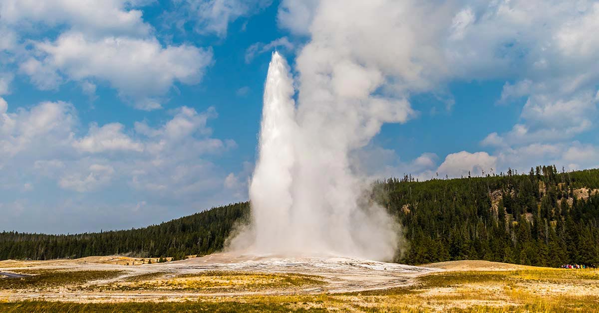
Old Faithful Geyser, Yellowstone National Park

Watching Old Faithful Geyser erupt is a Yellowstone National Park tradition. People from all over the world have journeyed here to watch this famous geyser. The park’s wildlife and scenery might be as well-known today, but it was the unique thermal features like Old Faithful Geyser that inspired the establishment of Yellowstone as the world’s first national park in 1872. Old Faithful is one of nearly 500 geysers in Yellowstone and one of six that park rangers currently predict. It is uncommon to be able to predict geyser eruptions with regularity, but Old Faithful has lived up to its name, only lengthening the time between eruptions by about 30 minutes in the last 30 years. Thermal features change constantly and it is possible Old Faithful may stop erupting someday. Geysers and other thermal features are evidence of ongoing volcanic activity beneath the surface and change is part of this natural system.

Check out Fishing Bridge

The original bridge was built in 1902. It was a rough-hewn corduroy log bridge with a slightly different alignment than the current bridge. The existing bridge was built in 1937. Fishing Bridge was historically a tremendously popular place to fish. Angling from the bridge was quite good, due to the fact that it was a major spawning area for cutthroat trout. However, because of the decline of the cutthroat population (in part, a result of this practice), the bridge was closed to fishing in 1973.

Visit Yellowstone Lake

Yellowstone Lake, Yellowstone National Park

Large volcanic eruptions have occurred in Yellowstone approximately every 600,000 years. The most recent of these erupted from two large vents, one near Old Faithful and one just north of Fishing Bridge. Ash from this huge explosion -- 1,000 times the size of Mount St. Helens -- has been found all across the continent. The magma chamber then collapsed, forming a large caldera filled partially by subsequent lava flows. Part of this caldera is the 136-square mile basin of Yellowstone Lake. The original lake was 200 feet. higher than the present-day lake, extending northward across Hayden Valley to the base of Mt. Washburn.

Explore the West Thumb of Yellowstone Lake

Members of the 1870 Washburn party noted that Yellowstone Lake was shaped like "a human hand with the fingers extended and spread apart as much as possible," with the large west bay representing the thumb. In 1878, however, the Hayden Survey used the name West Arm for the bay. West Bay was also used. Norris' maps of 1880 and 1881 used West Bay or Thumb. During the 1930s, park personnel attempted to change the name back to West Arm, but West Thumb remains the accepted name.

West Thumb, Yellowstone National Park

Explore the West Thumb Geyser Basin

West Thumb Geyser Basin, including Potts Basin to the north, is the largest geyser basin on the shores of Yellowstone Lake. The heat source of the hydrothermal features in this location is thought to be relatively close to the surface—only 10,000 feet down! The West Thumb of Yellowstone Lake was formed by a large volcanic explosion that occurred approximately 150,000 years ago. The resulting collapsed volcano later filled with water forming an extension of Yellowstone Lake. The West Thumb is about the same size as another famous volcanic caldera, Crater Lake in Oregon, but much smaller than the great Yellowstone Caldera. It is interesting to note that West Thumb is a caldera within a caldera. The hydrothermal features at West Thumb are found not only on the lake shore, but extend under the surface of the lake as well. Several underwater geysers were discovered in the early 1990s and can be seen as slick spots or slight bulges in the summer. During the winter, the underwater thermal features are visible as melt holes in the icy surface of the lake. The ice averages about three feet thick during the winter.

View Wildlife in Hayden Valley

Bison, Hayden Valley, Yellowstone National Park

Hayden Valley is located six miles north of Fishing Bridge Junction. Hayden Valley offers some of the best habitat in the lower 48 states for viewing wildlife like grizzly bears, bison, and elk. Hayden Valley was once filled by an arm of Yellowstone Lake and it contains fine-grained lake sediments that are now covered with glacial till left from the most recent glacial retreat, about 13,000 years ago. Because the glacial till contains many different grain sizes, including clay and a thin layer of lake sediments, water cannot percolate readily into the ground. This is why Hayden Valley is marshy and has little encroachment of trees. Stay tuned for the next installment of Best Things to do in Yellowstone National Park!


Click here to see the Old Faithful poster.

Rob Decker is a photographer and graphic artist with a single passion for our National Parks! Rob is on a journey to explore and photograph each of our national parks and to create WPA-style posters to celebrate the amazing landscapes, vibrant culture and rich history that embody America's Best Idea!

Tuesday, March 27, 2018

Some 70 miles west of Key West Florida, in the Gulf of Mexico, lies one of North America’s most inaccessible national parks. Renowned for pirate legends, shipwrecks, and sheer unspoiled beauty, Dry Tortugas National Park harbors unrivaled coral reefs and marine life, an annual birding spectacle, and majestic Fort Jefferson, the largest masonry stronghold in the Western Hemisphere.

Getting There

Accessible only by boat or seaplane, just 60,000 visitors make it to Dry Tortugas National Park each year. Compare that to the more than 330 million people who visited America’s national parks last year. But it’s really no surprise when you consider what’s involved just getting there. The jumping off point is Key West, Florida, and from there, you can choose between an all-day boat ride, and half- or full-day seaplane trips, assuming you don’t have your own vessel.

Pre-Flight

When I visited Dry Tortugas National Park, I opted for the seaplane flight and checked in at the Key West Seaplane Adventures office at 7:30 for an 8:00 am flight. Even though it was late March, the sun was just rising, and filtered by wisps of pink and orange clouds. When the remaining nine passengers arrived, we received our briefing, were introduced to our pilot, and then walked out on to the tarmac together to board the DHC-3 DeHavilland Turbine Otter Amphibian. The plane can carry 10 passengers plus the pilot…and when the co-pilot seat was offered up, I literally jumped at the opportunity!
Our pilot has been flying to and from Dry Tortugas for years. He would make five trips to and from Dry Tortugas that day…and after dropping us off, his early morning return flight to Key West would be a solo one.

Ready for Takeoff

Once we had our seat belts fastened, and perhaps more importantly, our headphones on, the pilot began to narrate our early morning adventure as we taxied out on to the runway. I fired up my video camera…and before I knew it we were airborne heading due east into the morning sun, and just as quickly banking south, then west for a bird’s eye view of Key West. It was only then that I had the exhilarating realization I would be setting down in a place I’d only been able to conjure in my imagination — turquoise waters, green sea turtles, bright coral, frigate birds, shipwrecks, and a coastal fortress some 170 years old.

The co-pilot’s seat offered the perfect view of Key West, its hotels, Duvall Street and Mallory Square, which quickly faded from view. The pilot pumped some music into our headphones…though I wasn’t quite sure what to make of his first selection: Tom Petty’s “Free Fallin’”!
Flying at at 130 knots, we were quickly over an area called the “Flats,” a body of shallow water just 3–5 feet deep extending almost 20 miles to the west. Flying at just 500 feet above the water, these shallows are teeming with Loggerhead turtles and you could clearly see dozens of them swimming about as we cruised overhead.

25 miles out, we flew directly over Marquesas Islands, a coral atoll…and then over an area called the “Quicksands.” Here the water is 30 feet deep with a sea bed of constantly shifting sand dunes. This is where treasure hunter Mel Fisher found the Spanish Galleons Antocha and Margarita — and more than a half a billion dollars of gold and silver strewn across an eight mile area. They continue to work the site, and even today, there are regular finds of huge Spanish Emeralds.

But it wasn’t long from my vantage point in the cockpit before I could begin to make out Fort Jefferson on Garden Key, and further west, the lighthouse on Loggerhead Key.

Fort Jefferson, Dry Tortugas National Park Fort Jefferson, a massive but unfinished coastal fortress, is the largest brick masonry structure in the Americas. Composed of over 16 million bricks, the building covers 16 acres.

Florida was acquired from Spain (1819–1821) by the United States, which considered the 75 mile stretch connecting the Gulf Coast and Atlantic Ocean important to protect, since anyone who occupied the area could seize control trade along the Gulf Coast.

Construction of Fort Jefferson began on Garden Key in 1847, and although more than $250,000 had been spent by 1860, the fort was never finished. As the largest 19th century American masonry coastal fort, it also served as a remote prison facility during the Civil War. The most famous inmate was Dr. Samuel Mudd, who set the leg of John Wilkes Booth following the assassination of President Lincoln. Mudd was convicted of conspiracy and was imprisoned on the Dry Tortugas from 1865 to 1869. The fort continued to serve as a military prison until 1874.

Almost There…

Our pilot banked the De Havilland to the right, providing a spectacular view of the islands and Fort Jefferson, heading the seaplane into the wind for the smoothest landing I’ve ever experienced — on land or sea — gently skimming the surface, and we glided effortlessly across the turquoise waters and headed towards shore. One more roar of the engines, a quick turn, and we were up on the beach ready to disembark.

We arrived about 8:30 AM…and aside from the 10 passengers on board, a half dozen campers at one end of the Garden Key, and a few National Park Service employees, we had the island to ourselves.
As I watched the seaplane take off, heading back to Key West, it struck me just how isolated we were in this remote ocean wilderness.

I imagined the islands didn’t look much different to Spanish explorer Juan Ponce de León, credited for discovering the islands in 1531. He named them Las Tortugas, or “The Turtles,” as the islands and surrounding waters were aswarm with loggerhead , hawksbill, leatherback, and green turtles. For nearly three hundred years, pirates raided not only passing ships, but relied on turtles for meat and eggs and also pilfered the nests of roosting sooty and noddy terns. Nautical charts began to show that The Tortugas were dry — due to the lack of fresh water — and eventually the islands were renamed as The Dry Tortugas.

Taking advantage of the early morning light, I headed inside the fort, making my way up the spiral staircase, and stepped out of the old Garden Key lighthouse built in 1825. The lighthouse is no longer in use, since the “new” 167 foot tall lighthouse on Loggerhead Key, completed in 1858, continues to flash its beacon to mariners, warning of the shallow waters.

The view from atop of Fort Jefferson provided a spectacular 360 degree panorama. And besides the few spits of land that make up the park, there was nothing but sky and sea in every direction.

About the Park

Dry Tortugas National Park, situated at the farthest end of the Florida Keys, is closer to Cuba than to the American mainland. A cluster of seven islands, composed mostly of sand and coral reefs, just 93 of the park’s 64,000 acres are above water. The three easternmost keys are simply spits of white coral sand, while 49-acre Loggerhead Key, three miles out, marks the western edge of the island chain. The park’s sandy keys are in a constant state of flux — shaped by tides and currents, weather and climate. In fact, four islands completely disappeared between 1875 and 1935, a testament to the fragility of the ecosystem.

The Dry Tortugas are recognized for their near-pristine natural resources including seagrass beds, fisheries, and sea turtle and bird nesting habitat. The surrounding coral reefs make up the third-largest barrier reef system outside of Australia and Belize.

President Franklin D. Roosevelt established Fort Jefferson National Monument under the Antiquities Act on January 4, 1935. It was expanded to it’s current size in 1983, when the monument was re-designated by an act of Congress as Dry Tortugas National Park on October 26, 1992. Its charter: to protect the island and marine environment, to preserve Fort Jefferson and submerged cultural resources such as shipwrecks.

Inside Fort Jefferson

Just 100 yards or so from Fort Jefferson is Bush Key. Home to a diverse collection of birds that frequent the islands, it features a mix of mangrove, sea oats, bay cedar, sea grape and prickly pear cactus, reflecting the original character of the islands.

A great wildlife spectacle occurs each year between February and September, when as many as 100,000 sooty terns travel from the Caribbean Sea and west-central Atlantic Ocean to nest on the islands of the Dry Tortugas. Brown noddies, roseate terns, double-crested cormorants, brown pelicans and the Magnificent frigatebird, with its 7-foot wingspan, breed here as well. Although Bush Key was closed to visitors when I visited, hundreds, if not thousands of birds filled the skies and the sounds of their screeches and calls filled the otherwise tranquil surroundings.

There is no water, food, bathing facilities, supplies, or public lodging (other than camping on Garden Key) in the park. All visitors, campers, and boaters are required to pack out whatever they pack in, so the National Park Service created a wi-fi hotspot — only at the dock — where you can scan a QR code and download a variety of PDFs to your phone or tablet. It’s an idea that’s bound to catch on with so many mobile devices, reducing the need to print (and throw away) paper brochures. Inside Fort Jefferson, a small visitor’s center has a few exhibits and shows a short video. I stepped across the entranceway, and found an equally small office that houses the National Park Service employees who maintain and manage the park.

Some of the best snorkeling in North America

Although I was only on the half-day seaplane trip, I still had enough time for a quick swim and snorkel on the west side of Garden Key.

In the late 1800s, the US Navy built piers and coaling warehouses for refueling, but strong storms destroyed them, leaving only their underpinnings. These pilings, and the deeper water of the dredged channel, now offer an excellent opportunity to see larger fish like tarpon, grouper, barracuda…as well as the occasional shark.

Multi-colored sea fans swayed in the gentle current. Colorful reef fish — with their vivid and boldly patterned reds, yellows, greens and blues — were camouflaged amongst the bright coral and sea grasses. Today, turtle populations have diminished, but you may still be able to see green, loggerhead, hawksbill, and leatherback sea turtles.

As I walked back to the changing rooms at the dock, the seaplane for my return flight was just landing and I realized my time at Dry Tortugas was coming to an end. If I ever have a chance to get back, I would definitely opt for the full day trip.

A week later, after returning home to Colorado and was shoveling snow off of the driveway, a small plane passed overhead and I suddenly thought of my flight to Dry Tortugas : the bright sun, the crystal clear waters, the abundant life — above and below the water’s surface — a surreal landscape so captivating, so remote, that even having seen it with my own eyes, I still somehow could barely imagine it.

About the Author

Rob Decker is a photographer and graphic artist who is currently on a quest to photograph and create iconic WPA-style posters for all 60 National Parks.
Dry Tortugas National Park
The Dry Tortugas National Park WPA-style Poster

Rob visited his first national park at age five and began photographing them at age seven on a 10,000 cross-country trip with his family. He would spend the next decade working on his own, building a wet darkroom with his grandfather in the garage and serving as head photographer for the high school yearbook.

But Rob’s professional training really started at age 19, when he had the rare opportunity to study under Ansel Adams in Yosemite National Park during the summer of 1979, less than five years before Mr. Adams passed away.

Since then, he has visited and photographed 46 of the national parks in the US, including those in Alaska, Hawaii, and the Virgin Islands.

You can see the current collection of posters at www.national-park-posters.com
Sunday, March 4, 2018

Actually, Hot Springs Reservation was initially created by an act of Congress on April 20, 1832 -- even before the concept of a national park existed -- and was the first time that a piece of land had been set aside by the federal government as an area for recreation. For centuries, the hot spring water was believed to possess medicinal properties -- and the subject of legend among several Native American tribes. Following federal protection, the city developed into a successful spa town and has been home to Major League Baseball spring training, illegal gambling, speakeasies and gangsters such as Al Capone, horse racing at Oaklawn Park, the Army and Navy Hospital, and 42nd President Bill Clinton.

Established in 1921, the soothing thermal waters first attracted rich and poor alike to Hot Springs National Park who came for the baths that heat and relax. A thriving city built up around the hot springs and was nicknamed “The American Spa.” Today, you can stroll through the Bathhouse Row National Historical Landmark District, drive the scenic mountain roads or hike and explore the park’s 26 miles of trails.

The park includes portions of downtown Hot Springs, making it one of the most accessible national parks (nearly 1.5 million visitors in 2015). Bathing in spring water is available in approved facilities and the entire Bathhouse Row area is designated as a National Historic Landmark District. It contains the grandest collection of bathhouses of its kind in North America, including many outstanding examples of Gilded Age architecture. The row's Fordyce Bathhouse serves as the park's visitor center and Buckstaff and Quapaw still operate as bathhouses.

Hot Springs National Park

Click here for more info: https://www.national-park-posters.com/product/hot-springs-national-park/

Friday, March 2, 2018

Celebrate Mount Rainier National Park's Birthday, March 2nd!


Ascending to 14,410 feet above sea level, Mount Rainier stands as an icon in the Washington landscape. An active volcano, Mount Rainier is the most glaciated peak in the contiguous U.S.A., spawning six major rivers. Subalpine wildflower meadows ring the icy volcano while ancient forest cloaks Mount Rainier’s lower slopes. Wildlife abounds in the park’s ecosystems. Mount Rainier National Park is located in southeast Pierce County and northeast Lewis County in Washington state.

It was established on March 2, 1899 as the fifth national park in the United States.
The park encompasses 236,381 acres including all of Mount Rainier, the 14,410-foot stratovolcano. The mountain rises abruptly from the surrounding land with elevations in the park ranging from 1,600 feet to over 14,000 feet. The highest point in the Cascade Range, around it are valleys, waterfalls, subalpine meadows, old-growth forest and more than 25 glaciers. The volcano is often shrouded in clouds that dump enormous amounts of rain and snow on the peak every year.
Mount Rainier National Park
Mount Rainier is circled by the Wonderland Trail and is covered by several glaciers and snowfields totaling some 35 square miles. Carbon Glacier is the largest glacier by volume in the contiguous United States, while Emmons Glacier is the largest glacier by area. Mount Rainier is a popular peak for mountaineering with some 10,000 attempts per year with approximately 50% making it to the summit. The park contains outstanding subalpine meadows and 91,000 acres of old growth forests.

Along with Mount Rainier National Park, Yellowstone National Park, Hot Springs National Park and Kings Canyon National Park also celebrate their anniversaries in March.

Now you can SAVE 25% OFF the Mount Rainier National Park poster -- or any National Park Poster -- at National Park Posters. Just use coupon code: SAVE25 when you check out!

Thursday, March 1, 2018

Yellowstone National Park Turns 146 Today!

Yellowstone, the first National Park in the U.S. and widely held to be the first national park in the world, was established by the U.S. Congress and signed into law by President Ulysses S. Grant on March 1, 1872. Straddling the borders of Montana and Wyoming, according the the act, Yellowstone was established "as a public park or pleasuring-ground for the benefit and enjoyment of the people" and placed it "under exclusive control of the Secretary of the Interior." Prior to the establishment of the National Park Service, the U.S. Army protected Yellowstone between 1886 and 1918 from Fort Yellowstone at Mammoth Hot Springs.

Yellowstone National Park is known for its wildlife and the world's greatest concentration of geysers, especially Old Faithful Geyser, one of the most popular features in the park. These geothermal features are the main reason the park was established as America's first national park—and sparked a worldwide national park movement. Today more than 100 nations contain some 1,200 national parks or equivalent preserves. A mountain wilderness, Yellowstone is home to grizzly bears, wolves, and herds of bison and elk. The park is the centerpiece of the Greater Yellowstone Ecosystem, the largest remaining nearly-intact ecosystem in the Earth's northern temperate zone.

People have spent time in the Yellowstone region for more than 11,000 years. Many tribes and bands used the park as their home, hunting grounds, and transportation routes prior to and after European American arrival.

Yellowstone National Park spans an area of 3,468 square miles. Yellowstone Lake is one of the largest high-elevation lakes in North America and is centered over the Yellowstone Caldera, the largest supervolcano on the continent. The caldera is considered an active volcano and has erupted with tremendous force several times in the last two million years. Half of the world's geothermal features are in Yellowstone, fueled by this ongoing volcanism. Lava flows and rocks from volcanic eruptions cover most of the land area of Yellowstone.

Today, Yellowstone National Park’s cultural resources tell the stories of people and their connections to the park. And, the protection of these resources affects how the park is managed.

Click Here to Learn More!

Along with Yellowstone National Park, Mount Rainier National Park, Hot Springs National Park and Kings Canyon National Park also celebrate their anniversaries in March.

Now you can SAVE 25% OFF the Yellowstone National Park poster -- or any National Park Poster -- at http://www.national-park-posters.com Just use coupon code: SAVE25 when you check out!
Click Here For More Details!